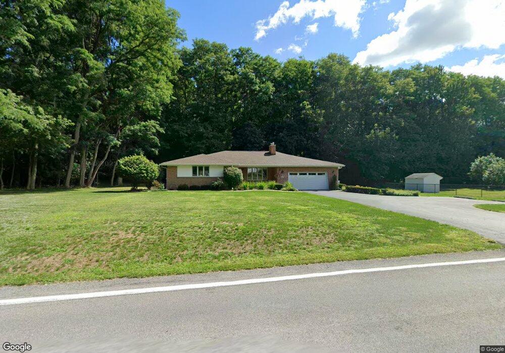
4685 Day Rd Lockport, NY 14094
Estimated Value: $351,000 - $411,000
3
Beds
3
Baths
2,323
Sq Ft
$167/Sq Ft
Est. Value
About This Home
This home is located at 4685 Day Rd, Lockport, NY 14094 and is currently estimated at $387,394, approximately $166 per square foot. 4685 Day Rd is a home located in Niagara County with nearby schools including Aaron Mossell Junior High School, Lockport High School, and DeSales Catholic School.
Ownership History
Date
Name
Owned For
Owner Type
Purchase Details
Closed on
Apr 30, 2010
Sold by
Scott Burnard and Scott Jessie M
Bought by
Noake Robert G and Noake Elaine H
Current Estimated Value
Home Financials for this Owner
Home Financials are based on the most recent Mortgage that was taken out on this home.
Original Mortgage
$50,000
Interest Rate
4.38%
Mortgage Type
New Conventional
Purchase Details
Closed on
Mar 19, 2004
Sold by
Garlock Ralph
Bought by
Scott Burnard
Create a Home Valuation Report for This Property
The Home Valuation Report is an in-depth analysis detailing your home's value as well as a comparison with similar homes in the area
Home Values in the Area
Average Home Value in this Area
Purchase History
| Date | Buyer | Sale Price | Title Company |
|---|---|---|---|
| Noake Robert G | $203,000 | None Available | |
| Scott Burnard | $190,000 | Daniel Caro |
Source: Public Records
Mortgage History
| Date | Status | Borrower | Loan Amount |
|---|---|---|---|
| Closed | Noake Robert G | $50,000 |
Source: Public Records
Tax History Compared to Growth
Tax History
| Year | Tax Paid | Tax Assessment Tax Assessment Total Assessment is a certain percentage of the fair market value that is determined by local assessors to be the total taxable value of land and additions on the property. | Land | Improvement |
|---|---|---|---|---|
| 2024 | $7,872 | $320,000 | $26,300 | $293,700 |
| 2023 | $7,855 | $309,000 | $21,300 | $287,700 |
| 2022 | $7,683 | $281,000 | $21,300 | $259,700 |
| 2021 | $7,894 | $235,000 | $14,000 | $221,000 |
| 2020 | $5,837 | $235,000 | $14,000 | $221,000 |
| 2019 | $3,244 | $215,000 | $14,000 | $201,000 |
| 2018 | $5,412 | $200,000 | $14,000 | $186,000 |
| 2017 | $5,529 | $200,000 | $14,000 | $186,000 |
| 2016 | $5,591 | $200,000 | $14,000 | $186,000 |
| 2015 | -- | $200,000 | $14,000 | $186,000 |
| 2014 | -- | $189,500 | $17,000 | $172,500 |
Source: Public Records
Map
Nearby Homes
- 4640 Day Rd
- 1215 Ridgewood Dr
- 133 Windermere Rd
- 4 Longcroft Dr
- 1020 N Circle Dr
- 6683 N Canal Rd
- 7308 Rochester Rd
- 7216 V/LOT Groff Wilson Rd
- 7338 Rochester Rd
- 42 Beverly Ave
- 35 Beverly Ave
- 715 Market St
- 24 Utica St
- 7406 Chestnut Ridge Rd
- 363 Davison Rd
- 6856 E High St
- 6836 E High St
- 15 Cleveland Place
- 33 Irving St
- 82 Lake Ave
- 7027 Chestnut Ridge Rd
- 4716 Day Rd
- 4688 Day Rd
- 6995 Chestnut Ridge Rd
- 6991 Chestnut Ridge Rd
- 4672 Day Rd
- 6987 Chestnut Ridge Rd
- 7028 Chestnut Ridge Rd
- 7032 Chestnut Ridge Rd
- 6996 Chestnut Ridge Rd
- 7036 Chestnut Ridge Rd
- 6983 Chestnut Ridge Rd
- 7040 Chestnut Ridge Rd
- 7048 Chestnut Ridge Rd
- 4666 Day Rd
- 6975 Chestnut Ridge Rd
- 6980 Chestnut Ridge Rd
- 7052 Chestnut Ridge Rd
- 4651 Day Rd
- 7054 Chestnut Ridge Rd