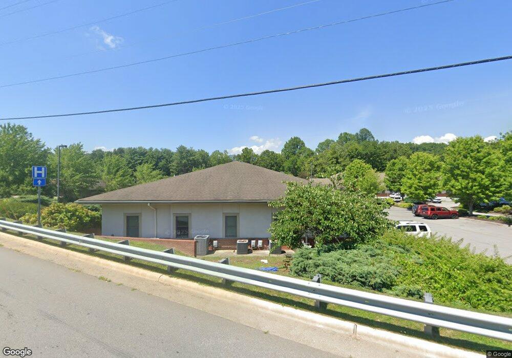
47 Bowman Dr Waynesville, NC 28785
Estimated Value: $1,417,063
--
Bed
--
Bath
6,578
Sq Ft
$215/Sq Ft
Est. Value
About This Home
This home is located at 47 Bowman Dr, Waynesville, NC 28785 and is currently estimated at $1,417,063, approximately $215 per square foot. 47 Bowman Dr is a home located in Haywood County with nearby schools including Junaluska Elementary, Waynesville Middle, and Tuscola High.
Ownership History
Date
Name
Owned For
Owner Type
Purchase Details
Closed on
May 26, 2022
Sold by
Toothland Llc
Bought by
Macs Five Properties Llc
Current Estimated Value
Home Financials for this Owner
Home Financials are based on the most recent Mortgage that was taken out on this home.
Original Mortgage
$1,058,000
Outstanding Balance
$1,005,187
Interest Rate
5.1%
Mortgage Type
New Conventional
Estimated Equity
$411,876
Purchase Details
Closed on
Dec 31, 2008
Sold by
C&B Toothland Llc
Bought by
Toothland Llc
Create a Home Valuation Report for This Property
The Home Valuation Report is an in-depth analysis detailing your home's value as well as a comparison with similar homes in the area
Home Values in the Area
Average Home Value in this Area
Purchase History
| Date | Buyer | Sale Price | Title Company |
|---|---|---|---|
| Macs Five Properties Llc | $1,245,000 | Brock Law Firm Pllc | |
| Toothland Llc | -- | Chicago Title Insurance Co |
Source: Public Records
Mortgage History
| Date | Status | Borrower | Loan Amount |
|---|---|---|---|
| Open | Macs Five Properties Llc | $1,058,000 |
Source: Public Records
Tax History Compared to Growth
Tax History
| Year | Tax Paid | Tax Assessment Tax Assessment Total Assessment is a certain percentage of the fair market value that is determined by local assessors to be the total taxable value of land and additions on the property. | Land | Improvement |
|---|---|---|---|---|
| 2025 | -- | $860,800 | $192,800 | $668,000 |
| 2024 | $6,456 | $860,800 | $192,800 | $668,000 |
| 2023 | $6,112 | $860,800 | $192,800 | $668,000 |
| 2022 | $5,767 | $860,800 | $192,800 | $668,000 |
| 2021 | $5,767 | $860,800 | $192,800 | $668,000 |
| 2020 | $5,437 | $755,200 | $155,100 | $600,100 |
| 2019 | $5,437 | $755,200 | $155,100 | $600,100 |
| 2018 | $5,437 | $755,200 | $155,100 | $600,100 |
| 2017 | $5,437 | $755,200 | $0 | $0 |
| 2016 | $5,796 | $826,700 | $0 | $0 |
| 2015 | $5,796 | $826,700 | $0 | $0 |
| 2014 | -- | $826,700 | $0 | $0 |
Source: Public Records
Map
Nearby Homes
- 1465 S Lakeshore Dr Unit D1
- 1465 S Lakeshore Dr Unit B2
- 40 Panda Trail
- 87 Atkins Loop
- 21 Gunter Dr
- 109 Tri Vista Dr Unit 5
- 187 Tri Vista Dr
- 96 Epworth Way
- 213 Chapel Dr
- 38 Eden Ln
- 21 Peaceful Way Unit 2
- 20 Lila Ln Unit B
- 541 Paragon Pkwy
- 29 Tillman Rd
- 31 Denali Ln
- 486 Oxford Rd
- L# 102 Hoosier Ct Unit 102
- 106 Hoosier Ct
- 00 Aster Ridge Dr Unit 10
- 00 Liner Cove Rd Unit 2
- 43 Bowman Dr
- 18 Bowman Dr
- 90 Haywood Office Park
- 59 Haywood Office Park
- 41 Britts Way
- 43 Old Clyde Rd
- 13 Haywood Office Park - Ste 106 Park
- 13 Haywood Office Park
- 18 Old Clyde Rd
- 5 Haywood Office Park
- 20 Old Clyde Rd Unit 45-50
- 20 Old Clyde Rd Unit 45,46,47,48,49, and
- 67 Britts Way
- 73 Old Clyde Rd
- 1941 County Rd
- 66 Lake Shadows Ln
- 1964 County Rd
- 60 Old Clyde Rd
- 00 County Rd
- 9 Haywood Office Park