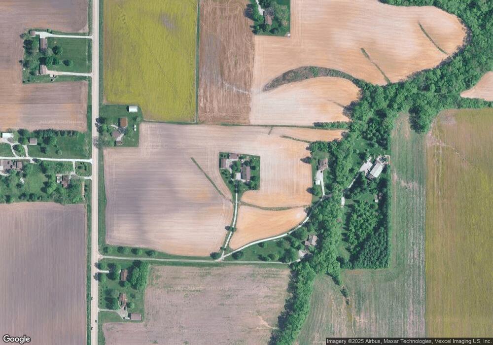
4700 Frank Scott Pkwy W Belleville, IL 62223
Estimated Value: $237,000 - $343,835
--
Bed
--
Bath
2,085
Sq Ft
$144/Sq Ft
Est. Value
About This Home
This home is located at 4700 Frank Scott Pkwy W, Belleville, IL 62223 and is currently estimated at $300,612, approximately $144 per square foot. 4700 Frank Scott Pkwy W is a home located in St. Clair County with nearby schools including Roosevelt Elementary School, Central Jr High School, and Our Lady Queen Of Peace Catholic School.
Ownership History
Date
Name
Owned For
Owner Type
Purchase Details
Closed on
Aug 10, 2005
Sold by
Lotz David William
Bought by
County Of St Clair
Current Estimated Value
Purchase Details
Closed on
Jun 18, 2001
Sold by
Keck Dorothy A
Bought by
Lotz David William
Purchase Details
Closed on
Mar 27, 2001
Sold by
Lotz Fred W and Lotz Barbara
Bought by
Lotz David William
Create a Home Valuation Report for This Property
The Home Valuation Report is an in-depth analysis detailing your home's value as well as a comparison with similar homes in the area
Home Values in the Area
Average Home Value in this Area
Purchase History
| Date | Buyer | Sale Price | Title Company |
|---|---|---|---|
| County Of St Clair | $800 | -- | |
| Lotz David William | -- | First American Title | |
| Lotz David William | -- | -- |
Source: Public Records
Tax History Compared to Growth
Tax History
| Year | Tax Paid | Tax Assessment Tax Assessment Total Assessment is a certain percentage of the fair market value that is determined by local assessors to be the total taxable value of land and additions on the property. | Land | Improvement |
|---|---|---|---|---|
| 2024 | $4,699 | $69,148 | $10,449 | $58,699 |
| 2023 | $4,718 | $65,810 | $7,701 | $58,109 |
| 2022 | $4,430 | $60,778 | $7,030 | $53,748 |
| 2021 | $4,385 | $58,599 | $6,678 | $51,921 |
| 2020 | $4,255 | $55,225 | $6,237 | $48,988 |
| 2019 | $4,482 | $58,977 | $6,336 | $52,641 |
| 2018 | $4,410 | $57,633 | $6,100 | $51,533 |
| 2017 | $4,330 | $56,279 | $5,872 | $50,407 |
| 2016 | $4,342 | $54,654 | $5,666 | $48,988 |
| 2014 | $3,148 | $45,667 | $4,411 | $41,256 |
| 2013 | $2,606 | $41,663 | $4,315 | $37,348 |
Source: Public Records
Map
Nearby Homes
- 6009 Rolling Hills Ln
- 1909 Menard Dr
- 1824 Menard Dr
- 1374 Rocky Creek Ct
- 45 Fenwood Dr
- 1366 Radden Ct
- 1800 Roosevelt Ave
- 324 Lake Forest Dr
- 636 S 19th St
- 633 Springwood Dr
- 800 Springwood Dr
- 245 Summers Trace
- 421 S 20th St
- 404 S 16th St
- 178 Wyndrose Estates Dr
- 7168 Mine Haul Rd
- 402 S 21st St
- 318 S 20th St
- 7400 Concordia Rd
- 207 S 17th St
- 4696 Frank Scott Pkwy W
- 4704 Frank Scott Pkwy W
- 4692 Frank Scott Pkwy W
- 4616 Frank Scott Pkwy W
- 4710 Frank Scott Pkwy W
- 4534 Frank Scott Pkwy W
- 4734 Frank Scott Pkwy W
- 4649 Frank Scott Pkwy W
- 4530 Frank Scott Pkwy W
- 4526 Frank Scott Pkwy W
- 5941 Rolling Hills Ln
- 5962 Rolling Hills Ln
- 4585 Frank Scott Pkwy W
- 5601 Concordia Rd
- 5801 Concordia Rd
- 4561 Frank Scott Pkwy W
- 5501 Concordia Church Rd
- 0 Concordia Church Rd Unit 16052544
- 0 Concordia Church Rd Unit 16052541
- 0 Concordia Church Rd Unit 17008184
