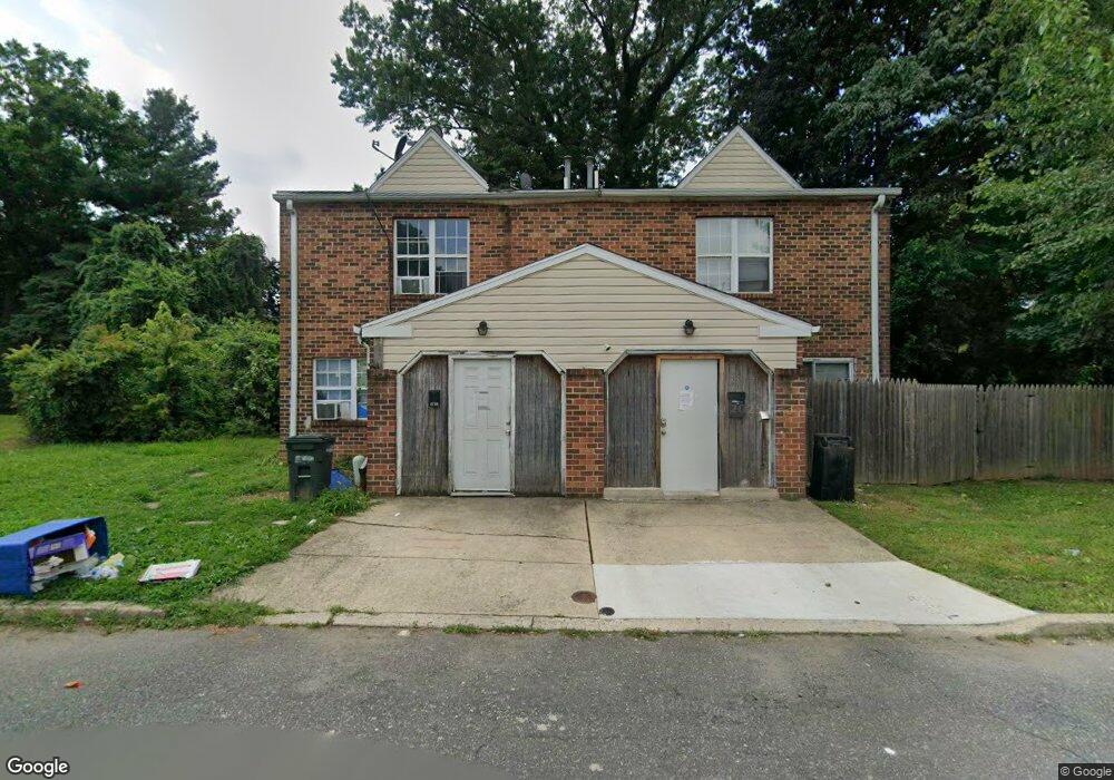
4708 Rutland St Philadelphia, PA 19124
Frankford NeighborhoodEstimated Value: $265,000 - $318,245
4
Beds
1
Bath
2,300
Sq Ft
$127/Sq Ft
Est. Value
About This Home
This home is located at 4708 Rutland St, Philadelphia, PA 19124 and is currently estimated at $292,811, approximately $127 per square foot. 4708 Rutland St is a home located in Philadelphia County with nearby schools including Frankford High School, Northwood Academy Charter School, and The Philadelphia Charter School for the Arts & Sciences.
Ownership History
Date
Name
Owned For
Owner Type
Purchase Details
Closed on
May 10, 2017
Sold by
Sharon Alef Properties Llc
Bought by
Vbha & A Properties Llc
Current Estimated Value
Purchase Details
Closed on
Nov 18, 2003
Sold by
Quest Holding Co
Bought by
Silverman Steven and Sims Ernest
Purchase Details
Closed on
Feb 10, 1997
Sold by
Rohner Christopher J and Crusader Savings Bank
Bought by
Quest Holding Co
Create a Home Valuation Report for This Property
The Home Valuation Report is an in-depth analysis detailing your home's value as well as a comparison with similar homes in the area
Home Values in the Area
Average Home Value in this Area
Purchase History
| Date | Buyer | Sale Price | Title Company |
|---|---|---|---|
| Vbha & A Properties Llc | $90,000 | Assurance Abstract Corp | |
| Silverman Steven | $820,000 | -- | |
| Quest Holding Co | $8,200 | -- |
Source: Public Records
Tax History Compared to Growth
Tax History
| Year | Tax Paid | Tax Assessment Tax Assessment Total Assessment is a certain percentage of the fair market value that is determined by local assessors to be the total taxable value of land and additions on the property. | Land | Improvement |
|---|---|---|---|---|
| 2026 | $3,459 | $245,000 | $49,000 | $196,000 |
| 2025 | $3,459 | $258,200 | $51,640 | $206,560 |
| 2024 | $3,459 | $258,200 | $51,640 | $206,560 |
| 2023 | $3,459 | $247,100 | $49,420 | $197,680 |
| 2022 | $2,315 | $247,100 | $49,420 | $197,680 |
| 2021 | $2,315 | $0 | $0 | $0 |
| 2020 | $2,315 | $0 | $0 | $0 |
| 2019 | $2,221 | $0 | $0 | $0 |
| 2018 | $2,514 | $0 | $0 | $0 |
| 2017 | $2,514 | $0 | $0 | $0 |
| 2016 | $2,470 | $0 | $0 | $0 |
| 2015 | $2,407 | $0 | $0 | $0 |
| 2014 | -- | $179,600 | $35,579 | $144,021 |
| 2012 | -- | $20,160 | $2,946 | $17,214 |
Source: Public Records
Map
Nearby Homes
- 4717 Northwood St
- 1001-3 Arrott St
- 1859 Harrison St
- 1052 Allengrove St
- 926 Foulkrod St
- 1300 Harrison St
- 4600 Horrocks St
- 4632 Oakland St
- 1241 Orthodox St
- 1208 Haworth St
- 1214 Haworth St
- 1335 Fillmore St
- 4046 E Roosevelt Blvd
- 4628 Pilling St
- 4626 Pilling St
- 5118 Oakland St
- 4665 Leiper St
- 5033 Akron St
- 1204 Pratt St
- 4431 Oakland St
- 4710 Rutland St
- 4731 Northwood St
- 4702 Rutland St
- 4727 Northwood St
- 4700 Rutland St
- 4725 Northwood St
- 1021 Herbert St
- 4705 Northwood St
- 4723 Northwood St
- 4723 Northwood St Unit 2
- 1016 Foulkrod St
- 1023 Herbert St
- 1018 Foulkrod St
- 4721 Northwood St
- 1025 Herbert St
- 1027 Herbert St
- 1020 Foulkrod St
- 4719 Northwood St
- 1029 Herbert St
- 1022 Foulkrod St