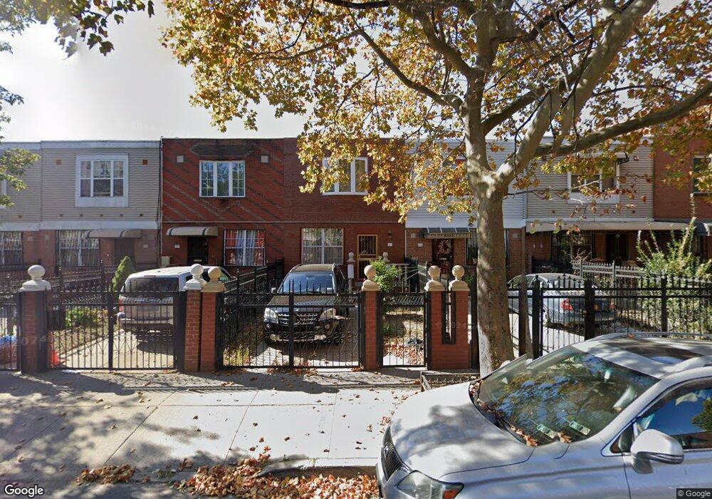
474 Hinsdale St Brooklyn, NY 11207
Brownsville NeighborhoodEstimated Value: $577,362 - $692,000
--
Bed
--
Bath
1,332
Sq Ft
$493/Sq Ft
Est. Value
About This Home
This home is located at 474 Hinsdale St, Brooklyn, NY 11207 and is currently estimated at $656,841, approximately $493 per square foot. 474 Hinsdale St is a home located in Kings County with nearby schools including Brooklyn Gardens Elementary School, J.H.S 292 Margaret S. Douglas, and Achievement First - East New York School.
Ownership History
Date
Name
Owned For
Owner Type
Purchase Details
Closed on
Nov 16, 1998
Sold by
Nehemiah Housing Development Fund Compan
Bought by
Steele Nerissa D
Current Estimated Value
Home Financials for this Owner
Home Financials are based on the most recent Mortgage that was taken out on this home.
Original Mortgage
$68,500
Interest Rate
6.76%
Create a Home Valuation Report for This Property
The Home Valuation Report is an in-depth analysis detailing your home's value as well as a comparison with similar homes in the area
Home Values in the Area
Average Home Value in this Area
Purchase History
| Date | Buyer | Sale Price | Title Company |
|---|---|---|---|
| Steele Nerissa D | $93,500 | First American Title Ins Co |
Source: Public Records
Mortgage History
| Date | Status | Borrower | Loan Amount |
|---|---|---|---|
| Previous Owner | Steele Nerissa D | $68,500 | |
| Closed | Steele Nerissa D | $20,000 |
Source: Public Records
Tax History Compared to Growth
Tax History
| Year | Tax Paid | Tax Assessment Tax Assessment Total Assessment is a certain percentage of the fair market value that is determined by local assessors to be the total taxable value of land and additions on the property. | Land | Improvement |
|---|---|---|---|---|
| 2025 | $4,454 | $37,560 | $13,740 | $23,820 |
| 2024 | $4,454 | $44,220 | $13,740 | $30,480 |
| 2023 | $4,504 | $43,500 | $13,740 | $29,760 |
| 2022 | $4,383 | $38,580 | $13,740 | $24,840 |
| 2021 | $4,349 | $33,300 | $13,740 | $19,560 |
| 2020 | $3,262 | $26,400 | $13,740 | $12,660 |
| 2019 | $3,817 | $26,400 | $13,740 | $12,660 |
| 2018 | $3,463 | $19,646 | $7,645 | $12,001 |
| 2017 | $3,185 | $19,495 | $7,494 | $12,001 |
| 2016 | $2,647 | $18,393 | $6,392 | $12,001 |
| 2015 | $852 | $17,353 | $5,352 | $12,001 |
| 2014 | $852 | $16,372 | $4,371 | $12,001 |
Source: Public Records
Map
Nearby Homes
- 533 Snediker Ave
- 406 Hinsdale St
- 541 Hinsdale St
- 576 Williams Ave
- 578 Williams Ave
- 582 Williams Ave
- 442 Newport St
- 584 Hinsdale St
- 606 Alabama Ave
- 546 Powell St
- 610 Alabama Ave
- 589 Hinsdale St
- 563 Powell St
- 699 Sackman St
- 440 Blake Ave
- 650 Williams Ave
- 660 Williams Ave Unit 142
- 297 Hinsdale St
- 661 Sheffield Ave
- 667 Sheffield Ave
- 476 Hinsdale St
- 472 Hinsdale St
- 478 Hinsdale St
- 470 Hinsdale St
- 480 Hinsdale St
- 468 Hinsdale St
- 482 Hinsdale St
- 466 Hinsdale St
- 484 Hinsdale St
- 464 Hinsdale St
- 479 Snediker Ave
- 481 Snediker Ave
- 477 Snediker Ave
- 483 Snediker Ave
- 475 Snediker Ave
- 486 Hinsdale St
- 485-495 Snediker Ave
- 462 Hinsdale St
- 485 Snediker Ave Unit 495
- 473 Snediker Ave