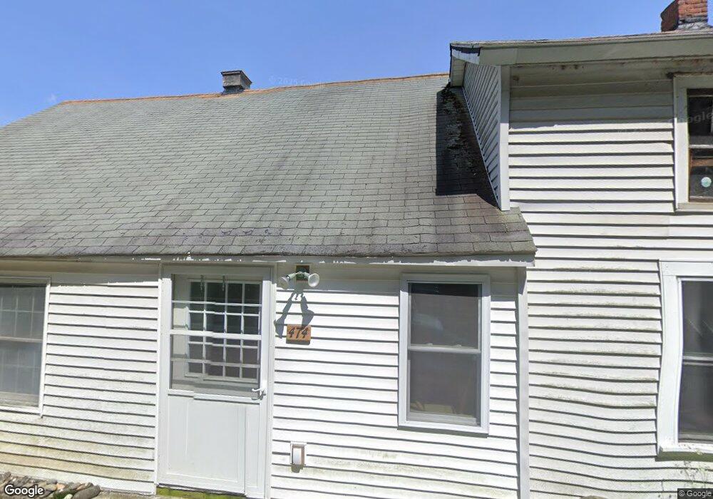
474 W Mountain Rd Bernardston, MA 01337
Estimated Value: $276,199 - $444,000
3
Beds
1
Bath
2,363
Sq Ft
$149/Sq Ft
Est. Value
About This Home
This home is located at 474 W Mountain Rd, Bernardston, MA 01337 and is currently estimated at $352,550, approximately $149 per square foot. 474 W Mountain Rd is a home located in Franklin County with nearby schools including Pioneer Valley Regional.
Ownership History
Date
Name
Owned For
Owner Type
Purchase Details
Closed on
Jul 14, 2010
Sold by
Tyler Tina M
Bought by
Tyler Gary B
Current Estimated Value
Purchase Details
Closed on
Mar 3, 2009
Sold by
Peterson Betsy A and Tyler Betsy A
Bought by
Tyler Gary B and Tyler Tina M
Purchase Details
Closed on
Feb 22, 2007
Sold by
Tyler Theodore C
Bought by
Tyler Gary B and Tyler Theodore C
Create a Home Valuation Report for This Property
The Home Valuation Report is an in-depth analysis detailing your home's value as well as a comparison with similar homes in the area
Home Values in the Area
Average Home Value in this Area
Purchase History
| Date | Buyer | Sale Price | Title Company |
|---|---|---|---|
| Tyler Gary B | -- | -- | |
| Tyler Gary B | -- | -- | |
| Tyler Gary B | -- | -- | |
| Tyler Gary B | -- | -- | |
| Tyler Gary B | -- | -- | |
| Tyler Gary B | -- | -- | |
| Tyler Gary B | -- | -- |
Source: Public Records
Mortgage History
| Date | Status | Borrower | Loan Amount |
|---|---|---|---|
| Previous Owner | Tyler Gary B | $15,000 | |
| Previous Owner | Tyler Gary B | $40,000 |
Source: Public Records
Tax History Compared to Growth
Tax History
| Year | Tax Paid | Tax Assessment Tax Assessment Total Assessment is a certain percentage of the fair market value that is determined by local assessors to be the total taxable value of land and additions on the property. | Land | Improvement |
|---|---|---|---|---|
| 2025 | $2,917 | $204,400 | $61,800 | $142,600 |
| 2024 | $3,136 | $191,900 | $61,800 | $130,100 |
| 2023 | $2,846 | $178,000 | $55,300 | $122,700 |
| 2022 | $2,778 | $161,500 | $50,200 | $111,300 |
| 2021 | $2,544 | $137,000 | $42,600 | $94,400 |
| 2020 | $2,582 | $138,900 | $42,500 | $96,400 |
| 2019 | $2,561 | $130,400 | $42,500 | $87,900 |
| 2018 | $2,536 | $123,900 | $43,100 | $80,800 |
| 2017 | $2,451 | $123,900 | $43,100 | $80,800 |
| 2016 | $2,411 | $123,900 | $43,100 | $80,800 |
| 2015 | $2,395 | $128,900 | $50,800 | $78,100 |
Source: Public Records
Map
Nearby Homes
- 539 Fox Hill Rd
- Lot 9 Fox Hill Rd (Off)
- 75 South St Unit 3
- 83 Eden Trail Branch
- 319 Greenfield Rd
- 218 Greenfield Rd
- 59 River St
- 47 Cross St
- 23 Industrial Dr
- 1 Northfield Rd
- 56 Brattleboro Rd
- 180 Bald Mountain Rd
- 704 Brattleboro Rd
- 775 Brattleboro Rd
- 31 Lovers Ln
- 27 Lunt Dr
- 001 Adams Rd
- 72 Meadowood Dr
- 151 Smead Hill Rd
- 696 Bernardston Rd
- 466 W Mountain Rd
- 459 W Mountain Rd
- 431 W Mountain Rd
- 494 W Mountain Rd
- 240 Eden Trail
- 199 Eden Trail
- 199 Eden Trail
- 375 W Mountain Rd
- 198 Eden Trail
- 343 W Mountain Rd
- 367 W Mountain Rd
- 372 Eden Trail
- 189 Eden Trail
- 369 W Mountain Rd
- 178 Eden Trail
- 178 Eden Trail
- 161 Eden Trail
- 161 Eden Trail
- 153 Eden Trail
- 348 Eden Trail