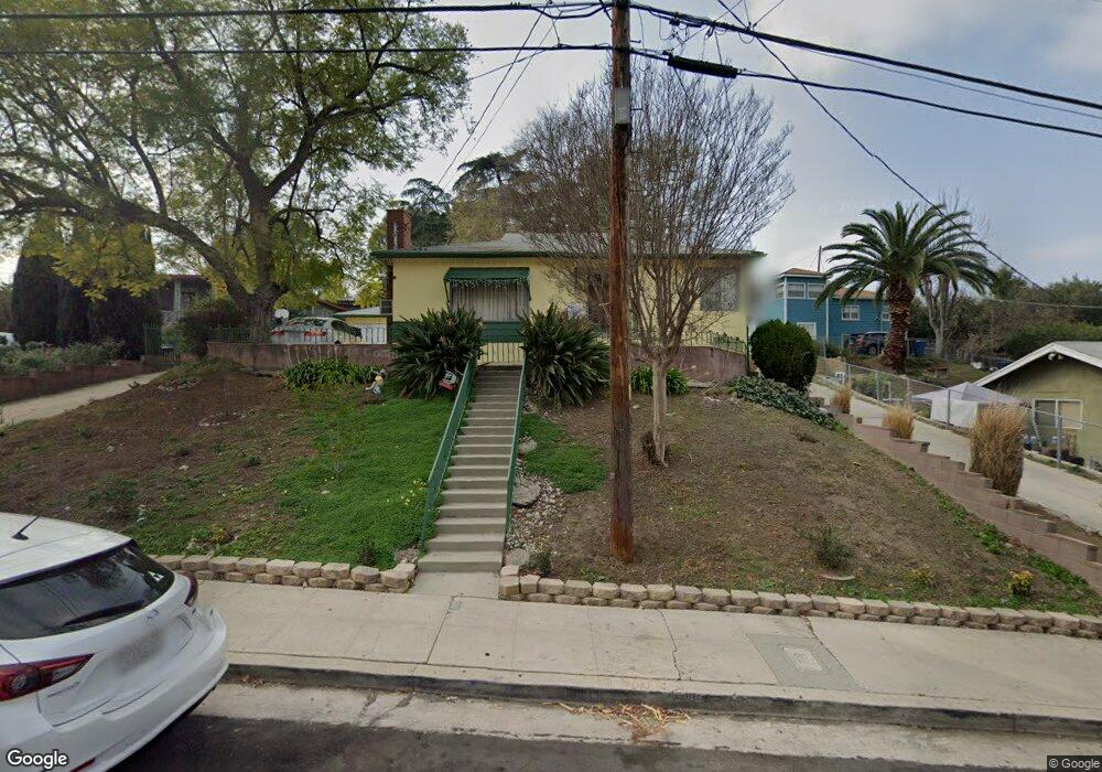
4764 Toland Way Los Angeles, CA 90042
Eagle Rock NeighborhoodEstimated Value: $1,165,917 - $1,356,000
3
Beds
2
Baths
1,600
Sq Ft
$796/Sq Ft
Est. Value
About This Home
This home is located at 4764 Toland Way, Los Angeles, CA 90042 and is currently estimated at $1,274,229, approximately $796 per square foot. 4764 Toland Way is a home located in Los Angeles County with nearby schools including Toland Way Elementary School, Benjamin Franklin High School, and Eagle Rock High School.
Ownership History
Date
Name
Owned For
Owner Type
Purchase Details
Closed on
Nov 6, 2009
Sold by
Fiore Robert and Fiore Family Trust
Bought by
Hardt Robert
Current Estimated Value
Home Financials for this Owner
Home Financials are based on the most recent Mortgage that was taken out on this home.
Original Mortgage
$268,000
Outstanding Balance
$175,083
Interest Rate
5.01%
Mortgage Type
New Conventional
Estimated Equity
$1,099,146
Create a Home Valuation Report for This Property
The Home Valuation Report is an in-depth analysis detailing your home's value as well as a comparison with similar homes in the area
Home Values in the Area
Average Home Value in this Area
Purchase History
| Date | Buyer | Sale Price | Title Company |
|---|---|---|---|
| Hardt Robert | $345,000 | Fidelity National Title Co |
Source: Public Records
Mortgage History
| Date | Status | Borrower | Loan Amount |
|---|---|---|---|
| Open | Hardt Robert | $268,000 |
Source: Public Records
Tax History Compared to Growth
Tax History
| Year | Tax Paid | Tax Assessment Tax Assessment Total Assessment is a certain percentage of the fair market value that is determined by local assessors to be the total taxable value of land and additions on the property. | Land | Improvement |
|---|---|---|---|---|
| 2025 | $5,430 | $445,319 | $356,260 | $89,059 |
| 2024 | $5,430 | $436,588 | $349,275 | $87,313 |
| 2023 | $5,326 | $428,028 | $342,427 | $85,601 |
| 2022 | $5,080 | $419,636 | $335,713 | $83,923 |
| 2021 | $5,014 | $411,409 | $329,131 | $82,278 |
| 2019 | $4,864 | $399,209 | $319,370 | $79,839 |
| 2018 | $4,793 | $391,382 | $313,108 | $78,274 |
| 2016 | $4,573 | $376,186 | $300,950 | $75,236 |
| 2015 | $4,506 | $370,536 | $296,430 | $74,106 |
| 2014 | $4,528 | $363,279 | $290,624 | $72,655 |
Source: Public Records
Map
Nearby Homes
- 4780 Hub St
- 4824 Toland Way
- 1336 Armadale Ave
- 4654 Toland Way
- 4854 Buchanan St
- 4500 Mont Eagle Place
- 1017 Dexter St
- 925 927 El Paso Dr
- 4925 Buchanan St
- 1113 N Avenue 50
- 1048 Dexter St
- 4666 York Blvd
- 1037 N Avenue 50
- 1087 Oneonta Dr
- 1127 Oneonta Dr
- 4312 Division St
- 865 N Avenue 50
- 4844 San Rafael Ave
- 917 N Avenue 51
- 5055 Hub St
- 4760 Toland Way
- 4770 Toland Way
- 4746 Toland Way
- 4746 Toland Way
- 4771 Toland Way
- 4752 Toland Way
- 4767 Toland Way
- 4777 Toland Way
- 4763 Toland Way
- 4759 Toland Way
- 4806 Toland Way
- 4810 Toland Way
- 4755 Toland Way
- 4744 Toland Way
- 4743 Baltimore St
- 4808 Toland Way
- 4745 Baltimore St
- 4740 Toland Way
- 4747 Baltimore St
- 4803 Toland Way