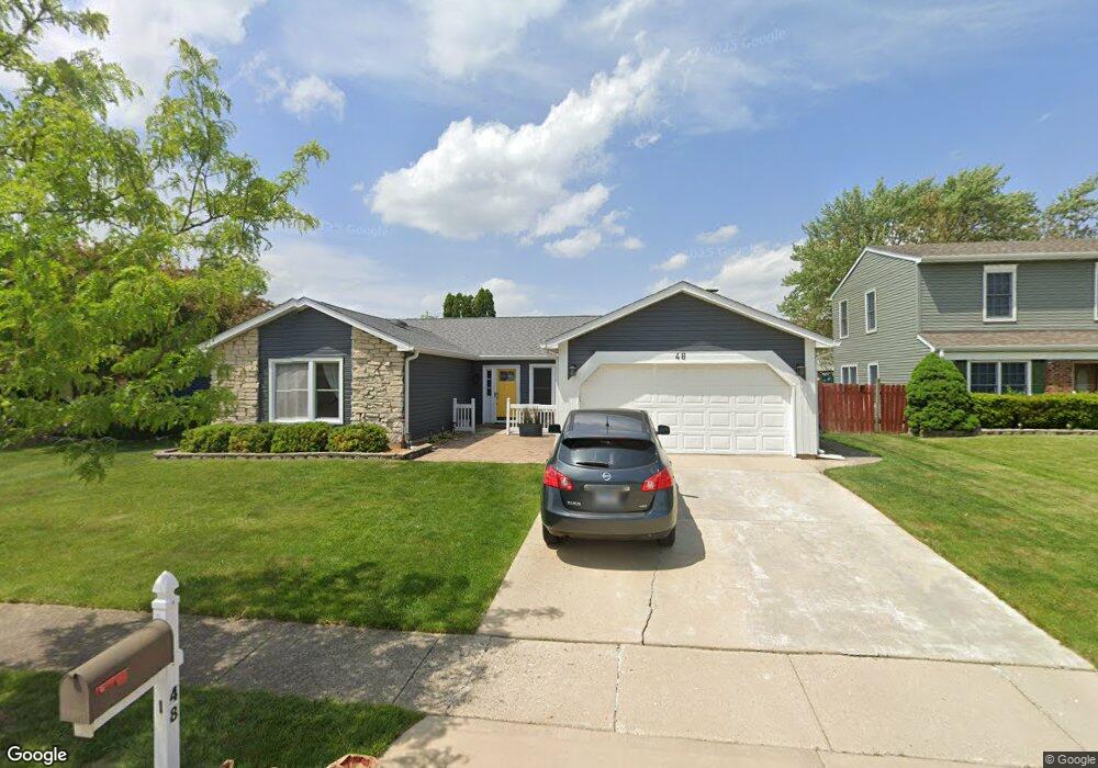
48 Campbell Dr Glendale Heights, IL 60139
Estimated Value: $331,000 - $405,000
3
Beds
2
Baths
1,710
Sq Ft
$215/Sq Ft
Est. Value
About This Home
This home is located at 48 Campbell Dr, Glendale Heights, IL 60139 and is currently estimated at $367,767, approximately $215 per square foot. 48 Campbell Dr is a home located in DuPage County with nearby schools including Americana Intermediate School, Glenside Middle School, and Glenbard North High School.
Ownership History
Date
Name
Owned For
Owner Type
Purchase Details
Closed on
Jul 9, 2013
Sold by
Anderson Judy L
Bought by
Mundi Paramjit K and Mundi Paramjit S
Current Estimated Value
Home Financials for this Owner
Home Financials are based on the most recent Mortgage that was taken out on this home.
Original Mortgage
$157,102
Outstanding Balance
$113,411
Interest Rate
3.75%
Mortgage Type
FHA
Estimated Equity
$254,356
Purchase Details
Closed on
Jul 28, 1994
Sold by
Howes John C and Howes Sheree L
Bought by
Andreasen Robert E and Andreasen Judy L
Create a Home Valuation Report for This Property
The Home Valuation Report is an in-depth analysis detailing your home's value as well as a comparison with similar homes in the area
Home Values in the Area
Average Home Value in this Area
Purchase History
| Date | Buyer | Sale Price | Title Company |
|---|---|---|---|
| Mundi Paramjit K | $160,000 | Chicago Title Insurance Comp | |
| Andreasen Robert E | $132,000 | West Counties Title Svcs Inc |
Source: Public Records
Mortgage History
| Date | Status | Borrower | Loan Amount |
|---|---|---|---|
| Open | Mundi Paramjit K | $157,102 |
Source: Public Records
Tax History Compared to Growth
Tax History
| Year | Tax Paid | Tax Assessment Tax Assessment Total Assessment is a certain percentage of the fair market value that is determined by local assessors to be the total taxable value of land and additions on the property. | Land | Improvement |
|---|---|---|---|---|
| 2024 | $6,671 | $100,777 | $23,313 | $77,464 |
| 2023 | $7,099 | $92,160 | $21,320 | $70,840 |
| 2022 | $8,319 | $88,910 | $21,180 | $67,730 |
| 2021 | $7,872 | $84,470 | $20,120 | $64,350 |
| 2020 | $7,577 | $82,410 | $19,630 | $62,780 |
| 2019 | $7,337 | $79,190 | $18,860 | $60,330 |
| 2018 | $8,185 | $78,770 | $18,370 | $60,400 |
| 2017 | $7,948 | $73,010 | $17,030 | $55,980 |
| 2016 | $7,653 | $67,570 | $15,760 | $51,810 |
| 2015 | $7,520 | $63,060 | $14,710 | $48,350 |
| 2014 | $6,860 | $57,610 | $14,710 | $42,900 |
| 2013 | $6,770 | $59,580 | $15,210 | $44,370 |
Source: Public Records
Map
Nearby Homes
- 39 Mill Pond Dr
- 1890 Harvest Ln
- 1760 Lombard Ct
- 67 Stonefield Dr
- 10 W Nevada Ave
- 133 Harding Ct
- 1713 Schmale Rd
- 134 W Montana Ave
- 200 Ahmed Ct
- 152 W Montana Ave
- 203 Ahmed Ct
- 1900 Basswood Ln
- 251 Polo Club Dr
- 241 Army Trail Rd
- 307 E Alpine Dr
- 56 N Golfview Ct
- 279 Blue Spruce Ln
- 1943 Towner Ln
- 1500 Golfview Ct Unit 5
- 1941 Aspen Ln
- 52 Campbell Dr
- 42 Campbell Dr
- 1871 Deere Ln Unit 16
- 1867 Deere Ln
- 1875 Deere Ln
- 38 Campbell Dr
- 58 Campbell Dr
- 43 Campbell Dr Unit 16
- 1863 Deere Ln
- 49 Campbell Dr
- 39 Campbell Dr
- 1879 Deere Ln
- 53 Campbell Dr
- 32 Campbell Dr
- 33 Campbell Dr
- 1883 Deere Ln
- 59 Campbell Dr
- 1870 Deere Ln
- 34 Blue Ridge Dr
- 1866 Deere Ln