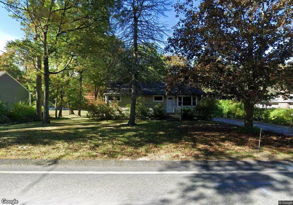
483 Bullard St Holden, MA 01520
Estimated Value: $448,000 - $487,000
3
Beds
2
Baths
1,328
Sq Ft
$357/Sq Ft
Est. Value
About This Home
This home is located at 483 Bullard St, Holden, MA 01520 and is currently estimated at $474,488, approximately $357 per square foot. 483 Bullard St is a home located in Worcester County with nearby schools including Wachusett Regional High School and Holden Christian Academy.
Ownership History
Date
Name
Owned For
Owner Type
Purchase Details
Closed on
Sep 5, 2002
Sold by
Proulx Michael R and Proulx Gloria L
Bought by
Gregoire James P and Chase Bridget M
Current Estimated Value
Home Financials for this Owner
Home Financials are based on the most recent Mortgage that was taken out on this home.
Original Mortgage
$197,100
Interest Rate
6.39%
Mortgage Type
Purchase Money Mortgage
Purchase Details
Closed on
Jul 23, 1987
Sold by
Klose George P
Bought by
Proulx Michael R
Create a Home Valuation Report for This Property
The Home Valuation Report is an in-depth analysis detailing your home's value as well as a comparison with similar homes in the area
Home Values in the Area
Average Home Value in this Area
Purchase History
| Date | Buyer | Sale Price | Title Company |
|---|---|---|---|
| Gregoire James P | $207,500 | -- | |
| Proulx Michael R | $137,900 | -- |
Source: Public Records
Mortgage History
| Date | Status | Borrower | Loan Amount |
|---|---|---|---|
| Open | Proulx Michael R | $201,000 | |
| Closed | Proulx Michael R | $197,100 | |
| Previous Owner | Proulx Michael R | $104,500 | |
| Previous Owner | Proulx Michael R | $10,842 |
Source: Public Records
Tax History Compared to Growth
Tax History
| Year | Tax Paid | Tax Assessment Tax Assessment Total Assessment is a certain percentage of the fair market value that is determined by local assessors to be the total taxable value of land and additions on the property. | Land | Improvement |
|---|---|---|---|---|
| 2025 | $5,656 | $408,100 | $170,600 | $237,500 |
| 2024 | $5,333 | $376,900 | $165,800 | $211,100 |
| 2023 | $5,133 | $342,400 | $144,000 | $198,400 |
| 2022 | $4,951 | $299,000 | $113,200 | $185,800 |
| 2021 | $4,804 | $276,100 | $108,000 | $168,100 |
| 2020 | $4,439 | $261,100 | $103,200 | $157,900 |
| 2019 | $4,380 | $251,000 | $103,200 | $147,800 |
| 2018 | $4,101 | $232,900 | $98,400 | $134,500 |
| 2017 | $4,032 | $229,200 | $98,400 | $130,800 |
| 2016 | $3,790 | $219,700 | $94,000 | $125,700 |
| 2015 | $3,796 | $209,500 | $94,000 | $115,500 |
| 2014 | $3,719 | $209,500 | $94,000 | $115,500 |
Source: Public Records
Map
Nearby Homes
- 300 Malden St
- 47 Preservation Ln
- 206 Wachusett St
- 33 Meadow Wood Dr
- 56 Highland Ave
- 15 Lowell Ave
- 21 Wyoming Dr
- 81 Mount View Dr
- 16 Highland Ave
- 8 (Lot 1) Holmes Dr
- 160 Shrewsbury St
- 83 Stoneleigh Rd
- 250 Shrewsbury St
- 8 Dawson Cir
- 93 Winfield Rd
- 9 Birchwood Dr
- 9 Short St
- 9 Holmes Dr
- 124 Bailey Rd
- 7 Holmes Dr