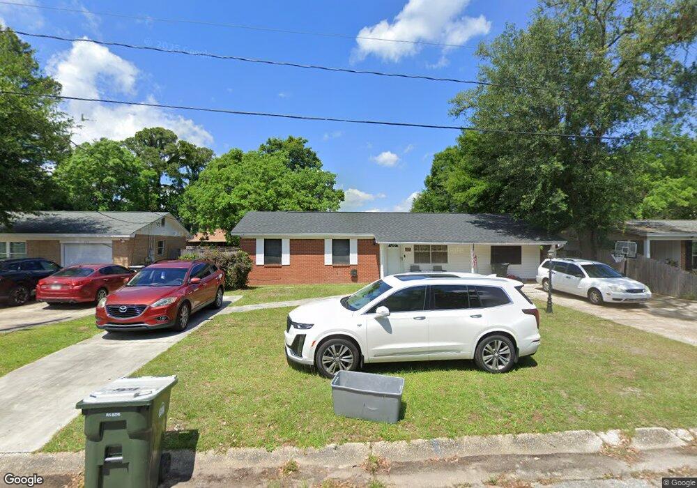
485 Corrydale Dr Pensacola, FL 32506
Estimated Value: $165,316 - $208,000
--
Bed
2
Baths
1,350
Sq Ft
$138/Sq Ft
Est. Value
About This Home
This home is located at 485 Corrydale Dr, Pensacola, FL 32506 and is currently estimated at $185,829, approximately $137 per square foot. 485 Corrydale Dr is a home located in Escambia County with nearby schools including Navy Point Elementary School, Warrington Middle School, and Escambia High School.
Ownership History
Date
Name
Owned For
Owner Type
Purchase Details
Closed on
Jul 31, 2003
Sold by
Blankenship Marvin and Blankenship Tara
Bought by
Rease Earlene A
Current Estimated Value
Home Financials for this Owner
Home Financials are based on the most recent Mortgage that was taken out on this home.
Original Mortgage
$76,000
Outstanding Balance
$32,540
Interest Rate
5.24%
Estimated Equity
$153,289
Purchase Details
Closed on
Jun 26, 1999
Sold by
Western Houses Ltd
Bought by
Blankenship Marvin and Blankenship Tara
Home Financials for this Owner
Home Financials are based on the most recent Mortgage that was taken out on this home.
Original Mortgage
$56,390
Interest Rate
7.23%
Mortgage Type
FHA
Create a Home Valuation Report for This Property
The Home Valuation Report is an in-depth analysis detailing your home's value as well as a comparison with similar homes in the area
Home Values in the Area
Average Home Value in this Area
Purchase History
| Date | Buyer | Sale Price | Title Company |
|---|---|---|---|
| Rease Earlene A | $76,000 | -- | |
| Blankenship Marvin | -- | -- | |
| Blankenship Marvin | $56,900 | -- |
Source: Public Records
Mortgage History
| Date | Status | Borrower | Loan Amount |
|---|---|---|---|
| Open | Rease Earlene A | $76,000 | |
| Previous Owner | Blankenship Marvin | $56,390 |
Source: Public Records
Tax History Compared to Growth
Tax History
| Year | Tax Paid | Tax Assessment Tax Assessment Total Assessment is a certain percentage of the fair market value that is determined by local assessors to be the total taxable value of land and additions on the property. | Land | Improvement |
|---|---|---|---|---|
| 2024 | $546 | $69,243 | -- | -- |
| 2023 | $546 | $67,227 | $0 | $0 |
| 2022 | $541 | $65,269 | $0 | $0 |
| 2021 | $547 | $63,368 | $0 | $0 |
| 2020 | $540 | $62,494 | $0 | $0 |
| 2019 | $536 | $61,089 | $0 | $0 |
| 2018 | $539 | $59,950 | $0 | $0 |
| 2017 | $541 | $58,717 | $0 | $0 |
| 2016 | $541 | $57,510 | $0 | $0 |
| 2015 | $521 | $57,111 | $0 | $0 |
| 2014 | $509 | $56,658 | $0 | $0 |
Source: Public Records
Map
Nearby Homes
- 346 Quigley Rd
- 863 Amberway Dr
- 6901 Corrydale Dr
- 6852 Lake Joanne Dr
- 6982 Lake Joanne Dr
- 668 N 72nd Ave Unit ABCD
- 6912 Kitty Hawk Dr
- 7621 Old Hickory Dr
- 516 Long Lake Dr
- 1299 Middlebrook Dr
- 7600 Old Hickory Dr
- 7201 Mier Henry Rd
- 7584 Sandy Creek Dr
- 9880 North St
- 365 Arabian Dr
- 333 S 61st Ave Unit 6
- 333 S 61st Ave Unit 1
- 333 S 61st Ave Unit 8
- 7685 Old Hickory Dr
- 330 Bunker Hill Dr
- 465 Corrydale Dr
- 503 Corrydale Dr
- 816 Amberwood Dr
- 812 Amberwood Dr
- 445 Corrydale Dr
- 521 Corrydale Dr
- 480 Corrydale Dr
- 820 Amberwood Dr
- 502 Corrydale Dr
- 470 Corrydale Dr
- 824 Amberwood Dr
- 808 Amberwood Dr
- 520 Corrydale Dr
- 450 Corrydale Dr
- 435 Corrydale Dr
- 531 Corrydale Dr
- 530 Corrydale Dr
- 430 Corrydale Dr
- 828 Amberwood Dr
- 503 Quigley Rd