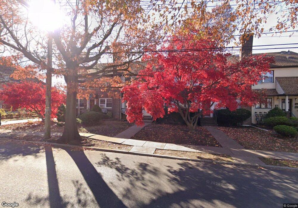
486 Manor Rd Staten Island, NY 10314
Westerleigh NeighborhoodEstimated Value: $675,000 - $831,000
--
Bed
--
Bath
1,872
Sq Ft
$417/Sq Ft
Est. Value
About This Home
This home is located at 486 Manor Rd, Staten Island, NY 10314 and is currently estimated at $779,975, approximately $416 per square foot. 486 Manor Rd is a home located in Richmond County with nearby schools including P.S. 29 Bardwell, Intermediate School 27, and Susan E Wagner High School.
Ownership History
Date
Name
Owned For
Owner Type
Purchase Details
Closed on
Jul 26, 2016
Sold by
Truelove Wayne L and Truelove Roy J
Bought by
Turner Katherine E and The Truelove Family Trust
Current Estimated Value
Purchase Details
Closed on
Apr 3, 1996
Sold by
Truelove Katherine M
Bought by
Truelove Wayne L and Truelove Roy J
Home Financials for this Owner
Home Financials are based on the most recent Mortgage that was taken out on this home.
Original Mortgage
$114,743
Interest Rate
7.34%
Create a Home Valuation Report for This Property
The Home Valuation Report is an in-depth analysis detailing your home's value as well as a comparison with similar homes in the area
Home Values in the Area
Average Home Value in this Area
Purchase History
| Date | Buyer | Sale Price | Title Company |
|---|---|---|---|
| Turner Katherine E | -- | None Available | |
| Truelove Wayne L | -- | -- |
Source: Public Records
Mortgage History
| Date | Status | Borrower | Loan Amount |
|---|---|---|---|
| Previous Owner | Truelove Wayne L | $114,743 |
Source: Public Records
Tax History Compared to Growth
Tax History
| Year | Tax Paid | Tax Assessment Tax Assessment Total Assessment is a certain percentage of the fair market value that is determined by local assessors to be the total taxable value of land and additions on the property. | Land | Improvement |
|---|---|---|---|---|
| 2025 | $6,855 | $41,760 | $10,487 | $31,273 |
| 2024 | $6,855 | $34,140 | $12,356 | $21,784 |
| 2023 | $6,685 | $32,918 | $10,369 | $22,549 |
| 2022 | $6,235 | $35,340 | $12,360 | $22,980 |
| 2021 | $6,586 | $33,960 | $12,360 | $21,600 |
| 2020 | $6,350 | $37,560 | $12,360 | $25,200 |
| 2019 | $5,949 | $37,320 | $12,360 | $24,960 |
| 2018 | $5,592 | $27,432 | $10,642 | $16,790 |
| 2017 | $5,592 | $27,432 | $12,285 | $15,147 |
| 2016 | $5,214 | $26,080 | $12,019 | $14,061 |
| 2015 | $4,548 | $24,606 | $13,289 | $11,317 |
| 2014 | $4,548 | $23,700 | $13,740 | $9,960 |
Source: Public Records
Map
Nearby Homes
- 148 Sturges St
- 136 Sturges St
- 254 Rice Ave
- 80 Beechwood Place
- 80 Kemball Ave
- 21 Winthrop Place
- 25 Winthrop Place
- 25 Coale Ave
- 36 Sawyer Ave
- 125 Westcott Blvd
- 100 Knox Place
- 160 Westcott Blvd
- 27 Sommers Ln
- 126 Slosson Ave
- 328 Manor Rd
- 33 Gower St
- 1625 Victory Blvd
- 249 Slosson Ave
- 301 Slosson Ave
- 17 Carolina Place
- 484 Manor Rd
- 490 Manor Rd
- 482 Manor Rd Unit Bsmt
- 482 Manor Rd Unit A
- 12 Crowell Ave
- 16 Crowell Ave
- 498 Manor Rd
- 20 Crowell Ave
- 111 Governor Rd
- 464 Manor Rd
- 11 Raymond Ave
- 17 Raymond Ave
- 144 Sturges St
- 5 Raymond Ave
- 19 Crowell Ave
- 109 Governor Rd
- 460 Manor Rd
- 21 Raymond Ave
- 465 Manor Rd
- 140 Sturges St
