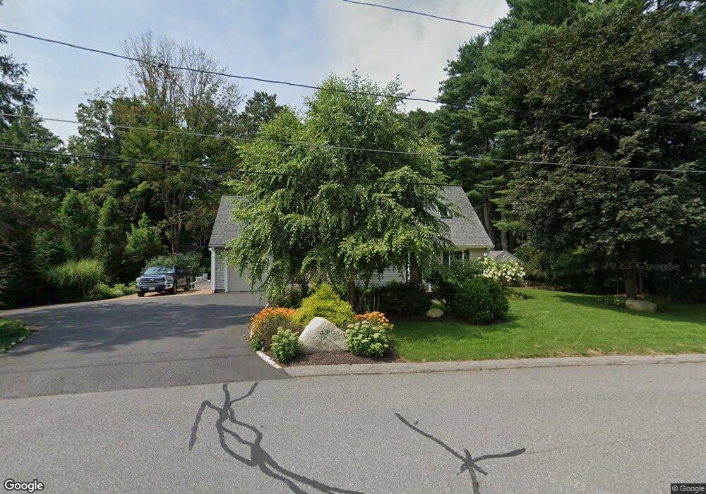
49 Massasoit Ave Sudbury, MA 01776
Estimated Value: $866,753 - $986,000
3
Beds
2
Baths
1,656
Sq Ft
$564/Sq Ft
Est. Value
About This Home
This home is located at 49 Massasoit Ave, Sudbury, MA 01776 and is currently estimated at $933,438, approximately $563 per square foot. 49 Massasoit Ave is a home located in Middlesex County with nearby schools including Israel Loring Elementary School, Ephraim Curtis Middle School, and Lincoln-Sudbury Regional High School.
Ownership History
Date
Name
Owned For
Owner Type
Purchase Details
Closed on
Dec 2, 2010
Sold by
Magnuson Robert C and Magnuson Eric
Bought by
Brady Paul and Brady Ellen W
Current Estimated Value
Home Financials for this Owner
Home Financials are based on the most recent Mortgage that was taken out on this home.
Original Mortgage
$288,000
Outstanding Balance
$188,788
Interest Rate
4.22%
Mortgage Type
Purchase Money Mortgage
Estimated Equity
$744,650
Purchase Details
Closed on
Jun 12, 2003
Sold by
Magnuson Robert Conrad and A
Bought by
Magnuson Eric and Wassam Mary M
Create a Home Valuation Report for This Property
The Home Valuation Report is an in-depth analysis detailing your home's value as well as a comparison with similar homes in the area
Home Values in the Area
Average Home Value in this Area
Purchase History
| Date | Buyer | Sale Price | Title Company |
|---|---|---|---|
| Brady Paul | $320,000 | -- | |
| Magnuson Eric | -- | -- |
Source: Public Records
Mortgage History
| Date | Status | Borrower | Loan Amount |
|---|---|---|---|
| Open | Brady Paul | $288,000 |
Source: Public Records
Tax History Compared to Growth
Tax History
| Year | Tax Paid | Tax Assessment Tax Assessment Total Assessment is a certain percentage of the fair market value that is determined by local assessors to be the total taxable value of land and additions on the property. | Land | Improvement |
|---|---|---|---|---|
| 2025 | $11,090 | $757,500 | $393,100 | $364,400 |
| 2024 | $10,702 | $732,500 | $381,600 | $350,900 |
| 2023 | $10,960 | $695,000 | $353,300 | $341,700 |
| 2022 | $10,520 | $582,800 | $324,300 | $258,500 |
| 2021 | $10,112 | $537,000 | $324,300 | $212,700 |
| 2020 | $9,908 | $537,000 | $324,300 | $212,700 |
| 2019 | $9,618 | $537,000 | $324,300 | $212,700 |
| 2018 | $9,752 | $543,900 | $345,800 | $198,100 |
| 2017 | $9,127 | $514,500 | $328,900 | $185,600 |
| 2016 | $8,788 | $493,700 | $316,400 | $177,300 |
| 2015 | $8,437 | $479,400 | $304,200 | $175,200 |
| 2014 | $8,407 | $466,300 | $295,300 | $171,000 |
Source: Public Records
Map
Nearby Homes
- 23 Massasoit Ave
- 36 Concord Rd
- 94 Goodmans Hill Rd
- 1011 Boston Post Rd
- 216 Landham Rd
- 270 Old Lancaster Rd
- 89 Bridle Path
- 6 Old County Rd Unit 16
- 24 Woodland Rd
- 7 Adams Rd
- 84 Hopestill Brown Rd
- 0 Wagonwheel Rd
- 63 Landham Rd
- 0 Robbins Rd
- 12 Hickory Rd
- 30 Rolling Ln
- 91 Eaton Rd W
- 32 Eaton Rd W
- 427 Concord Rd
- 19 Nob Hill Dr
- 55 Massasoit Ave
- 18 Allen Place
- 46 Massasoit Ave
- 45 Massasoit Ave
- 58 Massasoit Ave
- 19 Franklin Place
- 25 Franklin Place
- 42 Massasoit Ave
- 34 Church St
- 10 Allen Place
- 40 Massasoit Ave
- 39 Massasoit Ave
- 11 Allen Place
- 22 Franklin Place
- 14 Bradley Place
- 18 Franklin Place
- 30 Church St
- 33 Massasoit Ave
- 26 Franklin Place
- 6 Allen Place