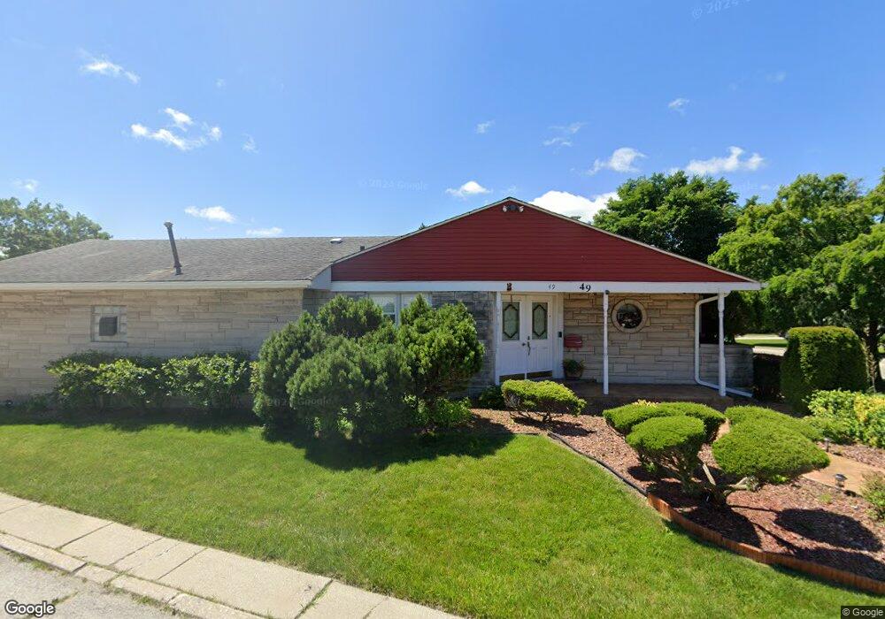
49 Schrum Rd Calumet City, IL 60409
Estimated Value: $175,281 - $241,000
3
Beds
1
Bath
1,526
Sq Ft
$133/Sq Ft
Est. Value
About This Home
This home is located at 49 Schrum Rd, Calumet City, IL 60409 and is currently estimated at $202,570, approximately $132 per square foot. 49 Schrum Rd is a home located in Cook County with nearby schools including Hoover Elementary School, Schrum Memorial Middle School, and Thornton Fractional North High School.
Ownership History
Date
Name
Owned For
Owner Type
Purchase Details
Closed on
Sep 22, 2004
Sold by
Lundy Steve W and Lundy Vita J
Bought by
Terrell Ray A and Terrell Brenda F
Current Estimated Value
Home Financials for this Owner
Home Financials are based on the most recent Mortgage that was taken out on this home.
Original Mortgage
$178,100
Outstanding Balance
$85,217
Interest Rate
5.37%
Mortgage Type
Unknown
Estimated Equity
$117,353
Create a Home Valuation Report for This Property
The Home Valuation Report is an in-depth analysis detailing your home's value as well as a comparison with similar homes in the area
Home Values in the Area
Average Home Value in this Area
Purchase History
| Date | Buyer | Sale Price | Title Company |
|---|---|---|---|
| Terrell Ray A | $180,000 | Atgf Inc |
Source: Public Records
Mortgage History
| Date | Status | Borrower | Loan Amount |
|---|---|---|---|
| Open | Terrell Ray A | $178,100 |
Source: Public Records
Tax History Compared to Growth
Tax History
| Year | Tax Paid | Tax Assessment Tax Assessment Total Assessment is a certain percentage of the fair market value that is determined by local assessors to be the total taxable value of land and additions on the property. | Land | Improvement |
|---|---|---|---|---|
| 2024 | $8,341 | $16,000 | $2,758 | $13,242 |
| 2023 | $7,135 | $16,000 | $2,758 | $13,242 |
| 2022 | $7,135 | $11,790 | $2,434 | $9,356 |
| 2021 | $7,076 | $11,788 | $2,433 | $9,355 |
| 2020 | $6,138 | $11,788 | $2,433 | $9,355 |
| 2019 | $5,725 | $11,129 | $2,271 | $8,858 |
| 2018 | $5,756 | $11,129 | $2,271 | $8,858 |
| 2017 | $6,183 | $12,078 | $2,271 | $9,807 |
| 2016 | $4,566 | $9,273 | $2,109 | $7,164 |
| 2015 | $4,415 | $9,273 | $2,109 | $7,164 |
| 2014 | $4,281 | $9,273 | $2,109 | $7,164 |
| 2013 | $4,338 | $9,974 | $2,109 | $7,865 |
Source: Public Records
Map
Nearby Homes
- 1374 Kenilworth Dr
- 1404 Wentworth Ave Unit 1
- 1375 Forest Place
- 107 163rd St
- 43 163rd St
- 1373 Stanley Blvd
- 1420 Wentworth Ave
- 1395 Freeland Ave
- 1304 Freeland Ave
- 1341 Gordon Ave
- 1351 Gordon Ave
- 1461 Wentworth Ave
- 1313 Gordon Ave
- 1464 Shirley Dr
- 1473 Wentworth Ave
- 302 161st St
- 16 164th Place
- 1481 Lincoln Ave
- 100 Michigan City Rd
- 305 River Oaks Dr
- 1345 Wentworth Ave
- 1345 Wentworth Ave
- 48 Schrum Rd
- 46 Schrum Rd
- 47 Schrum Rd
- 44 Schrum Rd
- 1351 Wentworth Ave
- 1351 Wentworth Ave
- 1334 Wentworth Ave
- 1336 Wentworth Ave
- 1336 Wentworth Ave Unit 1-2
- 1336 Wentworth Ave Unit 1
- 1334 1/2 Wentworth Ave
- 1332 Wentworth Ave
- 1332 Wentworth Ave Unit 1334
- 1330 Wentworth Ave
- 1338 Wentworth Ave Unit 1-2
- 1338 Wentworth Ave Unit 1
- 1340 Wentworth Ave
- 1340 Wentworth Ave