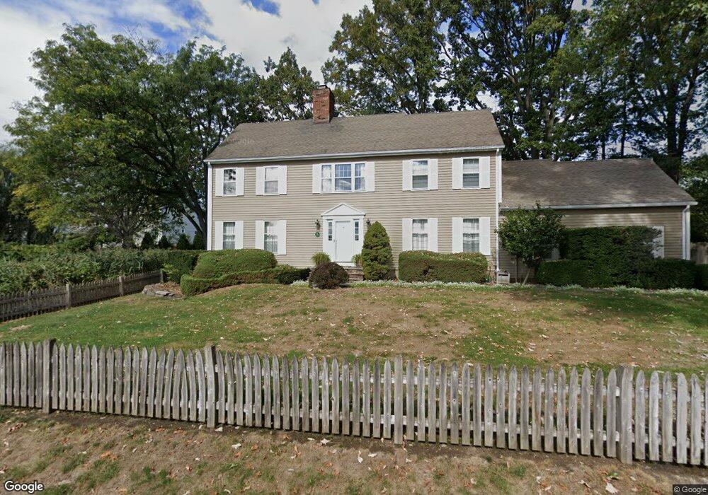
49 Top Gallant Rd Unit 21 Stamford, CT 06902
Waterside NeighborhoodEstimated Value: $835,000 - $924,000
3
Beds
2
Baths
1,751
Sq Ft
$514/Sq Ft
Est. Value
About This Home
This home is located at 49 Top Gallant Rd Unit 21, Stamford, CT 06902 and is currently estimated at $899,224, approximately $513 per square foot. 49 Top Gallant Rd Unit 21 is a home located in Fairfield County with nearby schools including Stillmeadow Elementary School, Cloonan School, and Westhill High School.
Ownership History
Date
Name
Owned For
Owner Type
Purchase Details
Closed on
Feb 28, 2022
Sold by
Lilienthal Peter S and Lilienthal Carol A
Bought by
Peter S Lilienthal Ret
Current Estimated Value
Purchase Details
Closed on
Nov 1, 1994
Sold by
Threshie Elizabeth A
Bought by
Threshie Charles F and Mcelreath Holly L
Purchase Details
Closed on
Aug 16, 1993
Sold by
Vanech Bros
Bought by
Treshie Elizabeth
Create a Home Valuation Report for This Property
The Home Valuation Report is an in-depth analysis detailing your home's value as well as a comparison with similar homes in the area
Home Values in the Area
Average Home Value in this Area
Purchase History
| Date | Buyer | Sale Price | Title Company |
|---|---|---|---|
| Peter S Lilienthal Ret | -- | None Available | |
| Threshie Charles F | $240,000 | -- | |
| Treshie Elizabeth | $228,450 | -- |
Source: Public Records
Mortgage History
| Date | Status | Borrower | Loan Amount |
|---|---|---|---|
| Previous Owner | Treshie Elizabeth | $38,750 | |
| Previous Owner | Treshie Elizabeth | $400,000 | |
| Previous Owner | Treshie Elizabeth | $419,000 | |
| Previous Owner | Treshie Elizabeth | $204,800 |
Source: Public Records
Tax History Compared to Growth
Tax History
| Year | Tax Paid | Tax Assessment Tax Assessment Total Assessment is a certain percentage of the fair market value that is determined by local assessors to be the total taxable value of land and additions on the property. | Land | Improvement |
|---|---|---|---|---|
| 2025 | $10,446 | $436,690 | $0 | $436,690 |
| 2024 | $10,201 | $436,690 | $0 | $436,690 |
| 2023 | $11,022 | $436,690 | $0 | $436,690 |
| 2022 | $10,571 | $389,070 | $0 | $389,070 |
| 2021 | $10,482 | $389,070 | $0 | $389,070 |
| 2020 | $10,252 | $389,070 | $0 | $389,070 |
| 2019 | $10,252 | $389,070 | $0 | $389,070 |
| 2018 | $9,933 | $389,070 | $0 | $389,070 |
| 2017 | $9,296 | $345,700 | $0 | $345,700 |
| 2016 | $9,030 | $345,700 | $0 | $345,700 |
| 2015 | $8,791 | $345,700 | $0 | $345,700 |
| 2014 | -- | $345,700 | $0 | $345,700 |
Source: Public Records
Map
Nearby Homes
- 3 Davenport Dr
- 602 Fairfield Ave
- 20 Cook Rd
- 42 Signal Rd
- 54 Signal Rd
- 50 Signal Rd
- 46 Signal Rd
- 94 Southfield Ave Unit 1403
- 40 Orchard St
- 57 Lockwood Ave
- 51 Forest Ave Unit 60
- 51 Forest Ave Unit 98
- 51 Forest Ave Unit 82
- 17 Highview Ave
- 45 Binney Ln
- 8 Park Ave
- 19 Waverly Place
- 46 Park Ave
- 21 Binney Ln
- 348 Sound Beach Ave
- 49 Top Gallant Rd Unit 19
- 79 Burwood Ave
- 85 Burwood Ave
- 85 Burwood Ave Unit LEFT
- 85 Burwood Ave Unit Front
- 75 Burwood Ave
- 71 Burwood Ave
- 95 Burwood Ave
- 97 Burwood Ave Unit A
- 97 Burwood Ave Unit B
- 65 Burwood Ave
- 61 Burwood Ave
- 4 Keith St
- 101 Burwood Ave Unit 2
- 101 Burwood Ave Unit 1
- 2 Top Gallant Rd
- 55 Burwood Ave
- 76 Burwood Ave