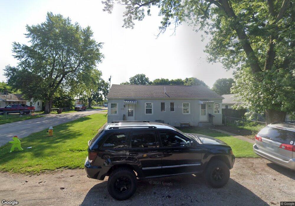
4920 Wire Dr Dayton, OH 45414
Northridge NeighborhoodEstimated Value: $118,000 - $184,000
4
Beds
2
Baths
1,240
Sq Ft
$118/Sq Ft
Est. Value
About This Home
This home is located at 4920 Wire Dr, Dayton, OH 45414 and is currently estimated at $145,824, approximately $117 per square foot. 4920 Wire Dr is a home located in Montgomery County with nearby schools including Northridge High School, Horizon Science Academy-Dayton Elementary School, and Horizon Science Academy Dayton High School.
Ownership History
Date
Name
Owned For
Owner Type
Purchase Details
Closed on
Jan 19, 2021
Sold by
Tdk Investment Llc
Bought by
Messinger Eric
Current Estimated Value
Home Financials for this Owner
Home Financials are based on the most recent Mortgage that was taken out on this home.
Original Mortgage
$70,500
Outstanding Balance
$62,799
Interest Rate
2.6%
Mortgage Type
New Conventional
Estimated Equity
$83,025
Purchase Details
Closed on
Mar 25, 2020
Sold by
Singer Scott P
Bought by
Tdk Investment Llc
Purchase Details
Closed on
Aug 23, 2016
Sold by
Estate Of Phillip T Singer
Bought by
Singer Scott P and Singer Darrin H
Purchase Details
Closed on
Aug 19, 2016
Sold by
Estate Of Herietta M Singer
Bought by
Singer Philip T
Create a Home Valuation Report for This Property
The Home Valuation Report is an in-depth analysis detailing your home's value as well as a comparison with similar homes in the area
Home Values in the Area
Average Home Value in this Area
Purchase History
| Date | Buyer | Sale Price | Title Company |
|---|---|---|---|
| Messinger Eric | $94,000 | Pm Title | |
| Tdk Investment Llc | $18,000 | Partners Land Title Agency | |
| Singer Scott P | -- | None Available | |
| Singer Philip T | -- | None Available |
Source: Public Records
Mortgage History
| Date | Status | Borrower | Loan Amount |
|---|---|---|---|
| Open | Messinger Eric | $70,500 |
Source: Public Records
Tax History Compared to Growth
Tax History
| Year | Tax Paid | Tax Assessment Tax Assessment Total Assessment is a certain percentage of the fair market value that is determined by local assessors to be the total taxable value of land and additions on the property. | Land | Improvement |
|---|---|---|---|---|
| 2024 | $1,121 | $13,080 | $3,770 | $9,310 |
| 2023 | $1,121 | $13,080 | $3,770 | $9,310 |
| 2022 | $1,124 | $9,480 | $2,730 | $6,750 |
| 2021 | $1,163 | $9,480 | $2,730 | $6,750 |
| 2020 | $1,170 | $9,480 | $2,730 | $6,750 |
| 2019 | $1,895 | $11,790 | $2,460 | $9,330 |
| 2018 | $1,932 | $11,790 | $2,460 | $9,330 |
| 2017 | $1,794 | $11,790 | $2,460 | $9,330 |
| 2016 | $1,520 | $11,120 | $2,730 | $8,390 |
| 2015 | $1,391 | $11,120 | $2,730 | $8,390 |
| 2014 | $1,391 | $11,120 | $2,730 | $8,390 |
| 2012 | -- | $19,560 | $2,910 | $16,650 |
Source: Public Records
Map
Nearby Homes
- 2585 Coronette Ave
- 2424 Ottello Ave
- 4404 Ross Ave
- 4400 Canyon Rd
- 2417 Neff Rd
- 2233 Ottello Ave
- 2315 Rector Ave
- 2073 Auburndale Ave
- 2124 Lodell Ave
- 2216 Rector Ave
- 2304 Homesite Dr
- 2110 Needmore Rd
- 2127 Marker Ave
- 3394 Lodge Ave Unit 3384
- 2171 Argray Dr
- 2412 Neva Dr
- 1742 Eric Dr
- 2422 Oneida Ave
- 5586 Wadsworth Rd
- 1820 E Siebenthaler Ave