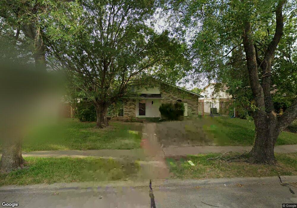
4929 Watkins Dr the Colony, TX 75056
Estimated Value: $304,928 - $378,000
3
Beds
2
Baths
1,409
Sq Ft
$238/Sq Ft
Est. Value
About This Home
This home is located at 4929 Watkins Dr, the Colony, TX 75056 and is currently estimated at $334,732, approximately $237 per square foot. 4929 Watkins Dr is a home located in Denton County with nearby schools including Peters Colony Elementary School, Stewarts Creek Elementary School, and Lakeview Middle School.
Ownership History
Date
Name
Owned For
Owner Type
Purchase Details
Closed on
Sep 25, 2015
Sold by
Sarwal Manoranjan
Bought by
Jnrp Series H Llc
Current Estimated Value
Purchase Details
Closed on
Jul 5, 2012
Sold by
Sarwal Purnima
Bought by
Sarwal Manoranjan
Purchase Details
Closed on
Apr 5, 2012
Sold by
The Bank Of New York Mellon Trust Compan
Bought by
Sarwal Purnima
Purchase Details
Closed on
Sep 21, 2004
Sold by
Peterson Joseph J and Peterson Cynthia Wyatt
Bought by
Delagala Jose
Home Financials for this Owner
Home Financials are based on the most recent Mortgage that was taken out on this home.
Original Mortgage
$84,525
Interest Rate
5.81%
Mortgage Type
Purchase Money Mortgage
Purchase Details
Closed on
Feb 7, 2004
Sold by
Gala Jose De La and Gala Carmen De La
Bought by
The Bank Of New York Mellon Trust Compan and The Bank Of New York Trust Company Na
Create a Home Valuation Report for This Property
The Home Valuation Report is an in-depth analysis detailing your home's value as well as a comparison with similar homes in the area
Home Values in the Area
Average Home Value in this Area
Purchase History
| Date | Buyer | Sale Price | Title Company |
|---|---|---|---|
| Jnrp Series H Llc | -- | Attorney | |
| Sarwal Manoranjan | -- | None Available | |
| Sarwal Purnima | -- | Fatco | |
| Delagala Jose | -- | Ctic | |
| The Bank Of New York Mellon Trust Compan | $90,000 | None Available |
Source: Public Records
Mortgage History
| Date | Status | Borrower | Loan Amount |
|---|---|---|---|
| Previous Owner | Delagala Jose | $84,525 | |
| Closed | Delagala Jose | $10,000 |
Source: Public Records
Tax History Compared to Growth
Tax History
| Year | Tax Paid | Tax Assessment Tax Assessment Total Assessment is a certain percentage of the fair market value that is determined by local assessors to be the total taxable value of land and additions on the property. | Land | Improvement |
|---|---|---|---|---|
| 2025 | $5,046 | $236,000 | $67,100 | $168,900 |
| 2024 | $5,046 | $260,000 | $67,100 | $192,900 |
| 2023 | $5,271 | $269,000 | $62,638 | $206,362 |
| 2022 | $5,038 | $240,000 | $67,100 | $172,900 |
| 2021 | $4,610 | $207,000 | $43,481 | $163,519 |
| 2020 | $4,334 | $195,000 | $43,481 | $151,519 |
| 2019 | $4,408 | $192,000 | $43,481 | $148,519 |
| 2018 | $4,159 | $180,000 | $43,481 | $136,519 |
| 2017 | $3,427 | $146,694 | $43,481 | $103,213 |
| 2016 | $3,046 | $130,378 | $34,892 | $95,486 |
| 2015 | $2,800 | $128,940 | $26,840 | $102,100 |
| 2014 | $2,800 | $115,629 | $26,840 | $88,789 |
| 2013 | -- | $103,487 | $26,840 | $76,647 |
Source: Public Records
Map
Nearby Homes
- 4924 Wagner Dr
- 4937 Wagner Dr
- 5001 Wheeler Cir
- 5008 N Colony Blvd
- 4821 Hamilton Ct
- 5001 N Colony Blvd
- 4824 Wheeler Dr
- 4913 N Colony Blvd
- 4917 Ashlock Dr
- 4933 Crawford Dr
- 4715 Chowning Cir
- 7420 Elm St
- 5109 Reed Dr
- 5057 Roberts Dr
- 5013 Nash Dr
- 4713 Jennings Dr
- 4522 Jenkins St
- 4529 Carr St
- 4817 Pemberton Ln
- 4500 Larner St
- 4925 Watkins Dr
- 4933 Watkins Dr
- 4921 Watkins Dr
- 4937 Watkins Dr
- 4928 Wagner Dr
- 4932 Wagner Dr
- 4928 Watkins Dr
- 4924 Watkins Dr
- 4920 Wagner Dr
- 4932 Watkins Dr
- 4936 Wagner Dr
- 4917 Watkins Dr
- 4941 Watkins Dr
- 4920 Watkins Dr
- 4936 Watkins Dr
- 4916 Wagner Dr
- 4940 Wagner Dr
- 4916 Watkins Dr
- 4913 Watkins Dr
- 4940 Watkins Dr