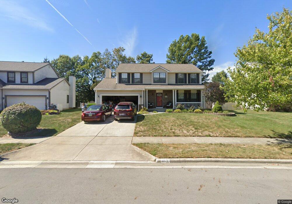
493 Burns Dr N Westerville, OH 43082
Genoa NeighborhoodEstimated Value: $441,000 - $464,000
4
Beds
3
Baths
2,202
Sq Ft
$206/Sq Ft
Est. Value
About This Home
This home is located at 493 Burns Dr N, Westerville, OH 43082 and is currently estimated at $453,492, approximately $205 per square foot. 493 Burns Dr N is a home located in Delaware County with nearby schools including Robert Frost Elementary School, Heritage Middle School, and Westerville-North High School.
Ownership History
Date
Name
Owned For
Owner Type
Purchase Details
Closed on
Sep 4, 2003
Sold by
Seech Dionigia A
Bought by
Seech Douglas R
Current Estimated Value
Home Financials for this Owner
Home Financials are based on the most recent Mortgage that was taken out on this home.
Original Mortgage
$191,250
Outstanding Balance
$73,361
Interest Rate
3.75%
Mortgage Type
Purchase Money Mortgage
Estimated Equity
$380,131
Purchase Details
Closed on
Sep 7, 1999
Sold by
Blythe Billy T
Bought by
Seech Douglas R and Seech Dionigia A
Home Financials for this Owner
Home Financials are based on the most recent Mortgage that was taken out on this home.
Original Mortgage
$144,000
Interest Rate
7.59%
Mortgage Type
New Conventional
Create a Home Valuation Report for This Property
The Home Valuation Report is an in-depth analysis detailing your home's value as well as a comparison with similar homes in the area
Home Values in the Area
Average Home Value in this Area
Purchase History
| Date | Buyer | Sale Price | Title Company |
|---|---|---|---|
| Seech Douglas R | -- | Chelsea Title Agency | |
| Seech Douglas R | $160,000 | -- |
Source: Public Records
Mortgage History
| Date | Status | Borrower | Loan Amount |
|---|---|---|---|
| Open | Seech Douglas R | $191,250 | |
| Closed | Seech Douglas R | $144,000 |
Source: Public Records
Tax History Compared to Growth
Tax History
| Year | Tax Paid | Tax Assessment Tax Assessment Total Assessment is a certain percentage of the fair market value that is determined by local assessors to be the total taxable value of land and additions on the property. | Land | Improvement |
|---|---|---|---|---|
| 2024 | $6,444 | $126,490 | $29,400 | $97,090 |
| 2023 | $6,371 | $126,490 | $29,400 | $97,090 |
| 2022 | $5,519 | $84,780 | $20,130 | $64,650 |
| 2021 | $5,566 | $84,780 | $20,130 | $64,650 |
| 2020 | $5,603 | $84,780 | $20,130 | $64,650 |
| 2019 | $4,848 | $70,070 | $17,500 | $52,570 |
| 2018 | $4,766 | $70,070 | $17,500 | $52,570 |
| 2017 | $4,728 | $64,610 | $12,740 | $51,870 |
| 2016 | $4,795 | $64,610 | $12,740 | $51,870 |
| 2015 | $4,586 | $64,610 | $12,740 | $51,870 |
| 2014 | $4,632 | $64,610 | $12,740 | $51,870 |
| 2013 | $4,424 | $61,670 | $12,740 | $48,930 |
Source: Public Records
Map
Nearby Homes
- 656 Olde Mill Dr
- 754 Kingsmead Rd Unit 18754
- 672 Stonefield Dr
- 718 Sugar Ct
- 547 County Line Rd
- 267 Windemere Place
- 223 Dogwood Ln
- 175 Nottingham Ct
- 348 Buck Run Trail
- 150 Matthew Ave
- 137 Abbeycross Ln
- 705 N State St Unit 211
- 129 Abbeycross Ln Unit 129
- 114 Canterbrick Dr
- 543 N State St
- 66 Abbeycross Ln
- 912 Lakeway Ct E
- 368 E College Ave
- 389 Ridgemoor Ln
- 364 E College Ave
- 499 Burns Dr N
- 487 Burns Dr N
- 500 Radcliff Dr
- 492 Radcliff Dr
- 494 Radcliff Dr
- 507 Burns Dr N
- 510 Radcliff Dr
- 481 Burns Dr N
- 490 Burns Dr N
- 488 Radcliff Dr
- 513 Burns Dr N
- 520 Radcliff Dr
- 473 Burns Dr N
- 486 Radcliff Dr
- 478 Burns Dr N
- 499 Radcliff Dr
- 509 Radcliff Dr
- 521 Burns Dr N
- 470 Burns Dr N
- 465 Burns Dr N