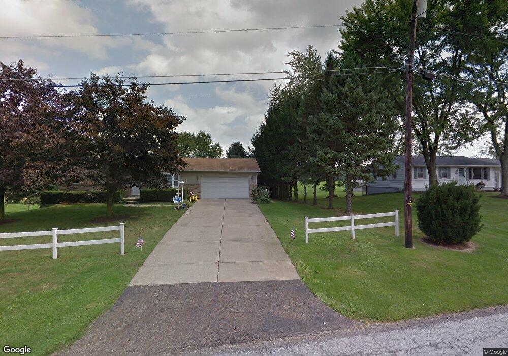
4930 Eshelman St Louisville, OH 44641
Estimated Value: $164,000 - $208,000
3
Beds
1
Bath
1,092
Sq Ft
$175/Sq Ft
Est. Value
About This Home
This home is located at 4930 Eshelman St, Louisville, OH 44641 and is currently estimated at $190,777, approximately $174 per square foot. 4930 Eshelman St is a home located in Stark County with nearby schools including Louisville High School and St. Thomas Aquinas High School & Middle School.
Ownership History
Date
Name
Owned For
Owner Type
Purchase Details
Closed on
Jun 27, 2023
Sold by
Fawver Mary Ann
Bought by
Westrich Zachary W and Westrich Gara L
Current Estimated Value
Home Financials for this Owner
Home Financials are based on the most recent Mortgage that was taken out on this home.
Original Mortgage
$126,170
Outstanding Balance
$123,210
Interest Rate
6.88%
Mortgage Type
FHA
Estimated Equity
$67,567
Create a Home Valuation Report for This Property
The Home Valuation Report is an in-depth analysis detailing your home's value as well as a comparison with similar homes in the area
Home Values in the Area
Average Home Value in this Area
Purchase History
| Date | Buyer | Sale Price | Title Company |
|---|---|---|---|
| Westrich Zachary W | -- | None Listed On Document |
Source: Public Records
Mortgage History
| Date | Status | Borrower | Loan Amount |
|---|---|---|---|
| Open | Westrich Zachary W | $126,170 |
Source: Public Records
Tax History Compared to Growth
Tax History
| Year | Tax Paid | Tax Assessment Tax Assessment Total Assessment is a certain percentage of the fair market value that is determined by local assessors to be the total taxable value of land and additions on the property. | Land | Improvement |
|---|---|---|---|---|
| 2025 | -- | $54,670 | $15,610 | $39,060 |
| 2024 | -- | $54,670 | $15,610 | $39,060 |
| 2023 | $2,277 | $45,750 | $11,060 | $34,690 |
| 2022 | $1,806 | $45,750 | $11,060 | $34,690 |
| 2021 | $1,811 | $45,750 | $11,060 | $34,690 |
| 2020 | $1,498 | $41,090 | $9,940 | $31,150 |
| 2019 | $1,504 | $41,100 | $9,940 | $31,160 |
| 2018 | $1,500 | $41,100 | $9,940 | $31,160 |
| 2017 | $1,443 | $38,440 | $9,310 | $29,130 |
| 2016 | $1,411 | $38,440 | $9,310 | $29,130 |
| 2015 | $1,414 | $38,440 | $9,310 | $29,130 |
| 2014 | $1,275 | $33,500 | $8,120 | $25,380 |
| 2013 | $641 | $33,500 | $8,120 | $25,380 |
Source: Public Records
Map
Nearby Homes
- 2015 E Main St
- 203 Brookfield St
- 5495 Meese Rd NE
- 1812 E Broad St
- 1715 High St
- 5765 Maplegrove St
- 2110 Edmar St
- 0 Michigan Blvd
- 6052 N Nickelplate St
- 1170 Winding Ridge Ave
- 308 Superior St
- 910 Crosswyck Cir
- 641 S Nickelplate St
- 520 S Silver St
- 3390 Meese Rd NE
- 728 E Broad St
- 325 Lincoln Ave
- 316 E Reno Dr
- 428 Honeycrisp Dr NE
- 3047 Mcintosh Dr NE
- 4900 Eshelman St
- 4934 Eshelman St
- 4956 Eshelman St
- 4901 Eshelman St
- 4866 Eshelman St
- 4869 Eshelman St
- 4963 Eshelman St
- 4822 Eshelman St
- 4887 Eshelman St
- 4874 Stoner Ave
- 4810 Eshelman St
- 9144 Scott St
- 9144 Scott St
- 9153 Scott St
- 9104 Scott St
- 9115 Scott St
- 4870 Stoner Ave
- 9091 Scott St
- 4942 Stoner Ave
- 4950 Stoner Ave