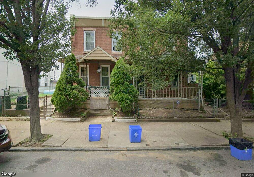
4942 Duffield St Philadelphia, PA 19124
Frankford NeighborhoodEstimated Value: $208,000 - $231,000
4
Beds
1
Bath
1,600
Sq Ft
$135/Sq Ft
Est. Value
About This Home
This home is located at 4942 Duffield St, Philadelphia, PA 19124 and is currently estimated at $215,762, approximately $134 per square foot. 4942 Duffield St is a home located in Philadelphia County with nearby schools including Harding Warren G Middle School, Frankford High School, and Mastery Schools Smedley Elementary.
Ownership History
Date
Name
Owned For
Owner Type
Purchase Details
Closed on
Jun 14, 2005
Sold by
Robinson Alfred
Bought by
Robinson Jonathan W
Current Estimated Value
Home Financials for this Owner
Home Financials are based on the most recent Mortgage that was taken out on this home.
Original Mortgage
$63,050
Interest Rate
5.78%
Mortgage Type
Fannie Mae Freddie Mac
Create a Home Valuation Report for This Property
The Home Valuation Report is an in-depth analysis detailing your home's value as well as a comparison with similar homes in the area
Home Values in the Area
Average Home Value in this Area
Purchase History
| Date | Buyer | Sale Price | Title Company |
|---|---|---|---|
| Robinson Jonathan W | $65,000 | -- |
Source: Public Records
Mortgage History
| Date | Status | Borrower | Loan Amount |
|---|---|---|---|
| Closed | Robinson Jonathan W | $63,050 |
Source: Public Records
Tax History Compared to Growth
Tax History
| Year | Tax Paid | Tax Assessment Tax Assessment Total Assessment is a certain percentage of the fair market value that is determined by local assessors to be the total taxable value of land and additions on the property. | Land | Improvement |
|---|---|---|---|---|
| 2026 | $1,620 | $168,500 | $33,700 | $134,800 |
| 2025 | $1,620 | $168,500 | $33,700 | $134,800 |
| 2024 | $1,620 | $168,500 | $33,700 | $134,800 |
| 2023 | $1,620 | $115,700 | $23,140 | $92,560 |
| 2022 | $375 | $70,700 | $23,140 | $47,560 |
| 2021 | $1,005 | $0 | $0 | $0 |
| 2020 | $1,005 | $0 | $0 | $0 |
| 2019 | $964 | $0 | $0 | $0 |
| 2018 | $1,207 | $0 | $0 | $0 |
| 2017 | $1,207 | $0 | $0 | $0 |
| 2016 | $787 | $0 | $0 | $0 |
| 2015 | $753 | $0 | $0 | $0 |
| 2014 | -- | $86,200 | $28,188 | $58,012 |
| 2012 | -- | $6,080 | $1,157 | $4,923 |
Source: Public Records
Map
Nearby Homes
- 4943 Duffield St
- 1615 Wakeling St
- 5009 Hawthorne St
- 5103 Duffield St
- 1651 Conklin St
- 4942 Mulberry St
- 4938 Mulberry St
- 4843 Duffield St
- 5201 Hawthorne St
- 1724 Harrison St
- 1688 Fillmore St
- 1636 Fillmore St
- 1615 Fillmore St
- 4952 Charles St
- 1539 Dyre St
- 1641 Granite St
- 5020 Griscom St
- 5236 Marlowe St
- 1629 Foulkrod St
- 1818 Harrison St
- 4946 Duffield St
- 4940 Duffield St
- 4934 Duffield St
- 4948 Duffield St
- 4932 Duffield St
- 4952 Duffield St
- 1670 Wakeling St
- 1668 Wakeling St
- 4928 Duffield St
- 4954 Duffield St
- 1666 Wakeling St
- 4926 Duffield St
- 4931 Duffield St
- 4933 Duffield St
- 4935 Duffield St
- 4935 Duffield St Unit 1
- 4929 Duffield St
- 1664 Wakeling St Unit 1
- 1664 Wakeling St Unit 2
- 1664 Wakeling St