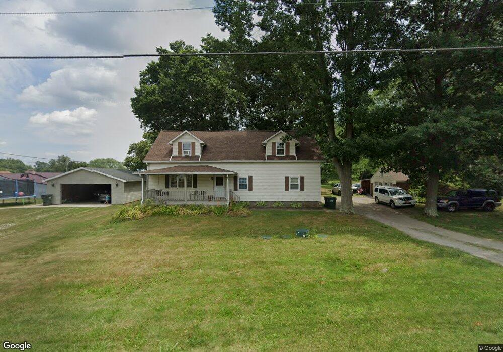
4950 Meese Rd Louisville, OH 44641
Estimated Value: $254,960 - $297,000
4
Beds
2
Baths
2,275
Sq Ft
$121/Sq Ft
Est. Value
About This Home
This home is located at 4950 Meese Rd, Louisville, OH 44641 and is currently estimated at $274,490, approximately $120 per square foot. 4950 Meese Rd is a home located in Stark County with nearby schools including Louisville High School and St. Thomas Aquinas High School & Middle School.
Ownership History
Date
Name
Owned For
Owner Type
Purchase Details
Closed on
Jan 4, 2006
Sold by
Sukosd John W
Bought by
Sukosd Cheryl L
Current Estimated Value
Home Financials for this Owner
Home Financials are based on the most recent Mortgage that was taken out on this home.
Original Mortgage
$65,000
Interest Rate
6.46%
Mortgage Type
Stand Alone Refi Refinance Of Original Loan
Create a Home Valuation Report for This Property
The Home Valuation Report is an in-depth analysis detailing your home's value as well as a comparison with similar homes in the area
Home Values in the Area
Average Home Value in this Area
Purchase History
| Date | Buyer | Sale Price | Title Company |
|---|---|---|---|
| Sukosd Cheryl L | -- | None Available |
Source: Public Records
Mortgage History
| Date | Status | Borrower | Loan Amount |
|---|---|---|---|
| Closed | Sukosd Cheryl L | $65,000 |
Source: Public Records
Tax History Compared to Growth
Tax History
| Year | Tax Paid | Tax Assessment Tax Assessment Total Assessment is a certain percentage of the fair market value that is determined by local assessors to be the total taxable value of land and additions on the property. | Land | Improvement |
|---|---|---|---|---|
| 2025 | -- | $60,350 | $11,520 | $48,830 |
| 2024 | -- | $60,350 | $11,520 | $48,830 |
| 2023 | $2,421 | $49,850 | $8,160 | $41,690 |
| 2022 | $2,424 | $49,850 | $8,160 | $41,690 |
| 2021 | $2,431 | $49,850 | $8,160 | $41,690 |
| 2020 | $1,398 | $30,170 | $7,350 | $22,820 |
| 2019 | $1,403 | $30,170 | $7,350 | $22,820 |
| 2018 | $1,399 | $30,170 | $7,350 | $22,820 |
| 2017 | $1,330 | $27,370 | $6,860 | $20,510 |
| 2016 | $1,300 | $27,370 | $6,860 | $20,510 |
| 2015 | $1,304 | $27,370 | $6,860 | $20,510 |
| 2014 | $1,229 | $23,880 | $5,990 | $17,890 |
| 2013 | $618 | $23,880 | $5,990 | $17,890 |
Source: Public Records
Map
Nearby Homes
- 2015 E Main St
- 5495 Meese Rd NE
- 1413 Washington Blvd
- 0 Michigan Blvd
- 1812 E Broad St
- 910 Crosswyck Cir
- 308 Superior St
- 2110 Edmar St
- 6052 N Nickelplate St
- 520 S Silver St
- 325 Lincoln Ave
- 344 E Reno Dr
- 728 E Broad St
- 316 E Reno Dr
- 428 Honeycrisp Dr NE
- 3047 Mcintosh Dr NE
- 432 Honeycrisp Dr NE
- 2962 Mcintosh Dr NE
- 2963 Mcintosh Dr NE
- 430 Honeycrisp Dr NE