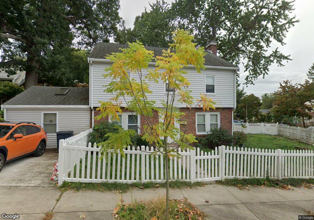
5 Bournedale Rd Jamaica Plain, MA 02130
Jamaica Plain NeighborhoodEstimated Value: $893,000 - $929,370
3
Beds
2
Baths
1,855
Sq Ft
$492/Sq Ft
Est. Value
About This Home
This home is located at 5 Bournedale Rd, Jamaica Plain, MA 02130 and is currently estimated at $912,593, approximately $491 per square foot. 5 Bournedale Rd is a home located in Suffolk County with nearby schools including Brooke Charter School Roslindale, The Croft School - Jamaica Plain, and St. Clare High School.
Ownership History
Date
Name
Owned For
Owner Type
Purchase Details
Closed on
Oct 17, 2012
Sold by
Gaddy Kim L
Bought by
5 Bournedale Road Rt
Current Estimated Value
Purchase Details
Closed on
Apr 3, 1995
Sold by
Laflamme Marion E and Knox Jean T
Bought by
Caddy Kim L
Home Financials for this Owner
Home Financials are based on the most recent Mortgage that was taken out on this home.
Original Mortgage
$102,000
Interest Rate
8.8%
Mortgage Type
Purchase Money Mortgage
Create a Home Valuation Report for This Property
The Home Valuation Report is an in-depth analysis detailing your home's value as well as a comparison with similar homes in the area
Home Values in the Area
Average Home Value in this Area
Purchase History
| Date | Buyer | Sale Price | Title Company |
|---|---|---|---|
| 5 Bournedale Road Rt | -- | -- | |
| Caddy Kim L | $127,500 | -- |
Source: Public Records
Mortgage History
| Date | Status | Borrower | Loan Amount |
|---|---|---|---|
| Previous Owner | Caddy Kim L | $102,000 |
Source: Public Records
Tax History Compared to Growth
Tax History
| Year | Tax Paid | Tax Assessment Tax Assessment Total Assessment is a certain percentage of the fair market value that is determined by local assessors to be the total taxable value of land and additions on the property. | Land | Improvement |
|---|---|---|---|---|
| 2025 | $9,154 | $790,500 | $280,500 | $510,000 |
| 2024 | $8,329 | $764,100 | $276,300 | $487,800 |
| 2023 | $7,668 | $714,000 | $258,200 | $455,800 |
| 2022 | $7,124 | $654,800 | $236,800 | $418,000 |
| 2021 | $6,783 | $635,700 | $229,900 | $405,800 |
| 2020 | $6,284 | $595,100 | $222,200 | $372,900 |
| 2019 | $5,973 | $566,700 | $184,700 | $382,000 |
| 2018 | $5,136 | $490,100 | $184,700 | $305,400 |
| 2017 | $5,090 | $480,600 | $184,700 | $295,900 |
| 2016 | $5,183 | $471,200 | $184,700 | $286,500 |
| 2015 | $5,029 | $415,300 | $174,200 | $241,100 |
| 2014 | $4,575 | $363,700 | $174,200 | $189,500 |
Source: Public Records
Map
Nearby Homes
- 18-20 Northbourne Rd Unit 18
- 50 Southbourne Rd
- 348-350 Hyde Park Ave Unit 2
- 31 Rodman St Unit 2
- 31 Rodman St Unit 1
- 158 Wachusett St Unit 3
- 19 Delford St
- 19 Delford St Unit 1
- 140 Wachusett St
- 4012 Washington St
- 178 Hyde Park Ave Unit 3
- 4031 Washington St
- 71 Wyvern St
- 143-171 Hyde Park Ave Unit 169A
- 36 Neponset Ave Unit 1
- 620 South St
- 24 Waterman Rd
- 187 Florence St Unit 2L
- 105 Neponset Ave Unit 105
- 103 Neponset Ave Unit 103A
- 38 Southbourne Rd
- 264 Wachusett St Unit 266
- 40 Southbourne Rd
- 6 Bournedale Rd
- 36 Southbourne Rd
- 42 Southbourne Rd
- 263 Wachusett St
- 259 Wachusett St
- 44 Southbourne Rd
- 44 Southbourne Rd
- 44 Southbourne Rd Unit 1
- 9 Bournedale Rd
- 34 Southbourne Rd
- 267 Wachusett St
- 267 Wachusett St Unit 1
- 255 Wachusett St
- 10 Bournedale Rd
- 46 Southbourne Rd
- 24 Southbourne Rd
- 18 Southbourne Rd