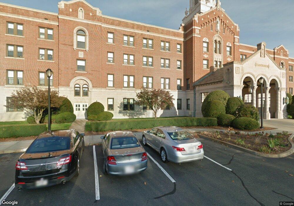
5 Gamelin St Holyoke, MA 01040
Estimated Value: $312,000
10
Beds
20
Baths
161,029
Sq Ft
$2/Sq Ft
Est. Value
About This Home
This home is located at 5 Gamelin St, Holyoke, MA 01040 and is currently priced at $312,000, approximately $1 per square foot. 5 Gamelin St is a home located in Hampden County with nearby schools including Butterfield Elementary School, Maurice A. Donahue Elementary School, and Holyoke High School.
Ownership History
Date
Name
Owned For
Owner Type
Purchase Details
Closed on
Feb 16, 2021
Sold by
Mercy Hospital Inc
Bought by
Holyoke Medical Prop Ownr
Current Estimated Value
Purchase Details
Closed on
Dec 17, 2014
Sold by
Sisters Of Providence
Bought by
Sisters Of Providence
Create a Home Valuation Report for This Property
The Home Valuation Report is an in-depth analysis detailing your home's value as well as a comparison with similar homes in the area
Home Values in the Area
Average Home Value in this Area
Purchase History
| Date | Buyer | Sale Price | Title Company |
|---|---|---|---|
| Holyoke Medical Prop Ownr | $1,000,000 | None Available | |
| Holyoke Medical Prop Ownr | $1,000,000 | None Available | |
| Sisters Of Providence | -- | -- |
Source: Public Records
Tax History Compared to Growth
Tax History
| Year | Tax Paid | Tax Assessment Tax Assessment Total Assessment is a certain percentage of the fair market value that is determined by local assessors to be the total taxable value of land and additions on the property. | Land | Improvement |
|---|---|---|---|---|
| 2025 | -- | $12,487,700 | $1,440,000 | $11,047,700 |
| 2024 | -- | $12,279,300 | $1,260,000 | $11,019,300 |
| 2023 | $0 | $12,279,300 | $1,260,000 | $11,019,300 |
| 2022 | $154,285 | $11,286,900 | $1,260,000 | $10,026,900 |
| 2021 | $0 | $11,226,900 | $1,200,000 | $10,026,900 |
| 2020 | $154,285 | $11,226,900 | $1,200,000 | $10,026,900 |
| 2019 | $0 | $10,507,000 | $780,000 | $9,727,000 |
| 2018 | $143,379 | $10,507,000 | $780,000 | $9,727,000 |
| 2017 | $136,498 | $10,507,000 | $780,000 | $9,727,000 |
| 2016 | $136,498 | $10,199,300 | $780,000 | $9,419,300 |
| 2015 | $136,498 | $10,199,300 | $780,000 | $9,419,300 |
Source: Public Records
Map
Nearby Homes
- 89-111 Whitney Ave
- 39 Bonnie Brae Dr
- 50 Overlook Dr
- 212 Poplar St
- 86 Beaumont Ave
- lot b Homestead Ave
- 51 Beaumont Ave
- 59 Clayton Dr
- 87 Blanchwood Ave
- 11 Annie's Way
- 81 Poplar St
- 54 Dayton St
- 90 Mckinstry Ave Unit 117
- 71 Florence St
- 53 Farnum Dr Unit 53
- 39 Daley St
- 66 Wayfield Ave
- 24 Daley St
- 76 Roy St
- 210 Clarendon Ave
- 494 Whitney Ave
- 496 Whitney Ave
- 106 Whitney Ave
- 507 Whitney Ave
- 507 Whitney Ave
- 507-517 Whitney Ave
- 1226 Main St Unit 1228
- 1222 Main St
- 1240 Main St
- 1218 Main St
- 1242 Main St
- 1244 Main St
- 1246 Main St Unit 1248
- 1236 Main St
- 1236 Main St Unit 301
- 1254 Main St Unit 1256
- 22 Whitney Ave Unit 24
- 22 Whitney Ave
- 1216 Main St
- 112 Highland Ave