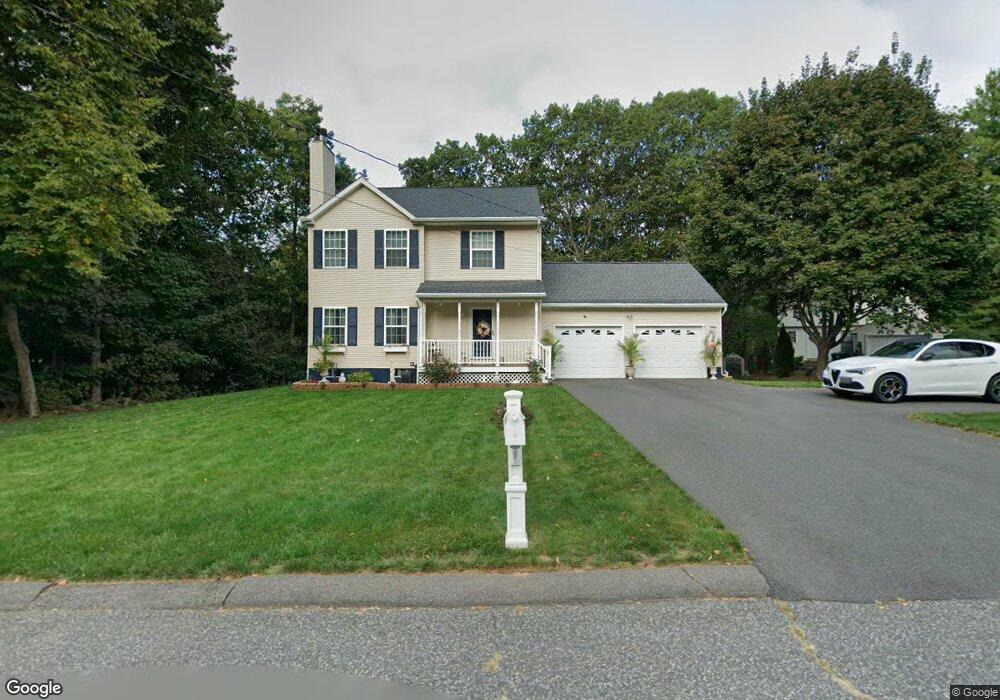
5 Wayne Ct Holyoke, MA 01040
Estimated Value: $383,631 - $478,000
4
Beds
3
Baths
1,648
Sq Ft
$254/Sq Ft
Est. Value
About This Home
This home is located at 5 Wayne Ct, Holyoke, MA 01040 and is currently estimated at $417,908, approximately $253 per square foot. 5 Wayne Ct is a home located in Hampden County with nearby schools including Harriet Bishop Elementary School, Lt. Clayre Sullivan Elementary School, and Holyoke High School.
Ownership History
Date
Name
Owned For
Owner Type
Purchase Details
Closed on
Dec 20, 2000
Sold by
New England Land Assoc and Clinton Ptrs Inc
Bought by
Westfield Rlty Llc
Current Estimated Value
Purchase Details
Closed on
Apr 27, 1994
Sold by
Authier and Authier Langlois
Bought by
Authier Raymond P
Purchase Details
Closed on
Feb 5, 1988
Sold by
Ahern Francis M
Bought by
Joe Chapdelaine & Sons
Purchase Details
Closed on
Jan 22, 1988
Sold by
Dube Eugene J
Bought by
Authier and Authier Langlois
Purchase Details
Closed on
Jul 16, 1987
Sold by
Frances T Roe Est
Bought by
Fanti Roy
Home Financials for this Owner
Home Financials are based on the most recent Mortgage that was taken out on this home.
Original Mortgage
$70,000
Interest Rate
10.69%
Mortgage Type
Purchase Money Mortgage
Create a Home Valuation Report for This Property
The Home Valuation Report is an in-depth analysis detailing your home's value as well as a comparison with similar homes in the area
Home Values in the Area
Average Home Value in this Area
Purchase History
| Date | Buyer | Sale Price | Title Company |
|---|---|---|---|
| Westfield Rlty Llc | $112,500 | -- | |
| Authier Raymond P | $36,000 | -- | |
| Joe Chapdelaine & Sons | $47,500 | -- | |
| Authier | $35,000 | -- | |
| Fanti Roy | $17,500 | -- |
Source: Public Records
Mortgage History
| Date | Status | Borrower | Loan Amount |
|---|---|---|---|
| Previous Owner | Fanti Roy | $70,000 |
Source: Public Records
Tax History Compared to Growth
Tax History
| Year | Tax Paid | Tax Assessment Tax Assessment Total Assessment is a certain percentage of the fair market value that is determined by local assessors to be the total taxable value of land and additions on the property. | Land | Improvement |
|---|---|---|---|---|
| 2025 | $5,247 | $300,500 | $68,400 | $232,100 |
| 2024 | $5,031 | $265,500 | $65,200 | $200,300 |
| 2023 | $4,818 | $256,800 | $65,200 | $191,600 |
| 2022 | $4,636 | $240,700 | $65,200 | $175,500 |
| 2021 | $4,436 | $230,200 | $62,400 | $167,800 |
| 2020 | $4,154 | $217,700 | $62,400 | $155,300 |
| 2019 | $4,188 | $217,100 | $62,400 | $154,700 |
| 2018 | $3,998 | $209,000 | $62,400 | $146,600 |
| 2017 | $4,007 | $209,000 | $62,400 | $146,600 |
| 2016 | $3,948 | $206,500 | $64,400 | $142,100 |
| 2015 | $3,932 | $206,500 | $64,400 | $142,100 |
Source: Public Records
Map
Nearby Homes
- 23 Scott Hollow Dr
- 89 Jarvis Ave
- 55 Longfellow Rd
- 104 Saint James Ave
- 1705-1707 Northampton St
- 1678 Northampton St
- 1225 Hampden St
- 33 Maple Crest Cir Unit D
- 15 Maple Crest Cir Unit D
- 34 Maple Crest Cir Unit B
- 37 Laura Ln
- 11 Longfellow Rd
- 165 Lincoln St
- 1114 Hampden St
- 15 Chapman Ave
- 46 Cherry Hill
- 102 W Meadowview Rd
- 1793 Northampton St
- 151 Lincoln St
- 68 Fairfield Ave
- 3 Wayne Ct
- 1 Wayne Ct
- 4 Wayne Ct
- 2 Wayne Ct
- 6 Wayne Ct
- 26 Scott Hollow Dr
- 8 Wayne Ct
- 24 Scott Hollow Dr
- 10 Wayne Ct
- 27 Scott Hollow Dr
- 237 Lacus Dr
- 227 Lacus Dr
- 256 Jarvis Ave
- 25 Scott Hollow Dr
- 12 Wayne Ct
- 19 Steven Dr
- 17 Steven Dr
- 22 Scott Hollow Dr
- 15 Steven Dr
- 0 Jarvis Avenue (Rear) Unit 30689943