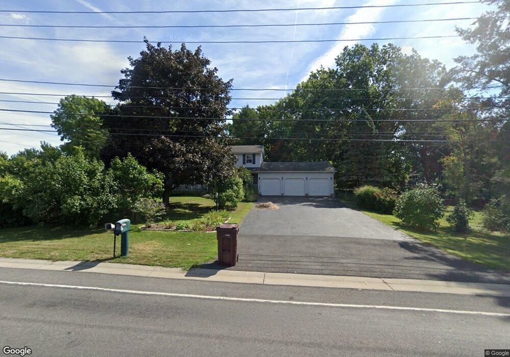
5 Whittier Rd Rochester, NY 14624
Estimated Value: $307,000 - $372,000
4
Beds
3
Baths
1,920
Sq Ft
$178/Sq Ft
Est. Value
About This Home
This home is located at 5 Whittier Rd, Rochester, NY 14624 and is currently estimated at $341,888, approximately $178 per square foot. 5 Whittier Rd is a home located in Monroe County with nearby schools including Churchville Chili Middle School 5 8, Fairbanks Road Elementary School, and Churchville-Chili Senior High School.
Ownership History
Date
Name
Owned For
Owner Type
Purchase Details
Closed on
Apr 28, 2000
Sold by
Bandy William
Bought by
Lines R Todd
Current Estimated Value
Purchase Details
Closed on
Oct 20, 1998
Sold by
Homanick Gary M and Homanick Karen M
Bought by
Bandy William and Bandy Pamela
Purchase Details
Closed on
Sep 14, 1994
Sold by
Maynard Stephen and Maynard Charlen
Bought by
Homanick Gary M and Homanick Karen M
Create a Home Valuation Report for This Property
The Home Valuation Report is an in-depth analysis detailing your home's value as well as a comparison with similar homes in the area
Home Values in the Area
Average Home Value in this Area
Purchase History
| Date | Buyer | Sale Price | Title Company |
|---|---|---|---|
| Lines R Todd | $139,900 | Joseph Mitchell | |
| Bandy William | $128,000 | -- | |
| Homanick Gary M | $139,000 | -- |
Source: Public Records
Tax History Compared to Growth
Tax History
| Year | Tax Paid | Tax Assessment Tax Assessment Total Assessment is a certain percentage of the fair market value that is determined by local assessors to be the total taxable value of land and additions on the property. | Land | Improvement |
|---|---|---|---|---|
| 2024 | $6,408 | $263,100 | $30,600 | $232,500 |
| 2023 | $6,563 | $168,600 | $27,500 | $141,100 |
| 2022 | $6,661 | $168,600 | $27,500 | $141,100 |
| 2021 | $6,461 | $168,600 | $27,500 | $141,100 |
| 2020 | $5,890 | $168,600 | $27,500 | $141,100 |
| 2019 | $5,492 | $168,600 | $27,500 | $141,100 |
| 2018 | $5,954 | $168,600 | $27,500 | $141,100 |
| 2017 | $2,898 | $153,300 | $27,500 | $125,800 |
| 2016 | $5,492 | $153,300 | $27,500 | $125,800 |
| 2015 | -- | $153,300 | $27,500 | $125,800 |
| 2014 | -- | $153,300 | $27,500 | $125,800 |
Source: Public Records
Map
Nearby Homes
- 6 Spicewood Ln
- 24 Weatherwood Ln
- 2017 Westside Dr
- 4 Loring Place
- 11 Province Dr
- 2044 Westside Dr
- 7 Baylor Cir
- 18 W Canon Dr
- 7 W Canon Dr
- 29 Golden Rd
- 61 Stony Point Rd
- 8 John Maries Way
- 52 Foxe Commons
- 14 Ascot Dr
- 271 Chestnut Ridge Rd
- 149 Norwich Dr
- 114 Norwich Dr Unit 86
- 48 Brasser Dr
- 5 Ascot Dr
- 5 Foxe Commons
- 9 Whittier Rd
- 1938 Westside Dr
- 1930 Westside Dr
- 6 Whittier Rd
- 10 Whittier Rd
- 53 Northwind Way
- 1940 Westside Dr
- 51 Northwind Way
- 12 Whittier Rd
- 49 Northwind Way
- 1912 Westside Dr
- 14 Whittier Rd
- 47 Northwind Way
- 0 Whittier Rd
- 1915 Westside Dr
- 53 Southwind Way
- 57 Southwind Way
- 1910 Westside Dr
- 1994 Westside Dr
- 1941 Westside Dr