Estimated Value: $173,447 - $199,000
--
Bed
2
Baths
1,468
Sq Ft
$128/Sq Ft
Est. Value
About This Home
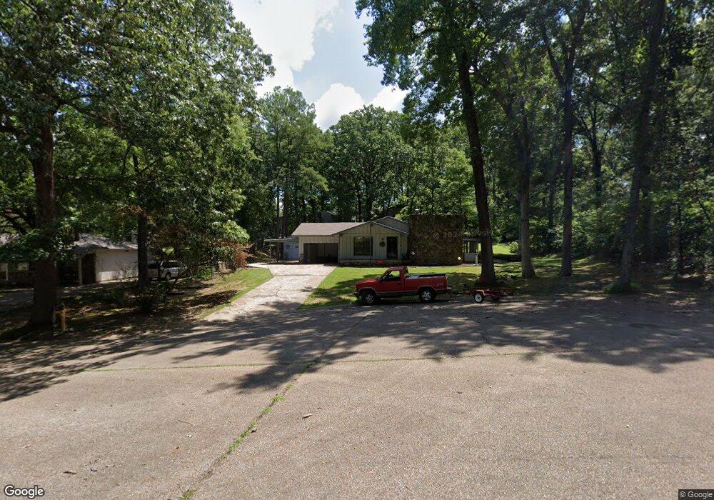
This home is located at 5 Woodlawn Cir, Wynne, AR 72396 and is currently estimated at $188,362, approximately $128 per square foot. 5 Woodlawn Cir is a home located in Cross County with nearby schools including Wynne Intermediate School, Wynne Primary School, and Wynne Junior High School.
Ownership History
Date
Name
Owned For
Owner Type
Purchase Details
Closed on
Dec 6, 2024
Sold by
Williams Carlos Dale
Bought by
Williams Carlos Dale and Williams Tamela Kaye
Current Estimated Value
Purchase Details
Closed on
Apr 2, 2012
Sold by
Summers Herbert J and Summers Donelda J
Bought by
Williams Carlos Dale
Purchase Details
Closed on
Jan 24, 1997
Bought by
Summers Herbert J and Summers Jr
Purchase Details
Closed on
Nov 1, 1987
Bought by
Hill Bryan C
Create a Home Valuation Report for This Property
The Home Valuation Report is an in-depth analysis detailing your home's value as well as a comparison with similar homes in the area
Home Values in the Area
Average Home Value in this Area
Purchase History
| Date | Buyer | Sale Price | Title Company |
|---|---|---|---|
| Williams Carlos Dale | -- | None Listed On Document | |
| Williams Carlos Dale | $93,000 | Cowling Title Company | |
| Summers Herbert J | $79,000 | -- | |
| Hill Bryan C | -- | -- |
Source: Public Records
Tax History Compared to Growth
Tax History
| Year | Tax Paid | Tax Assessment Tax Assessment Total Assessment is a certain percentage of the fair market value that is determined by local assessors to be the total taxable value of land and additions on the property. | Land | Improvement |
|---|---|---|---|---|
| 2024 | $624 | $22,750 | $4,960 | $17,790 |
| 2023 | $701 | $22,750 | $4,960 | $17,790 |
| 2022 | $751 | $22,750 | $4,960 | $17,790 |
| 2021 | $705 | $22,750 | $4,960 | $17,790 |
| 2020 | $656 | $22,750 | $4,960 | $17,790 |
| 2019 | $607 | $19,830 | $4,090 | $15,740 |
| 2018 | $632 | $19,830 | $4,090 | $15,740 |
| 2017 | $632 | $19,830 | $4,090 | $15,740 |
| 2016 | $632 | $19,830 | $4,090 | $15,740 |
| 2015 | $632 | $19,830 | $4,090 | $15,740 |
| 2014 | $659 | $20,390 | $5,010 | $15,380 |
Source: Public Records
Map
Nearby Homes
- 29 Sunset Dr
- 1910 Hess Ln
- 1011 Hilltop Dr
- 1310 Bridges Ave E
- 1404 Airpark Rd
- 6 A Londonderry Cir
- 1201 Peterson Dr
- 1484 Hamilton Ave E
- 568 Killough Rd N
- 1003 Oakwood Dr
- 2 Donegal Cir
- 1308 Killough Rd N
- 226 Nathan Dr E
- 1737 Peterson Rd
- 1405 Peterson Rd
- 206 Maple Dr
- 108 Nathan Dr E
- 102 Lombardy Ln
- 109 Nathan Dr E
- 1008 Languille Ave E
- 6 Woodlawn Cir
- 14 Briarcliff Cir
- 1801 Airpark Rd
- 1 Woodlawn Cir
- 1805 Airpark Rd
- 41 Morningside Dr
- 3 Woodlawn Cir
- 2100 Morningside Dr
- 1601 Airpark Rd
- 15 Briarcliff Cir
- 0 Airpark Rd
- 36 Morningside Dr
- 1809 Airpark Rd
- 2102 Morningside Dr
- 34 Morningside Dr
- 2211 Morningside Dr
- 2221 Morningside Dr
- 27 Sunset Dr
- 28 Sunset Dr
- 26 Sunset Dr