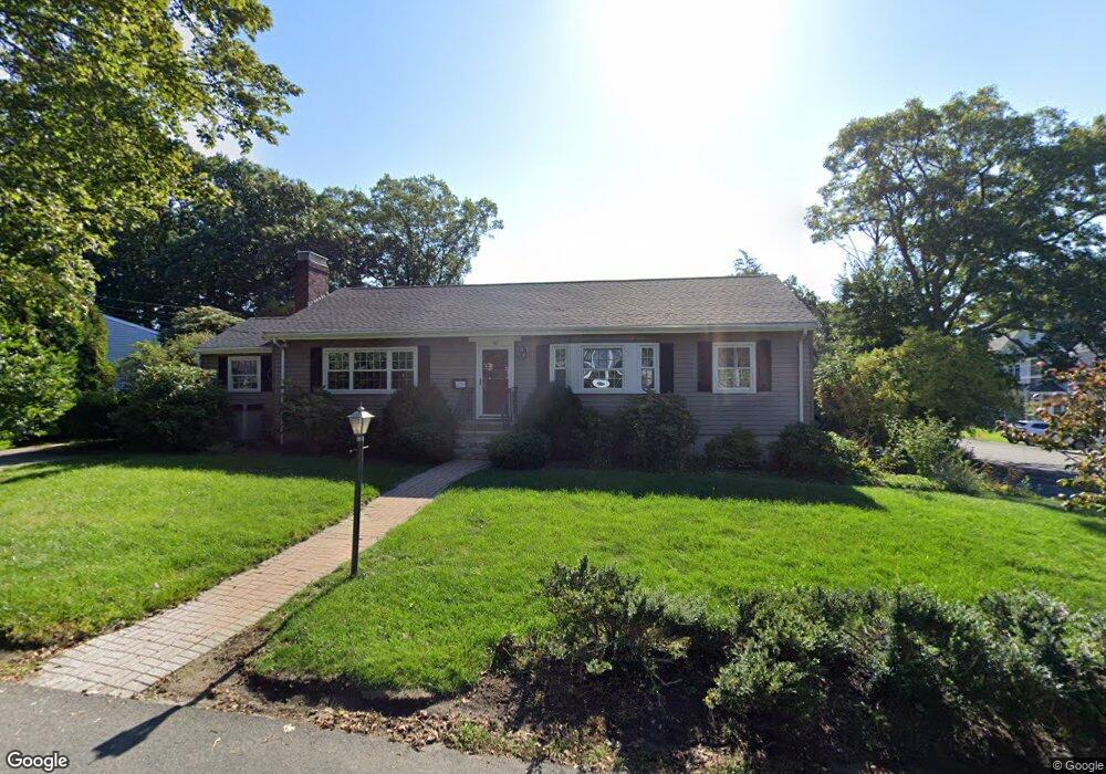
50 Oldham Rd Arlington, MA 02474
Arlington Heights NeighborhoodEstimated Value: $1,096,000 - $1,425,000
3
Beds
3
Baths
1,872
Sq Ft
$681/Sq Ft
Est. Value
About This Home
This home is located at 50 Oldham Rd, Arlington, MA 02474 and is currently estimated at $1,274,727, approximately $680 per square foot. 50 Oldham Rd is a home located in Middlesex County with nearby schools including M. Norcross Stratton Elementary School, Ottoson Middle School, and Arlington High School.
Ownership History
Date
Name
Owned For
Owner Type
Purchase Details
Closed on
Jun 4, 2010
Sold by
Ourfalian Maurice and Ourfalian Jacqueline
Bought by
Smith Cheryl
Current Estimated Value
Purchase Details
Closed on
Jul 15, 1987
Sold by
Helfer Pauline E
Bought by
Ourfalian Maurice
Home Financials for this Owner
Home Financials are based on the most recent Mortgage that was taken out on this home.
Original Mortgage
$150,000
Interest Rate
10.69%
Mortgage Type
Purchase Money Mortgage
Create a Home Valuation Report for This Property
The Home Valuation Report is an in-depth analysis detailing your home's value as well as a comparison with similar homes in the area
Home Values in the Area
Average Home Value in this Area
Purchase History
| Date | Buyer | Sale Price | Title Company |
|---|---|---|---|
| Smith Cheryl | -- | -- | |
| Ourfalian Maurice | $240,000 | -- |
Source: Public Records
Mortgage History
| Date | Status | Borrower | Loan Amount |
|---|---|---|---|
| Previous Owner | Ourfalian Maurice | $150,000 |
Source: Public Records
Tax History Compared to Growth
Tax History
| Year | Tax Paid | Tax Assessment Tax Assessment Total Assessment is a certain percentage of the fair market value that is determined by local assessors to be the total taxable value of land and additions on the property. | Land | Improvement |
|---|---|---|---|---|
| 2025 | $11,385 | $1,057,100 | $657,800 | $399,300 |
| 2024 | $10,820 | $1,021,700 | $657,800 | $363,900 |
| 2023 | $10,219 | $911,600 | $566,000 | $345,600 |
| 2022 | $9,642 | $844,300 | $535,400 | $308,900 |
| 2021 | $9,460 | $834,200 | $535,400 | $298,800 |
| 2020 | $9,226 | $834,200 | $535,400 | $298,800 |
| 2019 | $8,783 | $780,000 | $535,400 | $244,600 |
| 2018 | $8,480 | $699,100 | $458,900 | $240,200 |
| 2017 | $8,396 | $668,500 | $428,300 | $240,200 |
| 2016 | $7,773 | $607,300 | $367,100 | $240,200 |
| 2015 | $7,700 | $568,300 | $328,900 | $239,400 |
Source: Public Records
Map
Nearby Homes
- 6 Pawnee Dr
- 12 Longmeadow Rd
- 281 Forest St
- 16 Ridge St
- 10 Viking Rd
- 37 Pine St
- 5A Wood Ln
- 5 Wood Ln
- 4 Beck Rd
- 1205 Massachusetts Ave
- 1 Watermill Place Unit 308
- 0 Reed St
- 189 High St
- 11 Lowell St Unit B
- 139 High St
- 51 Lowell St
- 6 Appleton Place
- 14 Burton St Unit 16
- 14 Park Avenue Extension
- 18-20 Brattle St