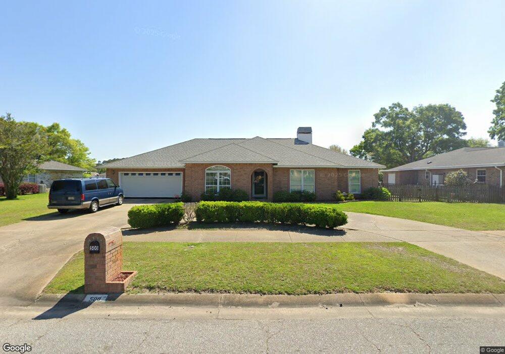
500 Bunker Hill Dr Pensacola, FL 32506
Estimated Value: $337,000 - $400,000
--
Bed
2
Baths
2,435
Sq Ft
$147/Sq Ft
Est. Value
About This Home
This home is located at 500 Bunker Hill Dr, Pensacola, FL 32506 and is currently estimated at $358,769, approximately $147 per square foot. 500 Bunker Hill Dr is a home located in Escambia County with nearby schools including Myrtle Grove Elementary School, Warrington Middle School, and Escambia High School.
Ownership History
Date
Name
Owned For
Owner Type
Purchase Details
Closed on
Dec 7, 2022
Sold by
Mcgrady Frances A
Bought by
Mcgrady Frances A and Mcgrady Timothy Wayne
Current Estimated Value
Purchase Details
Closed on
Apr 12, 2001
Sold by
Holland James H
Bought by
Mcgrady Elvin W and Mcgrady Frances A
Home Financials for this Owner
Home Financials are based on the most recent Mortgage that was taken out on this home.
Original Mortgage
$40,000
Interest Rate
6.99%
Purchase Details
Closed on
Jun 13, 1997
Sold by
Baldwin Carlton M and Baldwin Catherine K
Bought by
Holland James H and Holland Harriett D
Home Financials for this Owner
Home Financials are based on the most recent Mortgage that was taken out on this home.
Original Mortgage
$70,000
Interest Rate
8.01%
Create a Home Valuation Report for This Property
The Home Valuation Report is an in-depth analysis detailing your home's value as well as a comparison with similar homes in the area
Home Values in the Area
Average Home Value in this Area
Purchase History
| Date | Buyer | Sale Price | Title Company |
|---|---|---|---|
| Mcgrady Frances A | $100 | -- | |
| Mcgrady Elvin W | $158,900 | -- | |
| Holland James H | $152,900 | -- |
Source: Public Records
Mortgage History
| Date | Status | Borrower | Loan Amount |
|---|---|---|---|
| Previous Owner | Mcgrady Elvin W | $40,000 | |
| Previous Owner | Holland James H | $70,000 |
Source: Public Records
Tax History Compared to Growth
Tax History
| Year | Tax Paid | Tax Assessment Tax Assessment Total Assessment is a certain percentage of the fair market value that is determined by local assessors to be the total taxable value of land and additions on the property. | Land | Improvement |
|---|---|---|---|---|
| 2024 | $1,310 | $170,082 | -- | -- |
| 2023 | $1,310 | $165,129 | $0 | $0 |
| 2022 | $1,324 | $160,320 | $0 | $0 |
| 2021 | $1,315 | $155,651 | $0 | $0 |
| 2020 | $1,293 | $153,502 | $0 | $0 |
| 2019 | $1,261 | $150,051 | $0 | $0 |
| 2018 | $1,257 | $147,254 | $0 | $0 |
| 2017 | $1,251 | $144,226 | $0 | $0 |
| 2016 | $1,237 | $141,260 | $0 | $0 |
| 2015 | $1,225 | $140,279 | $0 | $0 |
| 2014 | $773 | $109,623 | $0 | $0 |
Source: Public Records
Map
Nearby Homes
- 6982 Lake Joanne Dr
- 6852 Lake Joanne Dr
- 6901 Corrydale Dr
- 6912 Kitty Hawk Dr
- 863 Amberway Dr
- 346 Quigley Rd
- 668 N 72nd Ave Unit ABCD
- 516 Long Lake Dr
- 7201 Mier Henry Rd
- 365 Arabian Dr
- 330 Bunker Hill Dr
- 333 S 61st Ave Unit 6
- 333 S 61st Ave Unit 1
- 333 S 61st Ave Unit 8
- 207 Arabian Dr
- 87 S 69th Ave
- 6342 Lake Charlene Terrace
- 402 Ronji Way
- 316 S 61st Ave
- 7416 Saint James Place
- 510 Bunker Hill Dr
- 426 Bunker Hill Dr
- 509 Bunker Hill Dr
- 424 Bunker Hill Dr
- 6972 Lake Joanne Dr
- 425 Bunker Hill Dr
- 7000 Lake Joanne Dr
- 6962 Lake Joanne Dr
- 6903 Kitty Hawk Dr
- 0 Lake Joanne Dr Unit 598282
- 0 Lake Joanne Dr Unit 603253
- 0 Lake Joanne Dr Unit 611911
- 0 Lake Joanne Dr Unit 3C 587904
- 0 Lake Joanne Dr Unit 2D 591520
- 0 Lake Joanne Dr Unit 595132
- 0 Lake Joanne Dr Unit 3A 596245
- 0 Lake Joanne Dr Unit 1A 598273
- 0 Lake Joanne Dr Unit 1D 607098
- 0 Lake Joanne Dr Unit 616649
- 0 Lake Joanne Dr Unit 344345