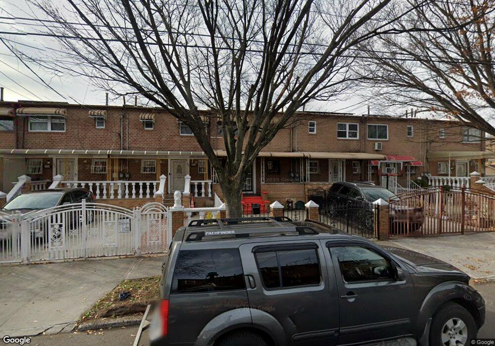
500 Christopher Ave Brooklyn, NY 11212
Brownsville NeighborhoodEstimated Value: $512,755 - $647,000
--
Bed
--
Bath
1,116
Sq Ft
$527/Sq Ft
Est. Value
About This Home
This home is located at 500 Christopher Ave, Brooklyn, NY 11212 and is currently estimated at $587,939, approximately $526 per square foot. 500 Christopher Ave is a home located in Kings County with nearby schools including P.S. 165 Ida Posner, P.S. 150 - Christopher, and P.S. 156 Waverly.
Ownership History
Date
Name
Owned For
Owner Type
Purchase Details
Closed on
Jun 20, 2006
Sold by
Allen Cecil and Allen Debra
Bought by
Davenport Holly
Current Estimated Value
Home Financials for this Owner
Home Financials are based on the most recent Mortgage that was taken out on this home.
Original Mortgage
$290,016
Outstanding Balance
$170,545
Interest Rate
6.67%
Mortgage Type
Purchase Money Mortgage
Estimated Equity
$417,394
Purchase Details
Closed on
Sep 23, 1997
Sold by
Allen Celia
Bought by
Allen Cecil and Allen Debra
Create a Home Valuation Report for This Property
The Home Valuation Report is an in-depth analysis detailing your home's value as well as a comparison with similar homes in the area
Home Values in the Area
Average Home Value in this Area
Purchase History
| Date | Buyer | Sale Price | Title Company |
|---|---|---|---|
| Davenport Holly | $362,520 | -- | |
| Davenport Holly | $362,520 | -- | |
| Allen Cecil | -- | -- | |
| Allen Cecil | -- | -- |
Source: Public Records
Mortgage History
| Date | Status | Borrower | Loan Amount |
|---|---|---|---|
| Open | Davenport Holly | $290,016 | |
| Closed | Davenport Holly | $290,016 | |
| Closed | Davenport Holly | $72,504 |
Source: Public Records
Tax History Compared to Growth
Tax History
| Year | Tax Paid | Tax Assessment Tax Assessment Total Assessment is a certain percentage of the fair market value that is determined by local assessors to be the total taxable value of land and additions on the property. | Land | Improvement |
|---|---|---|---|---|
| 2025 | $4,009 | $32,340 | $13,200 | $19,140 |
| 2024 | $4,009 | $31,440 | $13,200 | $18,240 |
| 2023 | $4,053 | $32,700 | $13,200 | $19,500 |
| 2022 | $3,954 | $31,680 | $13,200 | $18,480 |
| 2021 | $3,932 | $28,200 | $13,200 | $15,000 |
| 2020 | $1,844 | $25,860 | $13,200 | $12,660 |
| 2019 | $3,479 | $25,860 | $13,200 | $12,660 |
| 2018 | $3,390 | $16,632 | $8,509 | $8,123 |
| 2017 | $3,365 | $16,506 | $11,242 | $5,264 |
| 2016 | $3,113 | $15,572 | $11,773 | $3,799 |
| 2015 | $2,057 | $14,691 | $9,706 | $4,985 |
| 2014 | $2,057 | $13,860 | $10,980 | $2,880 |
Source: Public Records
Map
Nearby Homes
- 797 Mother Gaston Blvd
- 699 Sackman St
- 258 Lott Ave
- 546 Powell St
- 555 Christopher Ave
- 563 Powell St
- 578 Christopher Ave
- 587 Osborn St
- 504 Thatford Ave
- 892 Mother Gaston Blvd
- 923 Rockaway Ave
- 632 Osborn St
- 524 Chester St
- 442 Newport St
- 533 Snediker Ave
- 124 Lott Ave
- 664 Osborn St Unit 1
- 584 Hinsdale St
- 546 Bristol St
- 589 Hinsdale St
- 502 Christopher Ave
- 498 Christopher Ave
- 494 Christopher Ave
- 504 Christopher Ave
- 506 Christopher Ave
- 492 Christopher Ave
- 508 Christopher Ave
- 510 Christopher Ave
- 781-781A Mother Gaston Blvd
- 779 Mother Gaston Blvd
- 777 Mother Gaston Blvd
- 781 Mother Gaston Blvd Unit 781A
- 775 Mother Gaston Blvd
- 783 Mother Gaston Blvd
- 512 Christopher Ave
- 785 Mother Gaston Blvd
- 773 Mother Gaston Blvd
- 787 Mother Gaston Blvd
- 304 Newport St
- 306 Newport St