Estimated Value: $224,760 - $273,000
2
Beds
3
Baths
1,865
Sq Ft
$135/Sq Ft
Est. Value
About This Home
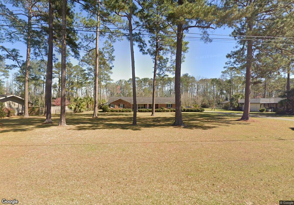
This home is located at 500 Newton Dr, Adel, GA 31620 and is currently estimated at $251,690, approximately $134 per square foot. 500 Newton Dr is a home located in Cook County with nearby schools including Cook Primary School, Cook Elementary School, and Cook County Middle School.
Ownership History
Date
Name
Owned For
Owner Type
Purchase Details
Closed on
Sep 30, 2020
Sold by
Waldenville Kenneth E
Bought by
Waldenville Kenneth E and Waldenville Lynda M
Current Estimated Value
Home Financials for this Owner
Home Financials are based on the most recent Mortgage that was taken out on this home.
Original Mortgage
$120,000
Outstanding Balance
$106,734
Interest Rate
2.9%
Estimated Equity
$144,956
Purchase Details
Closed on
Sep 10, 2018
Sold by
Fausett Ottis P
Bought by
Fausett Linda
Create a Home Valuation Report for This Property
The Home Valuation Report is an in-depth analysis detailing your home's value as well as a comparison with similar homes in the area
Home Values in the Area
Average Home Value in this Area
Purchase History
| Date | Buyer | Sale Price | Title Company |
|---|---|---|---|
| Waldenville Kenneth E | -- | -- | |
| Waldenville Kenneth E | $150,000 | -- | |
| Fausett Linda | -- | -- |
Source: Public Records
Mortgage History
| Date | Status | Borrower | Loan Amount |
|---|---|---|---|
| Open | Waldenville Kenneth E | $120,000 | |
| Closed | Waldenville Kenneth E | $120,000 |
Source: Public Records
Tax History Compared to Growth
Tax History
| Year | Tax Paid | Tax Assessment Tax Assessment Total Assessment is a certain percentage of the fair market value that is determined by local assessors to be the total taxable value of land and additions on the property. | Land | Improvement |
|---|---|---|---|---|
| 2024 | $2,407 | $73,066 | $17,920 | $55,146 |
| 2023 | $2,128 | $64,594 | $16,000 | $48,594 |
| 2022 | $2,128 | $64,594 | $16,000 | $48,594 |
| 2021 | $2,015 | $57,142 | $16,000 | $41,142 |
| 2020 | $2,015 | $57,142 | $16,000 | $41,142 |
| 2019 | $2,016 | $57,142 | $16,000 | $41,142 |
| 2018 | $2,018 | $57,142 | $16,000 | $41,142 |
| 2017 | $1,962 | $57,142 | $16,000 | $41,142 |
| 2016 | $1,965 | $57,142 | $16,000 | $41,142 |
| 2015 | $2,036 | $59,142 | $18,000 | $41,142 |
| 2014 | $2,036 | $59,142 | $18,000 | $41,142 |
| 2013 | -- | $59,142 | $18,000 | $41,142 |
Source: Public Records
Map
Nearby Homes
- 701 Gloria St
- 315 Newton Dr
- 901 E 4th St
- 625 Coxstill Rd
- 418 E 3rd St
- 322 Magnolia Dr
- 1306 Bear Creek Rd
- 1402 Bear Creek Rd
- 304 E 3rd St
- 211 S Gordon Ave
- 804 S Forrest Ave
- 2302 Thomas St
- 808 Laurel Ave
- 806 S Forrest Ave
- 808 S Laurel Ave
- 2503 Dianne St
- 2601 Massee Post Rd
- 507 S Poplar St
- 2603 Dianne St
- 1377 Hutchinson Parrish Rd
- 402 Newton Dr
- 502 Newton Dr
- 501 Newton Dr
- 403 Newton Dr
- 600 Newton Dr
- 601 Newton Dr
- 400 Newton Dr
- 401 Newton Dr
- 724 Tyson Cir
- 721 Tyson Cir
- 603 Newton Dr
- 721 Tyson Cir
- 0 Plantation Dr Unit 70743
- 0 Plantation Dr Unit 70742
- 0 Plantation Dr Unit 121826
- 317 Newton Dr
- 605 Newton Dr
- 312 Newton Dr
- 704 Irving Cir
- 606 Newton Dr