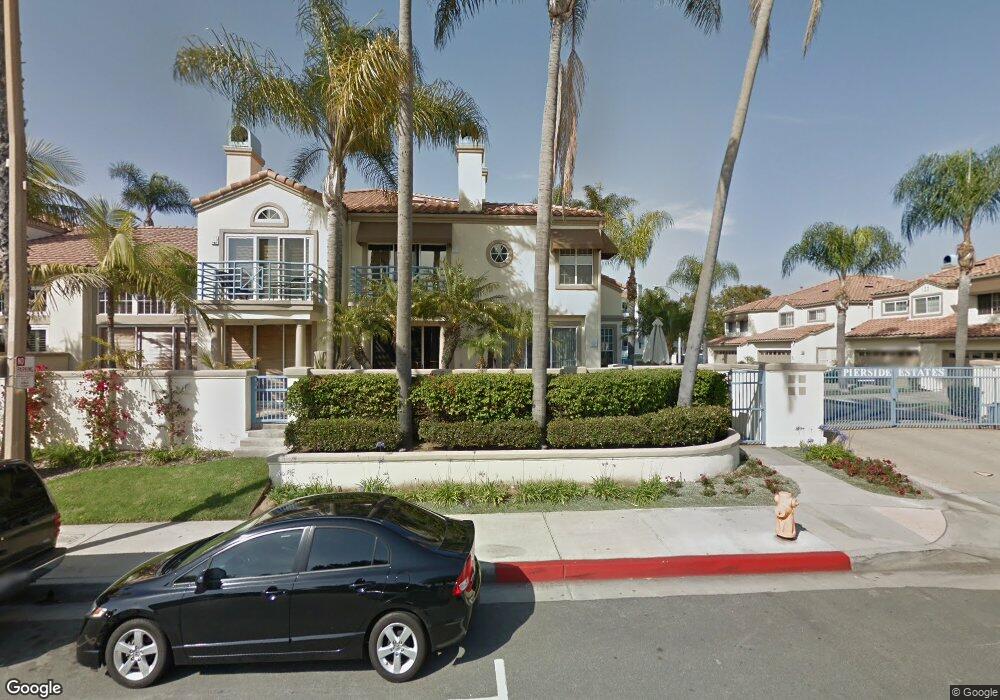
501 Pierside Cir Huntington Beach, CA 92648
Downtown Huntington Beach NeighborhoodEstimated Value: $1,917,000 - $2,232,917
3
Beds
3
Baths
2,476
Sq Ft
$828/Sq Ft
Est. Value
About This Home
This home is located at 501 Pierside Cir, Huntington Beach, CA 92648 and is currently estimated at $2,048,979, approximately $827 per square foot. 501 Pierside Cir is a home located in Orange County with nearby schools including Agnes L. Smith Elementary, Ethel Dwyer Middle, and Huntington Beach High School.
Ownership History
Date
Name
Owned For
Owner Type
Purchase Details
Closed on
Aug 5, 2003
Sold by
Issa Ferial S
Bought by
Usiadek Darrick
Current Estimated Value
Home Financials for this Owner
Home Financials are based on the most recent Mortgage that was taken out on this home.
Original Mortgage
$579,500
Outstanding Balance
$252,957
Interest Rate
5.5%
Mortgage Type
New Conventional
Estimated Equity
$1,796,022
Purchase Details
Closed on
Feb 1, 2000
Sold by
Golgolab Steve S
Bought by
Issa Ferial S
Create a Home Valuation Report for This Property
The Home Valuation Report is an in-depth analysis detailing your home's value as well as a comparison with similar homes in the area
Home Values in the Area
Average Home Value in this Area
Purchase History
| Date | Buyer | Sale Price | Title Company |
|---|---|---|---|
| Usiadek Darrick | $755,000 | Orange Coast Title Co | |
| Issa Ferial S | $338,000 | -- |
Source: Public Records
Mortgage History
| Date | Status | Borrower | Loan Amount |
|---|---|---|---|
| Open | Usiadek Darrick | $579,500 | |
| Closed | Usiadek Darrick | $100,000 |
Source: Public Records
Tax History Compared to Growth
Tax History
| Year | Tax Paid | Tax Assessment Tax Assessment Total Assessment is a certain percentage of the fair market value that is determined by local assessors to be the total taxable value of land and additions on the property. | Land | Improvement |
|---|---|---|---|---|
| 2025 | $11,995 | $1,073,444 | $757,062 | $316,382 |
| 2024 | $11,995 | $1,052,397 | $742,218 | $310,179 |
| 2023 | $11,729 | $1,031,762 | $727,664 | $304,098 |
| 2022 | $11,423 | $1,011,532 | $713,396 | $298,136 |
| 2021 | $11,211 | $991,699 | $699,408 | $292,291 |
| 2020 | $11,139 | $981,531 | $692,237 | $289,294 |
| 2019 | $11,005 | $962,286 | $678,664 | $283,622 |
| 2018 | $10,835 | $943,418 | $665,357 | $278,061 |
| 2017 | $10,692 | $924,920 | $652,311 | $272,609 |
| 2016 | $10,213 | $906,785 | $639,521 | $267,264 |
| 2015 | $10,117 | $893,165 | $629,915 | $263,250 |
| 2014 | $9,527 | $841,000 | $598,314 | $242,686 |
Source: Public Records
Map
Nearby Homes
- 316 6th St
- 414 Main St Unit 400
- 414 Main St Unit 330
- 414 Main St Unit 430
- 414 Main St Unit 200
- 414 Main St Unit 420
- 513 Pecan Ave
- 308 5th St
- 430 Lake St Unit 304
- 430 Lake St Unit 204
- 400 Lake St
- 309 8th St
- 517 Walnut Ave
- 214 Walnut Ave
- 621 8th St
- 111 Alabama St
- 626 Lake St
- 200 Pacific Coast Hwy Unit 130
- 219 1st St
- 620 Huntington St
- 503 Pierside Cir
- 505 Pierside Cir
- 507 Pierside Cir
- 404 Townsquare Ln
- 406 Townsquare Ln
- 408 Townsquare Ln
- 410 Townsquare Ln
- 504 Pierside Cir
- 506 Pierside Cir
- 511 Pierside Cir
- 325 5th St
- 415 Townsquare Ln
- 415 Townsquare Ln Unit 108
- 415 Townsquare Ln Unit 302
- 415 Townsquare Ln Unit 206
- 415 Townsquare Ln Unit 315
- 415 Townsquare Ln Unit 123
- 415 Townsquare Ln Unit 225
- 415 Townsquare Ln Unit 319
- 415 Townsquare Ln Unit 215