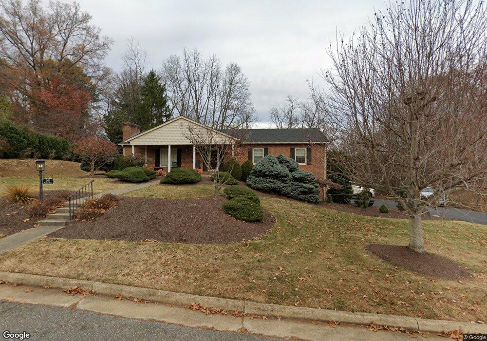
501 Victoria Dr Staunton, VA 24401
Estimated Value: $474,012 - $571,000
3
Beds
3
Baths
2,744
Sq Ft
$184/Sq Ft
Est. Value
About This Home
This home is located at 501 Victoria Dr, Staunton, VA 24401 and is currently estimated at $505,503, approximately $184 per square foot. 501 Victoria Dr is a home located in Staunton City with nearby schools including Thomas C. McSwain Elementary School, Shelburne Middle School, and Staunton High School.
Ownership History
Date
Name
Owned For
Owner Type
Purchase Details
Closed on
Jul 3, 2018
Sold by
Draper Larry B
Bought by
Heinz Scott P
Current Estimated Value
Purchase Details
Closed on
Sep 7, 2007
Sold by
Hinton David C and Jack R Hinton Revocable Living
Bought by
Draper Larry B
Home Financials for this Owner
Home Financials are based on the most recent Mortgage that was taken out on this home.
Original Mortgage
$214,400
Interest Rate
6.5%
Mortgage Type
New Conventional
Create a Home Valuation Report for This Property
The Home Valuation Report is an in-depth analysis detailing your home's value as well as a comparison with similar homes in the area
Home Values in the Area
Average Home Value in this Area
Purchase History
| Date | Buyer | Sale Price | Title Company |
|---|---|---|---|
| Heinz Scott P | $325,000 | None Available | |
| Draper Larry B | -- | None Available |
Source: Public Records
Mortgage History
| Date | Status | Borrower | Loan Amount |
|---|---|---|---|
| Previous Owner | Draper Larry B | $214,400 |
Source: Public Records
Tax History Compared to Growth
Tax History
| Year | Tax Paid | Tax Assessment Tax Assessment Total Assessment is a certain percentage of the fair market value that is determined by local assessors to be the total taxable value of land and additions on the property. | Land | Improvement |
|---|---|---|---|---|
| 2025 | $3,894 | $427,960 | $76,160 | $351,800 |
| 2024 | $3,260 | $366,260 | $65,560 | $300,700 |
| 2023 | $3,260 | $366,260 | $65,560 | $300,700 |
| 2022 | $2,667 | $289,860 | $48,960 | $240,900 |
| 2021 | $2,667 | $289,860 | $48,960 | $240,900 |
| 2020 | $2,578 | $271,360 | $48,960 | $222,400 |
| 2019 | $2,578 | $271,360 | $48,960 | $222,400 |
| 2018 | $2,478 | $255,460 | $48,960 | $206,500 |
| 2017 | $2,478 | $255,460 | $48,960 | $206,500 |
| 2016 | $2,320 | $244,240 | $49,840 | $194,400 |
| 2015 | $2,320 | $244,240 | $49,840 | $194,400 |
| 2014 | $2,320 | $244,240 | $49,840 | $194,400 |
Source: Public Records
Map
Nearby Homes
- 303 Copeland Dr
- 202 Kings Square
- 104 Carrsbrook Dr
- 211 Oak Ridge Cir
- 201 Oak Ridge Dr
- 2 Shannon Place
- 104 Woodland Dr
- 100 Harper Ct
- 1002 N Coalter St
- 1004 E Beverley St
- 45 Woodlee Rd
- 90 Woodlee Rd
- 3 CROWN RIDGE Berry Farm Rd
- 12 CROWN RIDGE Berry Farm Rd
- 4 CROWN RIDGE Berry Farm Rd
- 814 N Coalter St
- 606 and 612 Mason St
- Lot 5 Berry Farm Rd
- Lot 1 Revised Berry Farm Rd
- 3 Industry Way
- 503 Victoria Dr
- 402 Copeland Dr
- 502 Victoria Dr
- 504 Victoria Dr
- 505 Victoria Dr
- 416 Rainbow Dr
- 418 Rainbow Dr
- 511 Willoughby Ln
- 414 Rainbow Dr
- 507 Victoria Dr
- 412 Rainbow Dr
- 401 Copeland Dr
- 509 Willoughby Ln
- 508 Victoria Dr
- 509 Victoria Dr
- 502 Rainbow Dr
- 499 Victoria Dr
- 417 Rainbow Dr
- 304 Copeland Dr
- 415 Rainbow Dr