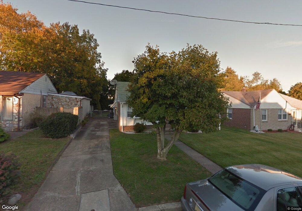
503 Larkspur St Philadelphia, PA 19116
Somerton NeighborhoodEstimated Value: $354,708 - $467,000
--
Bed
--
Bath
1,680
Sq Ft
$250/Sq Ft
Est. Value
About This Home
This home is located at 503 Larkspur St, Philadelphia, PA 19116 and is currently estimated at $420,677, approximately $250 per square foot. 503 Larkspur St is a home located in Philadelphia County with nearby schools including Loesche William H School, CCA Baldi Middle School, and George Washington High School.
Ownership History
Date
Name
Owned For
Owner Type
Purchase Details
Closed on
Nov 13, 2009
Sold by
Chonos Shirley May and Chonos Shirley Marie
Bought by
Chonos Shirley May and Chonos Steven T
Current Estimated Value
Purchase Details
Closed on
Nov 1, 2002
Sold by
Chonos Shirley May and Chonos Shirley Marie
Bought by
Chonos Shirley May and Chonos Steven T
Purchase Details
Closed on
May 16, 2002
Sold by
Chonos Shirley May and Chonos Steven T
Bought by
Chonos Shirley May and Chonos Shirley Marie
Create a Home Valuation Report for This Property
The Home Valuation Report is an in-depth analysis detailing your home's value as well as a comparison with similar homes in the area
Home Values in the Area
Average Home Value in this Area
Purchase History
| Date | Buyer | Sale Price | Title Company |
|---|---|---|---|
| Chonos Shirley May | -- | None Available | |
| Chonos Shirley May | -- | -- | |
| Chonos Shirley May | -- | -- |
Source: Public Records
Tax History Compared to Growth
Tax History
| Year | Tax Paid | Tax Assessment Tax Assessment Total Assessment is a certain percentage of the fair market value that is determined by local assessors to be the total taxable value of land and additions on the property. | Land | Improvement |
|---|---|---|---|---|
| 2026 | $3,985 | $355,600 | $71,120 | $284,480 |
| 2025 | $3,985 | $355,600 | $71,120 | $284,480 |
| 2024 | $3,985 | $355,600 | $71,120 | $284,480 |
| 2023 | $3,985 | $284,700 | $56,940 | $227,760 |
| 2022 | $3,355 | $239,700 | $56,940 | $182,760 |
| 2021 | $3,333 | $0 | $0 | $0 |
| 2020 | $3,333 | $0 | $0 | $0 |
| 2019 | $3,192 | $0 | $0 | $0 |
| 2018 | $2,675 | $0 | $0 | $0 |
| 2017 | $2,675 | $0 | $0 | $0 |
| 2016 | $2,255 | $0 | $0 | $0 |
| 2015 | $2,159 | $0 | $0 | $0 |
| 2014 | -- | $191,100 | $113,998 | $77,102 |
| 2012 | -- | $27,136 | $2,875 | $24,261 |
Source: Public Records
Map
Nearby Homes
- 509 Larkspur St
- 11715 Jeanes St
- 11022 Ferndale St
- 433 Regina St
- 441 Tomlinson Rd Unit F6
- 370 Selma St
- 11012 Audubon Ave
- 11722 Audubon Ave
- 807 Larkspur St
- 375 Avon St
- 133 Gardner St
- 808 Densmore Rd
- 11169 Hendrix St
- 412 Avon Place
- 118 Rennard Place
- 813 Piermont St
- 818 Burgess St
- 10665 Halstead St
- 10752 Jeanes St
- 825 Delray St
- 505 Larkspur St
- 501 Larkspur St
- 507 Larkspur St
- 502 Rennard St
- 500 Rennard St
- 502 Larkspur St
- 504 Larkspur St
- 500 Larkspur St
- 506 Larkspur St
- 11042 Ferndale St
- 506 Rennard St
- 11044 Ferndale St
- 511 Larkspur St
- 11040 Ferndale St
- 508 Larkspur St
- 11038 Ferndale St
- 508 Rennard St
- 11046 Ferndale St
- 503 Selma St
- 510 Larkspur St