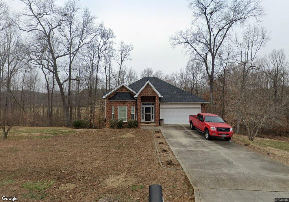
5032 Wild Wing Dr Gastonia, NC 28052
Estimated Value: $324,000 - $383,776
3
Beds
2
Baths
1,497
Sq Ft
$234/Sq Ft
Est. Value
About This Home
This home is located at 5032 Wild Wing Dr, Gastonia, NC 28052 and is currently estimated at $349,694, approximately $233 per square foot. 5032 Wild Wing Dr is a home located in Gaston County with nearby schools including Chapel Grove Elementary School, Southwest Middle School, and Hunter Huss High School.
Ownership History
Date
Name
Owned For
Owner Type
Purchase Details
Closed on
Apr 6, 2017
Sold by
Pilot David E
Bought by
Pilot Laradon
Current Estimated Value
Home Financials for this Owner
Home Financials are based on the most recent Mortgage that was taken out on this home.
Original Mortgage
$147,000
Outstanding Balance
$105,978
Interest Rate
4%
Mortgage Type
Adjustable Rate Mortgage/ARM
Estimated Equity
$243,716
Purchase Details
Closed on
May 30, 2007
Sold by
Reeger Builders Inc
Bought by
Pilot David E and Pilot Laradon B
Home Financials for this Owner
Home Financials are based on the most recent Mortgage that was taken out on this home.
Original Mortgage
$133,920
Interest Rate
6.25%
Mortgage Type
Purchase Money Mortgage
Create a Home Valuation Report for This Property
The Home Valuation Report is an in-depth analysis detailing your home's value as well as a comparison with similar homes in the area
Home Values in the Area
Average Home Value in this Area
Purchase History
| Date | Buyer | Sale Price | Title Company |
|---|---|---|---|
| Pilot Laradon | -- | None Available | |
| Pilot David E | $167,500 | None Available |
Source: Public Records
Mortgage History
| Date | Status | Borrower | Loan Amount |
|---|---|---|---|
| Open | Pilot Laradon | $147,000 | |
| Closed | Pilot David E | $133,920 | |
| Closed | Pilot David E | $33,480 |
Source: Public Records
Tax History Compared to Growth
Tax History
| Year | Tax Paid | Tax Assessment Tax Assessment Total Assessment is a certain percentage of the fair market value that is determined by local assessors to be the total taxable value of land and additions on the property. | Land | Improvement |
|---|---|---|---|---|
| 2025 | $2,339 | $327,620 | $35,160 | $292,460 |
| 2024 | $2,339 | $327,620 | $35,160 | $292,460 |
| 2023 | $2,279 | $327,860 | $35,400 | $292,460 |
| 2022 | $1,783 | $193,820 | $34,600 | $159,220 |
| 2021 | $1,789 | $193,820 | $34,600 | $159,220 |
| 2019 | $1,808 | $193,820 | $34,600 | $159,220 |
| 2018 | $1,393 | $142,869 | $27,870 | $114,999 |
| 2017 | $1,354 | $142,869 | $27,870 | $114,999 |
| 2016 | $1,354 | $138,894 | $0 | $0 |
| 2014 | $1,611 | $166,980 | $33,000 | $133,980 |
Source: Public Records
Map
Nearby Homes
- 335 S Fork Meadows Rd
- 1500 Crowders Creek Rd
- 1520 Woodend Ln
- 1270 Lilly Dr
- 150 Heatherwood Ct
- 1264 Lilly Dr
- 953 Bollinger Pond Dr
- 1014 Spring Dr
- 110 Jeran Ln
- 129 Hunter Lee Ln
- 5909 Crawford Rd
- 220 Lingerfelt Dr
- 226 Lingerfelt Dr
- 1041 Crowders Creek Rd
- 2300 Oakstone Cir
- 4841 Greenwood Dr
- 924 Ferguson Ridge Rd
- Lot 2 Rhyne Rd
- 1131 Colonial Rd
- 994 Rhyne Rd
- 5039 Wild Wing Dr
- 5104 Thornhill Dr
- 5047 Wild Wing Dr
- 5105 Thornhill Dr
- 5016 Wild Wing Dr
- 5108 Thornhill Dr
- 5019 Wild Wing Dr
- 5109 Thornhill Dr
- 5224 Morning Dove Ct
- 5051 Wild Wing Dr
- 5220 Morning Dove Ct
- 5216 Morning Dove Ct
- 1557 Thornhill Dr
- 5046 Wild Wing Dr
- 5212 Morning Dove Ct
- 5208 Morning Dove Ct
- 5015 Wild Wing Dr
- 5226 Morning Dove Ct
- 5204 Morning Dove Ct
- 5219 Morning Dove Ct