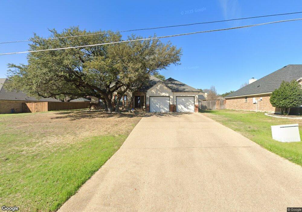
506 Crowfoot Dr Harker Heights, TX 76548
Estimated Value: $315,695 - $385,000
3
Beds
3
Baths
2,230
Sq Ft
$157/Sq Ft
Est. Value
About This Home
This home is located at 506 Crowfoot Dr, Harker Heights, TX 76548 and is currently estimated at $349,674, approximately $156 per square foot. 506 Crowfoot Dr is a home located in Bell County with nearby schools including Skipcha Elementary School, Union Grove Middle School, and Harker Heights High School.
Ownership History
Date
Name
Owned For
Owner Type
Purchase Details
Closed on
Mar 27, 2009
Sold by
Carothers Executive Homes Ltd
Bought by
Barnes Tony L and Barnes Mary Ann
Current Estimated Value
Home Financials for this Owner
Home Financials are based on the most recent Mortgage that was taken out on this home.
Original Mortgage
$264,568
Outstanding Balance
$169,037
Interest Rate
5.14%
Mortgage Type
VA
Estimated Equity
$180,637
Purchase Details
Closed on
Aug 13, 2007
Sold by
The Stagecoach Valley Lp
Bought by
Carothers Executive Homes Ltd
Home Financials for this Owner
Home Financials are based on the most recent Mortgage that was taken out on this home.
Original Mortgage
$196,000
Interest Rate
6.69%
Mortgage Type
Purchase Money Mortgage
Create a Home Valuation Report for This Property
The Home Valuation Report is an in-depth analysis detailing your home's value as well as a comparison with similar homes in the area
Home Values in the Area
Average Home Value in this Area
Purchase History
| Date | Buyer | Sale Price | Title Company |
|---|---|---|---|
| Barnes Tony L | -- | Monteith Abstract & Title Co | |
| Carothers Executive Homes Ltd | -- | Monteith Abstract & Title Co |
Source: Public Records
Mortgage History
| Date | Status | Borrower | Loan Amount |
|---|---|---|---|
| Open | Barnes Tony L | $264,568 | |
| Previous Owner | Carothers Executive Homes Ltd | $196,000 |
Source: Public Records
Tax History Compared to Growth
Tax History
| Year | Tax Paid | Tax Assessment Tax Assessment Total Assessment is a certain percentage of the fair market value that is determined by local assessors to be the total taxable value of land and additions on the property. | Land | Improvement |
|---|---|---|---|---|
| 2025 | -- | $338,362 | $52,000 | $286,362 |
| 2024 | -- | $318,817 | -- | -- |
| 2023 | $5,137 | $289,834 | $0 | $0 |
| 2022 | $5,361 | $263,485 | $0 | $0 |
| 2021 | $5,550 | $239,532 | $38,000 | $201,532 |
| 2020 | $6,723 | $277,840 | $38,000 | $239,840 |
| 2019 | $6,660 | $263,186 | $28,350 | $234,836 |
| 2018 | $6,340 | $266,188 | $28,350 | $237,838 |
| 2017 | $6,321 | $263,985 | $28,350 | $235,635 |
| 2016 | $6,158 | $257,151 | $28,350 | $228,801 |
| 2015 | $5,825 | $254,998 | $28,350 | $226,648 |
| 2014 | $5,825 | $260,090 | $0 | $0 |
Source: Public Records
Map
Nearby Homes
- 505 Lakota Ln
- 404 Prospector Trail
- 306 Wrought Iron Dr
- 215 Tribal Trail
- 711 Tundra Dr
- 501 Qualla Dr
- 514 Prospector Trail
- 419 Cattail Cir
- 423 W Iowa Dr
- 1008 Mustang Trail
- 424 W Iowa Dr
- 815 Olive Ln
- 418 Canoe Dr
- 925 Mustang Trail
- 923 Mustang Trail
- 2608 Moose Hide Dr
- 919 Mustang Trail
- 705 White Hawk Trail
- 303 Buckskin Trail
- 903 Mustang Trail