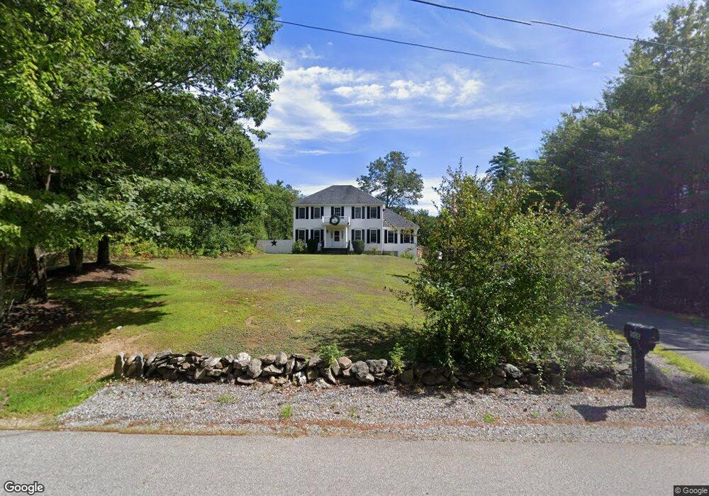
508 Brown Hill Rd Belmont, NH 03220
Estimated Value: $593,038 - $712,000
4
Beds
3
Baths
2,430
Sq Ft
$269/Sq Ft
Est. Value
About This Home
This home is located at 508 Brown Hill Rd, Belmont, NH 03220 and is currently estimated at $652,760, approximately $268 per square foot. 508 Brown Hill Rd is a home located in Belknap County with nearby schools including Belmont Elementary School, Belmont Middle School, and Belmont High School.
Ownership History
Date
Name
Owned For
Owner Type
Purchase Details
Closed on
Dec 30, 2016
Sold by
Brown Hill Ret
Bought by
Brown 3Rd Ernest E and Brown Linda E
Current Estimated Value
Home Financials for this Owner
Home Financials are based on the most recent Mortgage that was taken out on this home.
Original Mortgage
$234,617
Outstanding Balance
$192,345
Interest Rate
3.94%
Mortgage Type
Unknown
Estimated Equity
$460,416
Purchase Details
Closed on
Apr 19, 2011
Sold by
Duby Scott W and Duby Ronisue
Bought by
Brown Hill Road Ret
Home Financials for this Owner
Home Financials are based on the most recent Mortgage that was taken out on this home.
Original Mortgage
$257,307
Interest Rate
4.89%
Mortgage Type
Purchase Money Mortgage
Create a Home Valuation Report for This Property
The Home Valuation Report is an in-depth analysis detailing your home's value as well as a comparison with similar homes in the area
Home Values in the Area
Average Home Value in this Area
Purchase History
| Date | Buyer | Sale Price | Title Company |
|---|---|---|---|
| Brown 3Rd Ernest E | $233,333 | -- | |
| Brown Hill Road Ret | $264,000 | -- |
Source: Public Records
Mortgage History
| Date | Status | Borrower | Loan Amount |
|---|---|---|---|
| Open | Brown 3Rd Ernest E | $234,617 | |
| Previous Owner | Brown Hill Road Ret | $257,307 |
Source: Public Records
Tax History Compared to Growth
Tax History
| Year | Tax Paid | Tax Assessment Tax Assessment Total Assessment is a certain percentage of the fair market value that is determined by local assessors to be the total taxable value of land and additions on the property. | Land | Improvement |
|---|---|---|---|---|
| 2024 | $7,908 | $502,400 | $97,300 | $405,100 |
| 2023 | $8,331 | $476,900 | $75,100 | $401,800 |
| 2022 | $8,406 | $439,900 | $67,200 | $372,700 |
| 2021 | $7,508 | $281,500 | $47,100 | $234,400 |
| 2020 | $7,133 | $281,500 | $47,100 | $234,400 |
| 2019 | $7,040 | $281,500 | $47,100 | $234,400 |
| 2017 | $7,707 | $261,600 | $48,400 | $213,200 |
| 2016 | $7,542 | $261,600 | $48,400 | $213,200 |
| 2015 | $7,395 | $261,600 | $48,400 | $213,200 |
| 2014 | $7,233 | $261,600 | $48,400 | $213,200 |
| 2013 | $7,102 | $316,500 | $85,000 | $231,500 |
Source: Public Records
Map
Nearby Homes
- 0 Dock Rd
- 159 Province Rd
- 47 Dock Rd
- 230 Aiden Cir
- 221 Aiden Cir
- 0 Birch Ave Unit 48
- 36 Country Side Cir
- 38 Country Side Cir
- 126 Aiden Cir
- 2 Brook Ave
- 218 Wild Acres Rd
- 200 Hemlock Dr
- 8 Jodi Dr
- 0 Plum Ave Unit 99 5045503
- 203 Middle Route
- 493 Province Rd
- 0 Province Rd Unit 5068495
- 11 Highcrest Dr
- 18 Highcrest Dr
- 73 Seavey Rd
- 518 Brown Hill Rd
- 500 Brown Hill Rd
- 497 Brown Hill Rd
- 486 Brown Hill Rd
- 549 Brown Hill Rd
- 489 Brown Hill Rd
- 548 Brown Hill Rd
- 473 Brown Hill Rd
- 466 Brown Hill Rd
- 565 Brown Hill Rd
- 560 Brown Hill Rd
- 463 Brown Hill Rd
- 464 Brown Hill Rd
- 461 Brown Hill Rd
- 454 Brown Hill Rd
- 449 Brown Hill Rd
- 436 Brown Hill Rd
- 23 Morgan Rd
- 33 Morgan Rd
- 11 Morgan Rd