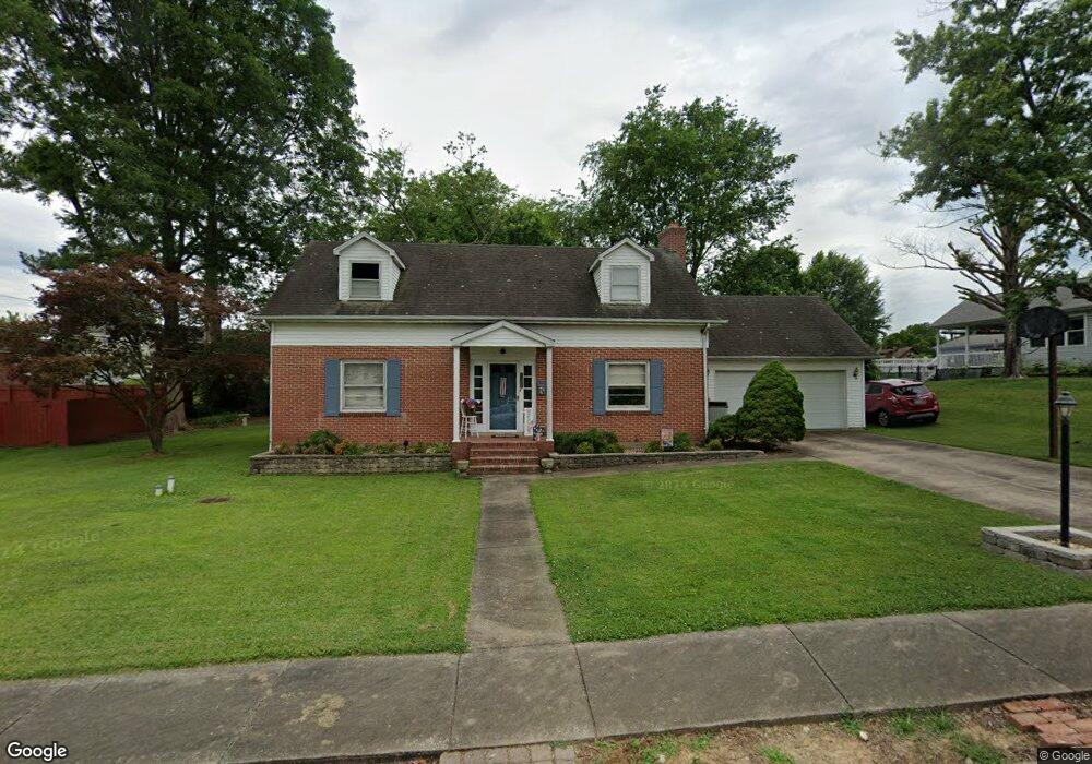
509 E North St Perryville, MO 63775
Estimated Value: $184,000 - $232,000
2
Beds
2
Baths
1,700
Sq Ft
$124/Sq Ft
Est. Value
About This Home
This home is located at 509 E North St, Perryville, MO 63775 and is currently estimated at $211,164, approximately $124 per square foot. 509 E North St is a home with nearby schools including Perryville Primary Center, Perryville Elementary School, and Perry County Middle School.
Ownership History
Date
Name
Owned For
Owner Type
Purchase Details
Closed on
Sep 13, 2024
Sold by
Brown Dennis J and Brown Tamara A
Bought by
Ehlers Marissa A and Schemel Carter D
Current Estimated Value
Home Financials for this Owner
Home Financials are based on the most recent Mortgage that was taken out on this home.
Original Mortgage
$186,240
Outstanding Balance
$180,565
Interest Rate
0.61%
Mortgage Type
Construction
Estimated Equity
$30,599
Purchase Details
Closed on
Oct 16, 1995
Bought by
Brown Dennis J and Brown Tamara A
Create a Home Valuation Report for This Property
The Home Valuation Report is an in-depth analysis detailing your home's value as well as a comparison with similar homes in the area
Home Values in the Area
Average Home Value in this Area
Purchase History
| Date | Buyer | Sale Price | Title Company |
|---|---|---|---|
| Ehlers Marissa A | $232,800 | -- | |
| Brown Dennis J | $91,500 | -- |
Source: Public Records
Mortgage History
| Date | Status | Borrower | Loan Amount |
|---|---|---|---|
| Open | Ehlers Marissa A | $186,240 |
Source: Public Records
Tax History Compared to Growth
Tax History
| Year | Tax Paid | Tax Assessment Tax Assessment Total Assessment is a certain percentage of the fair market value that is determined by local assessors to be the total taxable value of land and additions on the property. | Land | Improvement |
|---|---|---|---|---|
| 2024 | $1,329 | $25,584 | $4,600 | $20,984 |
| 2023 | $1,325 | $25,584 | $4,600 | $20,984 |
| 2022 | $1,286 | $24,817 | $3,833 | $20,984 |
| 2021 | $1,287 | $24,817 | $3,833 | $20,984 |
| 2020 | $1,241 | $23,720 | $3,527 | $20,193 |
| 2019 | $1,238 | $23,720 | $3,527 | $20,193 |
| 2018 | $1,030 | $21,986 | $2,913 | $19,073 |
| 2017 | $1,030 | $21,986 | $2,913 | $19,073 |
| 2016 | $1,030 | $20,311 | $2,913 | $17,398 |
| 2015 | -- | $20,311 | $2,913 | $17,398 |
| 2014 | -- | $19,887 | $2,865 | $17,022 |
Source: Public Records
Map
Nearby Homes
- 704 S Kingshighway St
- 221 N Walnut St
- 1002 Allens Landing Rd
- 7c Deerpath Dr
- 310 S Walnut St
- 333 Lynnie St
- 306 Cleo St
- 1006 Ridge Dr
- 118 W Saint Joseph St
- 818 Trade Winds Dr
- 223 Magnolia St
- 601 S Shelby St
- 0 Dorothy Dr Unit MAR24057583
- 0 N Highway 51
- 1004 Edgemont Blvd
- 1841 N Main St
- 0 Mission St
- 1656 Redbud Ct
- 1654 Redbud Ct
- 1650 Redbud Ct
- 519 E North St
- 501 E North St
- 203 Smith St
- 423 E North St
- 520 E Sainte Marie St Unit MARIES
- 520 E Sainte Marie St
- 516 St Maries
- 516 E Ste Maries St
- 423 East N
- 544 E Sainte Marie St
- 207 Smith St
- 516 E North St
- 512 E Sainte Marie St
- 516 E Sainte Marie
- 211 Smith St
- 202 Smith St
- 0 E North St
- 417 E North St
- 523 E Sainte Marie St
- 204 Smith St
