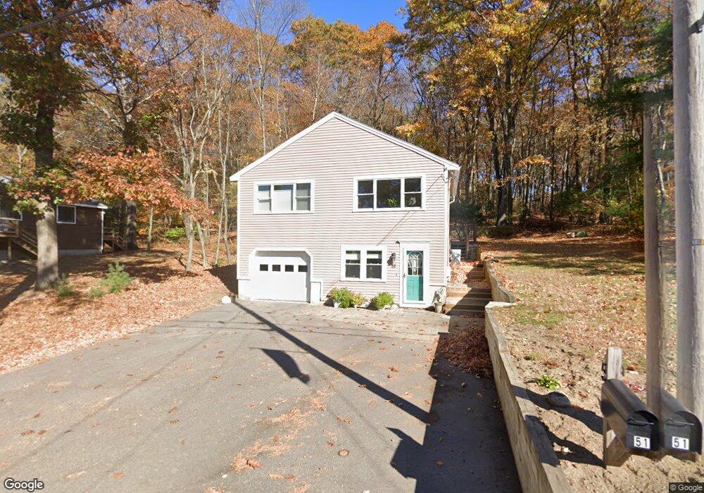
51 Lake Attitash Rd Amesbury, MA 01913
Estimated Value: $554,137 - $579,000
2
Beds
2
Baths
1,118
Sq Ft
$503/Sq Ft
Est. Value
About This Home
This home is located at 51 Lake Attitash Rd, Amesbury, MA 01913 and is currently estimated at $562,534, approximately $503 per square foot. 51 Lake Attitash Rd is a home located in Essex County with nearby schools including Amesbury High School and Amesbury Seventh-Day Adventist School.
Ownership History
Date
Name
Owned For
Owner Type
Purchase Details
Closed on
Oct 30, 2025
Sold by
Garside Maria I
Bought by
Maria I M Garside Ret and Garside
Current Estimated Value
Purchase Details
Closed on
Aug 15, 2023
Sold by
Svetaka Patrice A
Bought by
Garside Maria I
Home Financials for this Owner
Home Financials are based on the most recent Mortgage that was taken out on this home.
Original Mortgage
$360,800
Interest Rate
6.71%
Mortgage Type
Purchase Money Mortgage
Purchase Details
Closed on
Apr 23, 1996
Sold by
Sherwood David R and Sherwood Victoria
Bought by
Svetaka Patrice
Purchase Details
Closed on
Jun 29, 1993
Sold by
Dann Lottie L
Bought by
Sherwood David R and Sherwood Victoria
Purchase Details
Closed on
Sep 27, 1990
Sold by
Lake Attitash Rd
Bought by
Dann Lottie L
Create a Home Valuation Report for This Property
The Home Valuation Report is an in-depth analysis detailing your home's value as well as a comparison with similar homes in the area
Home Values in the Area
Average Home Value in this Area
Purchase History
| Date | Buyer | Sale Price | Title Company |
|---|---|---|---|
| Maria I M Garside Ret | -- | -- | |
| Garside Maria I | $451,000 | None Available | |
| Svetaka Patrice | $131,000 | -- | |
| Sherwood David R | $100,000 | -- | |
| Dann Lottie L | $50,000 | -- | |
| Dann Lottie L | $50,000 | -- |
Source: Public Records
Mortgage History
| Date | Status | Borrower | Loan Amount |
|---|---|---|---|
| Previous Owner | Garside Maria I | $360,800 | |
| Previous Owner | Dann Lottie L | $50,000 | |
| Previous Owner | Dann Lottie L | $100,000 |
Source: Public Records
Tax History Compared to Growth
Tax History
| Year | Tax Paid | Tax Assessment Tax Assessment Total Assessment is a certain percentage of the fair market value that is determined by local assessors to be the total taxable value of land and additions on the property. | Land | Improvement |
|---|---|---|---|---|
| 2025 | $7,171 | $468,700 | $186,400 | $282,300 |
| 2024 | $7,526 | $481,200 | $181,900 | $299,300 |
| 2023 | $6,338 | $387,900 | $165,400 | $222,500 |
| 2022 | $5,843 | $330,300 | $132,300 | $198,000 |
| 2021 | $6,369 | $349,000 | $132,300 | $216,700 |
| 2020 | $5,642 | $328,400 | $132,300 | $196,100 |
| 2019 | $5,748 | $312,900 | $126,300 | $186,600 |
| 2018 | $5,828 | $306,900 | $120,300 | $186,600 |
| 2017 | $5,891 | $295,300 | $140,300 | $155,000 |
| 2016 | $5,605 | $276,400 | $140,300 | $136,100 |
| 2015 | $5,577 | $271,500 | $140,300 | $131,200 |
| 2014 | $5,349 | $255,100 | $140,300 | $114,800 |
Source: Public Records
Map
Nearby Homes
- 4 Acadia Kimball Rd
- 1 Acadia Kimball Rd Unit 1
- 20 Hillside Ct
- 1 Bisson Ln
- 3 Greystone Rd
- 1 Tuxbury Ln
- 160 Haverhill Rd
- 152 Kimball Rd
- 10 Sharon Cir
- 188 Lions Mouth Rd
- 5 Moncrief St Unit 5
- 3 B St
- 6 B St
- 44 Pamela Ln
- 31 Whitter Meadows Dr Unit 31
- 61 E Main St
- 20 Mason Ct
- 10 Mason Ct Unit 10
- 16 Glen Devin St
- 49 W Greenwood St
- 45 Lake Attitash Rd
- 57 Lake Attitash Rd
- 52 Lake Attitash Rd
- 50 Lake Attitash Rd
- 54 Lake Attitash Rd
- 48 Lake Attitash Rd
- 46 Lake Attitash Rd
- 59 Lake Attitash Rd
- 99 Lake Attitash Rd
- 56 Lake Attitash Rd
- 44 Lake Attitash Rd
- 58 Lake Attitash Rd
- 43 Lake Attitash Rd
- 61 Lake Attitash Rd
- 42 Lake Attitash Rd
- 60 Lake Attitash Rd
- 40 1/2 Lake Attitash Rd
- 40 Lake Attitash Rd
- 62 Lake Attitash Rd
- 63 Lake Attitash Rd