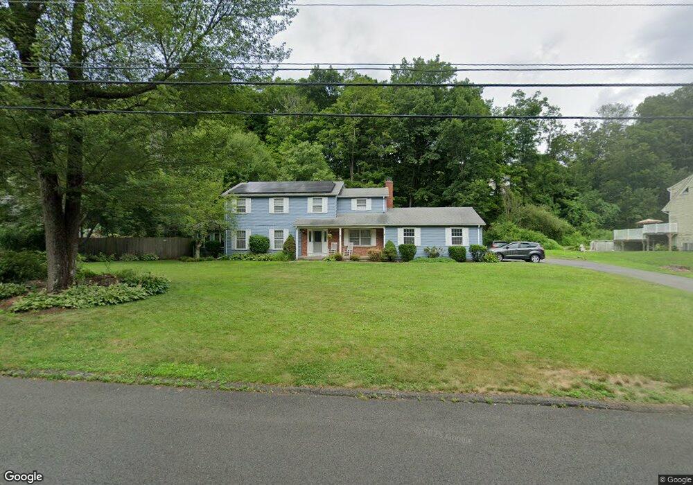
510 Brownstone Ridge Meriden, CT 06451
Estimated Value: $512,000 - $567,000
4
Beds
3
Baths
2,460
Sq Ft
$216/Sq Ft
Est. Value
About This Home
This home is located at 510 Brownstone Ridge, Meriden, CT 06451 and is currently estimated at $530,250, approximately $215 per square foot. 510 Brownstone Ridge is a home located in New Haven County with nearby schools including Hanover School, Lincoln Middle School, and Orville H. Platt High School.
Ownership History
Date
Name
Owned For
Owner Type
Purchase Details
Closed on
Sep 23, 1997
Sold by
White Eliot C and White Susan W
Bought by
Murphy Paul R and Murphy Martha Belt
Current Estimated Value
Create a Home Valuation Report for This Property
The Home Valuation Report is an in-depth analysis detailing your home's value as well as a comparison with similar homes in the area
Home Values in the Area
Average Home Value in this Area
Purchase History
| Date | Buyer | Sale Price | Title Company |
|---|---|---|---|
| Murphy Paul R | $177,526 | -- |
Source: Public Records
Mortgage History
| Date | Status | Borrower | Loan Amount |
|---|---|---|---|
| Open | Murphy Paul R | $50,000 | |
| Open | Murphy Paul R | $220,000 | |
| Closed | Murphy Paul R | $185,000 |
Source: Public Records
Tax History Compared to Growth
Tax History
| Year | Tax Paid | Tax Assessment Tax Assessment Total Assessment is a certain percentage of the fair market value that is determined by local assessors to be the total taxable value of land and additions on the property. | Land | Improvement |
|---|---|---|---|---|
| 2025 | $10,246 | $255,500 | $59,850 | $195,650 |
| 2024 | $9,277 | $255,500 | $59,850 | $195,650 |
| 2023 | $8,889 | $255,500 | $59,850 | $195,650 |
| 2022 | $8,429 | $255,500 | $59,850 | $195,650 |
| 2021 | $8,260 | $202,160 | $67,690 | $134,470 |
| 2020 | $8,260 | $202,160 | $67,690 | $134,470 |
| 2019 | $8,257 | $202,090 | $67,620 | $134,470 |
| 2018 | $8,294 | $202,090 | $67,620 | $134,470 |
| 2017 | $8,067 | $202,090 | $67,620 | $134,470 |
| 2016 | $8,190 | $223,580 | $60,550 | $163,030 |
| 2015 | $8,190 | $223,580 | $60,550 | $163,030 |
| 2014 | $7,991 | $223,580 | $60,550 | $163,030 |
Source: Public Records
Map
Nearby Homes
- 171 Oregon Rd
- 295 & 305 (Lot 103 & Oregon St
- 163 Glen Hills Rd
- 350 Glen Hills Rd
- 56 Glen Hills Rd
- 16 Greenway Place
- 55 Peacock Dr
- 274 Riverside Dr
- 176 Hancock St
- 0 River Rd
- 125 Dana Ln
- 24 Harrington St
- 661 Allen Ave
- 66 Dana Ln
- 25 Suzy Ct
- 23 Baldwin St
- 127 Lambert Ave
- 58 Baldwin St
- 24 Cutlery Ave
- 44 Douglas Dr
- 496 Brownstone Ridge
- 524 Brownstone Ridge
- 256 Brownstone Ridge
- 478 Brownstone Ridge
- 538 Brownstone Ridge
- 507 Brownstone Ridge
- 240 Brownstone Ridge
- 521 Brownstone Ridge
- 280 Brownstone Ridge
- 491 Brownstone Ridge
- 464 Brownstone Ridge
- 477 Brownstone Ridge
- 554 Brownstone Ridge
- 551 Brownstone Ridge
- 232 Brownstone Ridge
- 265 Brownstone Ridge
- 300 Brownstone Ridge
- 285 Brownstone Ridge
- 448 Brownstone Ridge
- 461 Brownstone Ridge