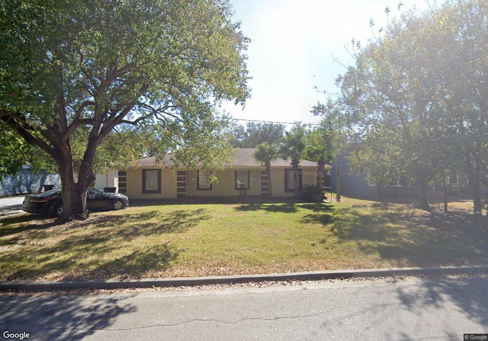
5104 10th St Port Arthur, TX 77642
Estimated Value: $111,203 - $140,000
2
Beds
--
Bath
1,352
Sq Ft
$90/Sq Ft
Est. Value
About This Home
This home is located at 5104 10th St, Port Arthur, TX 77642 and is currently estimated at $122,301, approximately $90 per square foot. 5104 10th St is a home located in Jefferson County with nearby schools including Travis Elementary School, Jefferson Middle School, and Memorial High School.
Ownership History
Date
Name
Owned For
Owner Type
Purchase Details
Closed on
Mar 28, 2024
Sold by
Gandhi Yogesh I
Bought by
Harrison Michael C and Harrison Nicole
Current Estimated Value
Purchase Details
Closed on
Apr 2, 2015
Sold by
Figueroa Tony
Bought by
Gandhi Yogesh I
Purchase Details
Closed on
Mar 5, 2008
Sold by
Ware Harvey J
Bought by
Figueroa Tony
Home Financials for this Owner
Home Financials are based on the most recent Mortgage that was taken out on this home.
Original Mortgage
$45,000
Interest Rate
5.47%
Mortgage Type
Seller Take Back
Create a Home Valuation Report for This Property
The Home Valuation Report is an in-depth analysis detailing your home's value as well as a comparison with similar homes in the area
Home Values in the Area
Average Home Value in this Area
Purchase History
| Date | Buyer | Sale Price | Title Company |
|---|---|---|---|
| Harrison Michael C | -- | Capital Title | |
| Gandhi Yogesh I | -- | None Available | |
| Figueroa Tony | -- | None Available |
Source: Public Records
Mortgage History
| Date | Status | Borrower | Loan Amount |
|---|---|---|---|
| Previous Owner | Figueroa Tony | $45,000 |
Source: Public Records
Tax History Compared to Growth
Tax History
| Year | Tax Paid | Tax Assessment Tax Assessment Total Assessment is a certain percentage of the fair market value that is determined by local assessors to be the total taxable value of land and additions on the property. | Land | Improvement |
|---|---|---|---|---|
| 2025 | $1,875 | $122,611 | $13,500 | $109,111 |
| 2024 | $1,875 | $100,717 | $4,850 | $95,867 |
| 2023 | $1,875 | $54,543 | $4,850 | $49,693 |
| 2022 | $1,732 | $54,543 | $4,850 | $49,693 |
| 2021 | $1,681 | $50,721 | $4,850 | $45,871 |
| 2020 | $1,213 | $37,419 | $4,850 | $32,569 |
| 2019 | $1,193 | $37,420 | $4,850 | $32,570 |
| 2018 | $1,294 | $40,590 | $4,850 | $35,740 |
| 2017 | $1,258 | $40,590 | $4,850 | $35,740 |
| 2016 | $1,143 | $39,010 | $4,850 | $34,160 |
| 2015 | $1,164 | $39,010 | $4,850 | $34,160 |
| 2014 | $1,164 | $39,010 | $4,850 | $34,160 |
Source: Public Records
Map
Nearby Homes
- 1349 Jefferson Dr
- 4600 Lakeshore Dr
- 4100 Dryden Rd
- 1529 Main Ave
- 3945 12th St
- 0 5th St
- 6121 13th St
- 2129 Neches Ave
- 4015 Lakeshore Dr
- 2434 Crescent Dr
- 000 16th St
- 2301 Owens Ave
- 2515 Glenwood Dr
- 6219 16th St
- 2615 3rd Ave
- 2720 Royal Ave
- 6268 Warren St
- 3737 Lakeshore Dr
- LOT 55 Royal Meadows Estate
- 2621 Evergreen Dr