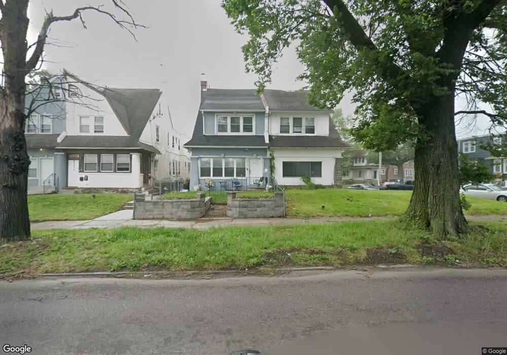
5117 Roosevelt Blvd Philadelphia, PA 19124
Lawncrest NeighborhoodEstimated Value: $270,619 - $362,000
--
Bed
--
Bath
2,163
Sq Ft
$149/Sq Ft
Est. Value
About This Home
This home is located at 5117 Roosevelt Blvd, Philadelphia, PA 19124 and is currently estimated at $322,905, approximately $149 per square foot. 5117 Roosevelt Blvd is a home located in Philadelphia County with nearby schools including Frankford High School, The Philadelphia Charter School for the Arts & Sciences, and Northwood Academy Charter School.
Ownership History
Date
Name
Owned For
Owner Type
Purchase Details
Closed on
Apr 18, 2005
Sold by
Byrne Dorothy A
Bought by
St Jean Cleonore J
Current Estimated Value
Home Financials for this Owner
Home Financials are based on the most recent Mortgage that was taken out on this home.
Original Mortgage
$136,000
Outstanding Balance
$87,419
Interest Rate
9.95%
Mortgage Type
Fannie Mae Freddie Mac
Estimated Equity
$235,486
Create a Home Valuation Report for This Property
The Home Valuation Report is an in-depth analysis detailing your home's value as well as a comparison with similar homes in the area
Home Values in the Area
Average Home Value in this Area
Purchase History
| Date | Buyer | Sale Price | Title Company |
|---|---|---|---|
| St Jean Cleonore J | $160,000 | -- |
Source: Public Records
Mortgage History
| Date | Status | Borrower | Loan Amount |
|---|---|---|---|
| Open | St Jean Cleonore J | $136,000 |
Source: Public Records
Tax History Compared to Growth
Tax History
| Year | Tax Paid | Tax Assessment Tax Assessment Total Assessment is a certain percentage of the fair market value that is determined by local assessors to be the total taxable value of land and additions on the property. | Land | Improvement |
|---|---|---|---|---|
| 2026 | $3,266 | $266,400 | $53,280 | $213,120 |
| 2025 | $3,266 | $266,400 | $53,280 | $213,120 |
| 2024 | $3,266 | $266,400 | $53,280 | $213,120 |
| 2023 | $3,266 | $233,300 | $46,660 | $186,640 |
| 2022 | $2,131 | $188,300 | $46,660 | $141,640 |
| 2021 | $2,760 | $0 | $0 | $0 |
| 2020 | $2,760 | $0 | $0 | $0 |
| 2019 | $2,648 | $0 | $0 | $0 |
| 2018 | $2,202 | $0 | $0 | $0 |
| 2017 | $2,622 | $0 | $0 | $0 |
| 2016 | $2,202 | $0 | $0 | $0 |
| 2015 | $18,301 | $0 | $0 | $0 |
| 2014 | -- | $187,300 | $46,755 | $140,545 |
| 2012 | -- | $19,584 | $4,405 | $15,179 |
Source: Public Records
Map
Nearby Homes
- 5505 Loretto Ave
- 4046 E Roosevelt Blvd
- 1048 Bridge St
- 5640 Miriam Rd
- 5659 Miriam Rd
- 5661 Miriam Rd
- 934 Brill St
- 894 Granite St
- 1859 Harrison St
- 1052 Allengrove St
- 880 Granite St
- 934 E Sanger St
- 991 Carver St
- 1137 Bridge St
- 996 Anchor St
- 925 E Sanger St
- 926 Foulkrod St
- 1204 Pratt St
- 894 E Sanger St
- 883 Brill St
- 5119 Roosevelt Blvd
- 5121 E Roosevelt Blvd Unit 1
- 5121 E Roosevelt Blvd Unit 2
- 5121 E Roosevelt Blvd
- 5121 E Roosevelt Blvd Unit A
- 5121 Roosevelt Blvd
- 5115 Roosevelt Blvd
- 5123 Roosevelt Blvd
- 5115 E Roosevelt Blvd
- 5113 Roosevelt Blvd
- 5129 Roosevelt Blvd
- 944 Kenwyn St
- 947 Kenwyn St
- 5111 Roosevelt Blvd
- 946 Kenwyn St
- 5111 E Roosevelt Blvd Unit 1ST FLOOR
- 5111 E Roosevelt Blvd Unit 2F
- 5111 E Roosevelt Blvd
- 949 Kenwyn St
- 5131 Roosevelt Blvd