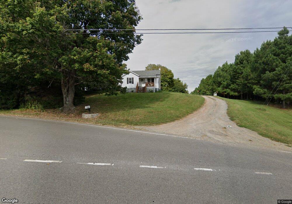
5129 Westfield Rd Mount Airy, NC 27030
Estimated Value: $104,000 - $206,711
2
Beds
1
Bath
1,126
Sq Ft
$147/Sq Ft
Est. Value
About This Home
This home is located at 5129 Westfield Rd, Mount Airy, NC 27030 and is currently estimated at $165,178, approximately $146 per square foot. 5129 Westfield Rd is a home located in Surry County with nearby schools including Westfield Elementary School, Pilot Mountain Middle School, and East Surry High School.
Ownership History
Date
Name
Owned For
Owner Type
Purchase Details
Closed on
Mar 29, 2022
Sold by
Hunt Bryant W and Hunt Treva C
Bought by
Hunt Andrew G and Lilly Sharon Madison
Current Estimated Value
Home Financials for this Owner
Home Financials are based on the most recent Mortgage that was taken out on this home.
Original Mortgage
$152,000
Outstanding Balance
$140,728
Interest Rate
3.15%
Mortgage Type
New Conventional
Estimated Equity
$24,450
Purchase Details
Closed on
Apr 17, 2015
Sold by
Shoffner Darlene N and Norman Michael D
Bought by
Hunt Bryant W and Hunt Treva C
Purchase Details
Closed on
Aug 1, 2010
Purchase Details
Closed on
Dec 1, 2002
Purchase Details
Closed on
Jul 1, 1990
Purchase Details
Closed on
Jul 1, 1947
Create a Home Valuation Report for This Property
The Home Valuation Report is an in-depth analysis detailing your home's value as well as a comparison with similar homes in the area
Home Values in the Area
Average Home Value in this Area
Purchase History
| Date | Buyer | Sale Price | Title Company |
|---|---|---|---|
| Hunt Andrew G | $150,000 | None Listed On Document | |
| Hunt Andrew G | $150,000 | None Listed On Document | |
| Hunt Bryant W | $50,000 | Attorney | |
| -- | -- | -- | |
| -- | -- | -- | |
| -- | -- | -- | |
| -- | -- | -- |
Source: Public Records
Mortgage History
| Date | Status | Borrower | Loan Amount |
|---|---|---|---|
| Open | Hunt Andrew G | $152,000 | |
| Closed | Hunt Andrew G | $152,000 |
Source: Public Records
Tax History Compared to Growth
Tax History
| Year | Tax Paid | Tax Assessment Tax Assessment Total Assessment is a certain percentage of the fair market value that is determined by local assessors to be the total taxable value of land and additions on the property. | Land | Improvement |
|---|---|---|---|---|
| 2025 | $806 | $127,700 | $23,400 | $104,300 |
| 2024 | $713 | $101,970 | $21,600 | $80,370 |
| 2023 | $702 | $101,970 | $21,600 | $80,370 |
| 2022 | $442 | $101,970 | $21,600 | $80,370 |
| 2021 | $449 | $61,330 | $18,000 | $43,330 |
| 2020 | $438 | $58,280 | $18,000 | $40,280 |
| 2019 | $435 | $58,280 | $0 | $0 |
| 2018 | $419 | $58,280 | $0 | $0 |
| 2017 | $411 | $58,280 | $0 | $0 |
| 2016 | $411 | $58,280 | $0 | $0 |
| 2013 | -- | $58,280 | $0 | $0 |
Source: Public Records
Map
Nearby Homes
- 140 Daniels Dell Ln
- Lot 4,5,6 Sideview Ln
- 7.8ac Norman Rd
- 733 Slate Mountain Rd
- 0 Norman Rd
- 00 Albion Church Rd
- 107 Cory Trail
- 731 Indian Grove Church Rd
- 583 Snody Rd
- 00 Blue Hollow Rd Unit 5
- 0 Blue Hollow Rd Unit 33 1176021
- 0 Blue Hollow Rd Unit 23105199
- 000 Blue Hollow Rd Unit 27
- Lot 5 Howell Rd
- 1305 Brim Rd
- 1507 Rogers Rd
- 339 Jessup Grove Church Rd
- 446 Gilley Rd
- 0 NE Pine St
- TBD Rogers Rd Unit TBD Rogers Road
- 5159 Westfield Rd
- 108 Baxter Ln
- 5156 Westfield Rd
- 124 Baxter Ln
- 5172 Westfield Rd
- 5213 Westfield Rd
- 5251 Westfield Rd
- 169 Slate Mountain Rd
- 5005 Westfield Rd
- 122 Clifton Ln
- 5268 Westfield Rd
- 4991 Westfield Rd
- 107 Woodville Rd
- 170 Buckhorn Trail
- 5274 Westfield Rd
- 102 Wytheville Ln
- xx 23.32 acres Slate Mountain Rd
- 103 Wytheville Ln
- 108 Woodville Rd
- 5286 Westfield Rd