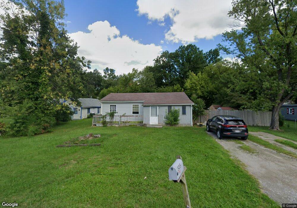
5135 Bond Ave Lorain, OH 44055
Estimated Value: $117,000 - $145,000
2
Beds
1
Bath
1,080
Sq Ft
$123/Sq Ft
Est. Value
About This Home
This home is located at 5135 Bond Ave, Lorain, OH 44055 and is currently estimated at $132,812, approximately $122 per square foot. 5135 Bond Ave is a home located in Lorain County with nearby schools including Vincent Elementary School, Durling Middle School, and Clearview High School.
Ownership History
Date
Name
Owned For
Owner Type
Purchase Details
Closed on
Feb 28, 2011
Sold by
Gargiulo Barbara
Bought by
Gargiulo Ronald
Current Estimated Value
Purchase Details
Closed on
Jan 25, 2006
Sold by
Gargiulo Barbara A
Bought by
Gargiulo Ronald
Purchase Details
Closed on
Aug 24, 2005
Sold by
Stahl Aaron Ray and Kallas Jennifer F
Bought by
Gargiulo Ronald and Gargiulo Barbara
Home Financials for this Owner
Home Financials are based on the most recent Mortgage that was taken out on this home.
Original Mortgage
$77,701
Interest Rate
8.8%
Mortgage Type
Seller Take Back
Purchase Details
Closed on
Mar 16, 1999
Sold by
The Bank Of New York
Bought by
Gargiulo Ronald and Gargiulo Barbara A
Purchase Details
Closed on
Nov 23, 1998
Sold by
Pedraza Ronald D
Bought by
The Bank Of New York
Create a Home Valuation Report for This Property
The Home Valuation Report is an in-depth analysis detailing your home's value as well as a comparison with similar homes in the area
Home Values in the Area
Average Home Value in this Area
Purchase History
| Date | Buyer | Sale Price | Title Company |
|---|---|---|---|
| Gargiulo Ronald | -- | Attorney | |
| Gargiulo Ronald | -- | None Available | |
| Gargiulo Ronald | -- | Attorney | |
| Stahl Aaron Ray | $79,900 | -- | |
| Gargiulo Ronald | $25,000 | Midland Title | |
| The Bank Of New York | $31,000 | -- |
Source: Public Records
Mortgage History
| Date | Status | Borrower | Loan Amount |
|---|---|---|---|
| Previous Owner | Stahl Aaron Ray | $77,701 |
Source: Public Records
Tax History Compared to Growth
Tax History
| Year | Tax Paid | Tax Assessment Tax Assessment Total Assessment is a certain percentage of the fair market value that is determined by local assessors to be the total taxable value of land and additions on the property. | Land | Improvement |
|---|---|---|---|---|
| 2024 | $1,730 | $39,246 | $10,084 | $29,162 |
| 2023 | $1,414 | $25,372 | $7,291 | $18,081 |
| 2022 | $1,450 | $25,372 | $7,291 | $18,081 |
| 2021 | $1,511 | $25,372 | $7,291 | $18,081 |
| 2020 | $1,390 | $22,160 | $6,370 | $15,790 |
| 2019 | $1,383 | $22,160 | $6,370 | $15,790 |
| 2018 | $1,707 | $22,160 | $6,370 | $15,790 |
| 2017 | $1,698 | $20,340 | $5,240 | $15,100 |
| 2016 | $1,537 | $20,340 | $5,240 | $15,100 |
| 2015 | $1,540 | $20,340 | $5,240 | $15,100 |
| 2014 | $1,182 | $21,350 | $5,500 | $15,850 |
| 2013 | $1,182 | $21,350 | $5,500 | $15,850 |
Source: Public Records
Map
Nearby Homes
- 5278 Farr Ave
- 5193 Liberty Ave
- 0 Vincent Ave
- VL Ridgewood St
- V/L Eschtruth St
- V/L Rear Land Unit 1
- V/L Rear Land Unit 2
- 4651 Camden Ave
- 4543 Norfolk Ave
- V/L Grove Ave
- 147 Stoney Brook Dr
- 3934 Gary Ave
- 206 Stoney Brook Dr
- 5877 Ford Rd
- 2315 Homewood Dr
- 2323 Homewood Dr
- 2456 E 37th St
- 2374 E 37th St
- 3690 Gary Ave
- 109 Meadowfield Ct