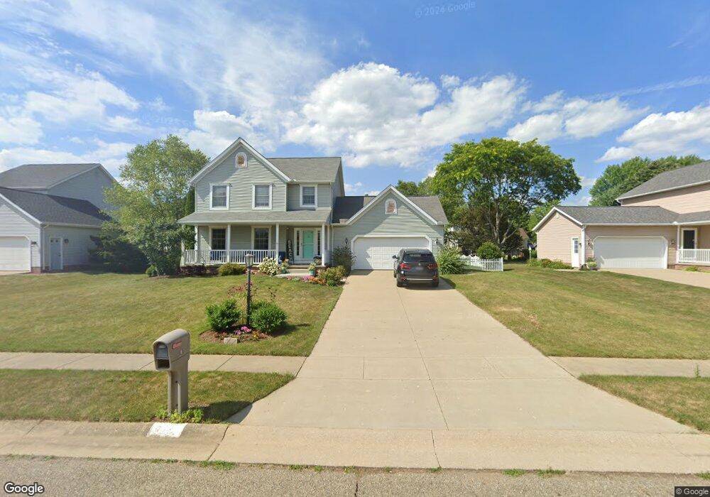
515 Rodeo St Louisville, OH 44641
Estimated Value: $286,000 - $322,000
3
Beds
3
Baths
1,961
Sq Ft
$156/Sq Ft
Est. Value
About This Home
This home is located at 515 Rodeo St, Louisville, OH 44641 and is currently estimated at $305,436, approximately $155 per square foot. 515 Rodeo St is a home located in Stark County with nearby schools including Louisville High School and St. Thomas Aquinas High School & Middle School.
Ownership History
Date
Name
Owned For
Owner Type
Purchase Details
Closed on
Jul 13, 1999
Sold by
Buffalo Ridge Allotment Inc
Bought by
Simpkins Richard D and Simpkins Amy M
Current Estimated Value
Home Financials for this Owner
Home Financials are based on the most recent Mortgage that was taken out on this home.
Original Mortgage
$124,165
Outstanding Balance
$34,725
Interest Rate
7.54%
Mortgage Type
Purchase Money Mortgage
Estimated Equity
$270,711
Create a Home Valuation Report for This Property
The Home Valuation Report is an in-depth analysis detailing your home's value as well as a comparison with similar homes in the area
Home Values in the Area
Average Home Value in this Area
Purchase History
| Date | Buyer | Sale Price | Title Company |
|---|---|---|---|
| Simpkins Richard D | $130,700 | -- |
Source: Public Records
Mortgage History
| Date | Status | Borrower | Loan Amount |
|---|---|---|---|
| Open | Simpkins Richard D | $124,165 |
Source: Public Records
Tax History Compared to Growth
Tax History
| Year | Tax Paid | Tax Assessment Tax Assessment Total Assessment is a certain percentage of the fair market value that is determined by local assessors to be the total taxable value of land and additions on the property. | Land | Improvement |
|---|---|---|---|---|
| 2025 | -- | $101,680 | $17,750 | $83,930 |
| 2024 | -- | $101,680 | $17,750 | $83,930 |
| 2023 | $3,079 | $71,650 | $17,610 | $54,040 |
| 2022 | $3,085 | $71,650 | $17,610 | $54,040 |
| 2021 | $3,093 | $71,650 | $17,610 | $54,040 |
| 2020 | $2,552 | $64,190 | $15,890 | $48,300 |
| 2019 | $2,562 | $61,600 | $15,890 | $45,710 |
| 2018 | $2,450 | $61,600 | $15,890 | $45,710 |
| 2017 | $2,311 | $56,070 | $12,950 | $43,120 |
| 2016 | $2,358 | $56,070 | $12,950 | $43,120 |
| 2015 | $2,365 | $56,070 | $12,950 | $43,120 |
| 2014 | $197 | $48,410 | $11,200 | $37,210 |
| 2013 | $1,102 | $48,410 | $11,200 | $37,210 |
Source: Public Records
Map
Nearby Homes
- 908 Sand Lot Cir
- 1702 View Pointe Ave
- 1639 Horizon Dr
- 8225 Georgetown St
- 641 S Nickelplate St
- 520 S Silver St
- 510 S Bauman Ct
- 728 E Broad St
- 204 E Broad St
- 2425 Miday Ave NE
- 6969 Georgetown St NE
- 107 E Broad St
- 308 Superior St
- 3390 Meese Rd NE
- 2110 Edmar St
- 1715 High St
- 1812 E Broad St
- 325 Lincoln Ave
- 0 Michigan Blvd
- 201 Indiana Ave
- 505 Rodeo St
- 525 Rodeo St
- 514 Buffalo Ridge St
- 524 Buffalo Ridge St
- 2014 Cherokee Ave
- 605 Rodeo St
- 524 Rodeo St
- 415 Rodeo Cir
- 604 Buffalo Ridge St
- 615 Rodeo St
- 604 Rodeo St
- 414 Buffalo Ridge St
- 414 Rodeo Cir
- 614 Buffalo Ridge St
- 405 Rodeo Cir
- 614 Rodeo St
- 515 Buffalo Ridge St
- 404 Buffalo Ridge St
- 625 Rodeo St
- 525 Buffalo Ridge St