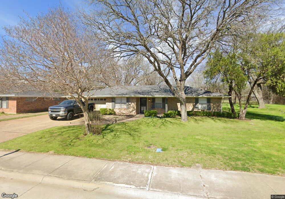
516 Forrest Ln Corsicana, TX 75110
Estimated Value: $186,867 - $282,000
--
Bed
--
Bath
1,845
Sq Ft
$130/Sq Ft
Est. Value
About This Home
This home is located at 516 Forrest Ln, Corsicana, TX 75110 and is currently estimated at $240,217, approximately $130 per square foot. 516 Forrest Ln is a home located in Navarro County with nearby schools including Corsicana High School and William Tyndale Christian Academy.
Ownership History
Date
Name
Owned For
Owner Type
Purchase Details
Closed on
Jul 31, 2015
Sold by
Davis Micheal K and Davis Rhonda I
Bought by
Don Lane Enterprises Llc Dlbla The Don
Current Estimated Value
Home Financials for this Owner
Home Financials are based on the most recent Mortgage that was taken out on this home.
Original Mortgage
$75,000
Outstanding Balance
$58,906
Interest Rate
4.07%
Mortgage Type
Purchase Money Mortgage
Estimated Equity
$181,311
Create a Home Valuation Report for This Property
The Home Valuation Report is an in-depth analysis detailing your home's value as well as a comparison with similar homes in the area
Home Values in the Area
Average Home Value in this Area
Purchase History
| Date | Buyer | Sale Price | Title Company |
|---|---|---|---|
| Don Lane Enterprises Llc Dlbla The Don | -- | Micro Title Navarro County |
Source: Public Records
Mortgage History
| Date | Status | Borrower | Loan Amount |
|---|---|---|---|
| Open | Don Lane Enterprises Llc Dlbla The Don | $75,000 |
Source: Public Records
Tax History Compared to Growth
Tax History
| Year | Tax Paid | Tax Assessment Tax Assessment Total Assessment is a certain percentage of the fair market value that is determined by local assessors to be the total taxable value of land and additions on the property. | Land | Improvement |
|---|---|---|---|---|
| 2025 | $2,863 | $151,210 | $40,440 | $110,770 |
| 2024 | $2,753 | $145,410 | $26,960 | $118,450 |
| 2023 | $2,659 | $144,060 | $26,960 | $117,100 |
| 2022 | $2,838 | $122,590 | $11,230 | $111,360 |
| 2021 | $3,123 | $120,140 | $11,230 | $108,910 |
| 2020 | $3,160 | $119,080 | $11,230 | $107,850 |
| 2019 | $3,380 | $123,060 | $11,230 | $111,830 |
| 2018 | $3,318 | $120,820 | $8,990 | $111,830 |
| 2017 | $2,989 | $108,990 | $8,990 | $100,000 |
| 2016 | $2,972 | $108,360 | $8,990 | $99,370 |
| 2015 | -- | $103,460 | $9,100 | $94,360 |
| 2014 | -- | $102,500 | $9,100 | $93,400 |
Source: Public Records
Map
Nearby Homes
- 2631 Fish Tank Rd
- 542 Forrest Ln
- 2629 Fish Tank Rd
- 421 Forrest Ln
- 2604 Forest Lane Cir
- 405 Fairmont Ave
- 2809 Lafayette St
- 408 Fairmont Ave
- 400 Fairmont Ave
- 2812 Winfield Dr
- 524 Lakewood Ave
- 800 Imperial Ln
- 3100 Louis Ave
- 1000 Bryn Mawr St
- 2110 Dartmouth Ln
- 1004 Bryn Mawr St
- 2420 N Beaton St
- 2200 N Beaton St
- 2903 N Beaton St
- 1305 Tammy Ave
- 520 Forrest Ln
- 512 Forrest Ln
- 505 Oakridge Dr
- 524 Forrest Ln
- 509 Oakridge Dr
- 515 Forrest Ln
- 519 Forrest Ln
- 2804 Lafayette St
- 523 Forrest Ln
- 528 Forrest Ln
- 513 Oakridge Dr
- 2905 Oakridge Dr
- 2808 Lafayette St
- 417 Forrest Ln
- 500 Oakridge Dr
- 527 Forrest Ln
- 517 Oakridge Dr
- 504 Oakridge Dr
- 532 Forrest Ln
- Lot 17-R2 Lafayette