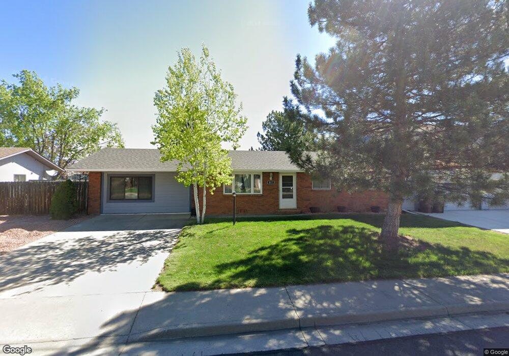
517 Chestnut Dr Loveland, CO 80538
Estimated Value: $365,000 - $413,000
3
Beds
1
Bath
1,040
Sq Ft
$375/Sq Ft
Est. Value
About This Home
This home is located at 517 Chestnut Dr, Loveland, CO 80538 and is currently estimated at $390,116, approximately $375 per square foot. 517 Chestnut Dr is a home located in Larimer County with nearby schools including Laurene Edmondson Elementary School, Lucile Erwin Middle School, and Loveland High School.
Ownership History
Date
Name
Owned For
Owner Type
Purchase Details
Closed on
Jan 31, 2012
Sold by
Colorado Housing & Finance Authority
Bought by
Sullivan Mark L
Current Estimated Value
Home Financials for this Owner
Home Financials are based on the most recent Mortgage that was taken out on this home.
Original Mortgage
$138,400
Outstanding Balance
$96,439
Interest Rate
4.25%
Mortgage Type
FHA
Estimated Equity
$293,677
Purchase Details
Closed on
Aug 19, 2011
Sold by
Evans Christine K
Bought by
Colorado Housing & Finance Authority
Purchase Details
Closed on
Nov 9, 2007
Sold by
Burnworth Mary Jo
Bought by
Evans Christine K
Home Financials for this Owner
Home Financials are based on the most recent Mortgage that was taken out on this home.
Original Mortgage
$134,440
Interest Rate
6.42%
Mortgage Type
Unknown
Purchase Details
Closed on
May 1, 1984
Bought by
Hatten Thomas E
Create a Home Valuation Report for This Property
The Home Valuation Report is an in-depth analysis detailing your home's value as well as a comparison with similar homes in the area
Home Values in the Area
Average Home Value in this Area
Purchase History
| Date | Buyer | Sale Price | Title Company |
|---|---|---|---|
| Sullivan Mark L | $142,000 | Land Title Guarantee Company | |
| Colorado Housing & Finance Authority | -- | None Available | |
| Evans Christine K | $154,900 | None Available | |
| Hatten Thomas E | -- | -- |
Source: Public Records
Mortgage History
| Date | Status | Borrower | Loan Amount |
|---|---|---|---|
| Open | Sullivan Mark L | $138,400 | |
| Previous Owner | Evans Christine K | $134,440 |
Source: Public Records
Tax History Compared to Growth
Tax History
| Year | Tax Paid | Tax Assessment Tax Assessment Total Assessment is a certain percentage of the fair market value that is determined by local assessors to be the total taxable value of land and additions on the property. | Land | Improvement |
|---|---|---|---|---|
| 2025 | $1,970 | $27,477 | $2,881 | $24,596 |
| 2024 | $1,901 | $27,477 | $2,881 | $24,596 |
| 2022 | $1,666 | $20,739 | $2,989 | $17,750 |
| 2021 | $1,710 | $21,336 | $3,075 | $18,261 |
| 2020 | $1,616 | $20,156 | $3,075 | $17,081 |
| 2019 | $1,589 | $20,156 | $3,075 | $17,081 |
| 2018 | $1,188 | $14,314 | $3,096 | $11,218 |
| 2017 | $1,025 | $14,314 | $3,096 | $11,218 |
| 2016 | $1,037 | $14,002 | $3,423 | $10,579 |
| 2015 | $1,028 | $14,000 | $3,420 | $10,580 |
| 2014 | $839 | $11,060 | $3,420 | $7,640 |
Source: Public Records
Map
Nearby Homes
- 605 W 57th St Unit 42
- 605 W 57th St Unit 20
- 605 W 57th St Unit 34
- 221 W 57th St Unit A3
- 221 W 57th St Unit 87B
- 221 W 57th St Unit 89B
- 221 W 57th St Unit 58B
- 221 W 57th St Unit 24A
- 221 W 57th St Unit B67
- 221 W 57th St Unit 61A
- 221 W 57th St Unit B61
- 221 W 57th St Unit 90A
- 221 W 57th St Unit 6B
- 221 W 57th St Unit A27
- 6304 Tongass Ave
- 5190 Brandywine Dr
- 5180 Brandywine Dr
- 486 Osceola Dr
- 369 Tahoe Dr
- 6675 N Harrison Ave
- 521 Chestnut Dr
- 5512 Meyers Dr
- 425 Chestnut Dr
- 516 Chestnut Dr
- 525 Chestnut Dr
- 5516 Meyers Dr
- 520 Chestnut Dr
- 512 Chestnut Dr
- 524 Chestnut Dr
- 508 Chestnut Dr
- 421 Chestnut Dr
- 5521 Meyers Dr
- 5520 Meyers Dr
- 605 Chestnut Dr
- 504 Chestnut Dr
- 600 Chestnut Dr
- 5513 Gabriel Dr
- 5517 Gabriel Dr
- 500 Chestnut Dr
- 5600 Meyers Dr