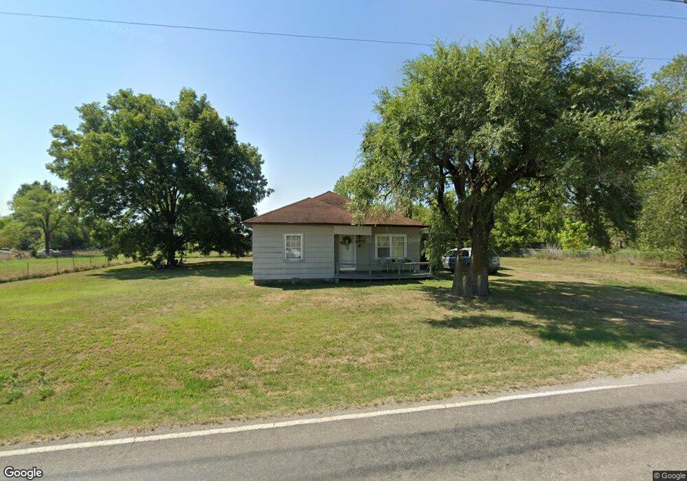
517 E 590th Ave Pittsburg, KS 66762
Estimated Value: $82,123 - $197,000
3
Beds
2
Baths
1,510
Sq Ft
$98/Sq Ft
Est. Value
About This Home
This home is located at 517 E 590th Ave, Pittsburg, KS 66762 and is currently estimated at $147,281, approximately $97 per square foot. 517 E 590th Ave is a home with nearby schools including Frank Layden Elementary School, Frontenac Junior High School, and Frontenac High School.
Ownership History
Date
Name
Owned For
Owner Type
Purchase Details
Closed on
Mar 25, 2015
Sold by
Coletta Bulot
Bought by
Hardesty Gary L and Hardesty Karen L
Current Estimated Value
Home Financials for this Owner
Home Financials are based on the most recent Mortgage that was taken out on this home.
Original Mortgage
$18,750
Outstanding Balance
$6,787
Interest Rate
3.82%
Mortgage Type
New Conventional
Estimated Equity
$140,494
Create a Home Valuation Report for This Property
The Home Valuation Report is an in-depth analysis detailing your home's value as well as a comparison with similar homes in the area
Home Values in the Area
Average Home Value in this Area
Purchase History
| Date | Buyer | Sale Price | Title Company |
|---|---|---|---|
| Hardesty Gary L | $23,437 | Crawford Cnty Abstract Co Inc | |
| Hardesty Gary L | -- | -- |
Source: Public Records
Mortgage History
| Date | Status | Borrower | Loan Amount |
|---|---|---|---|
| Open | Hardesty Gary L | $18,750 |
Source: Public Records
Tax History Compared to Growth
Tax History
| Year | Tax Paid | Tax Assessment Tax Assessment Total Assessment is a certain percentage of the fair market value that is determined by local assessors to be the total taxable value of land and additions on the property. | Land | Improvement |
|---|---|---|---|---|
| 2025 | $318 | $4,047 | $309 | $3,738 |
| 2024 | $318 | $3,782 | $309 | $3,473 |
| 2023 | $290 | $3,439 | $388 | $3,051 |
| 2022 | $285 | $3,292 | $458 | $2,834 |
| 2021 | $280 | $3,036 | $458 | $2,578 |
| 2020 | $275 | $2,897 | $268 | $2,629 |
| 2019 | $276 | $2,897 | $268 | $2,629 |
| 2018 | $276 | $2,897 | $268 | $2,629 |
| 2017 | $278 | $2,897 | $253 | $2,644 |
| 2016 | $272 | $2,897 | $253 | $2,644 |
| 2015 | $362 | $2,875 | $231 | $2,644 |
| 2014 | $362 | $2,116 | $214 | $1,902 |
Source: Public Records
Map
Nearby Homes
- 305 S 170th St
- 00 E 610th Ave
- 0 E 610th Ave
- 0000 E 610th Ave
- 000 E 610th Ave
- 00000 W Atkinson Rd
- 4094 Parkview Dr
- 576 E 47 Hwy
- 4075 Parkview Dr
- 4073 Parkview Dr
- 4070 Parkview Dr
- W Atkinson Ave
- 409 W Atkinson Rd
- 308 Caroline Dr
- 512 W Mckinley St
- 215 Countryview Dr
- 106 W Carlton St
- 1013 S Hugh St
- 609 S Mount Carmel Rd
- 512 S Brooklyn Ct
- 519 E 590th Ave
- 519 E 590th Ave
- 519 E 590th Ave
- 511 E 590th Ave
- 510 E 590th Ave
- 396 S 190th St
- 501 E 590th Ave
- 406 S 190th St
- 408 S 190th St
- 414 S 190th St
- 390 S 190th St
- 397 S 190th St
- 403 S 190th St
- 395 S 190th St
- 386 S 190th St
- 393 S 190th St
- 379 S 191st St
- 376 S 191st St
- 416 S 190th St
- 385 S 190th St