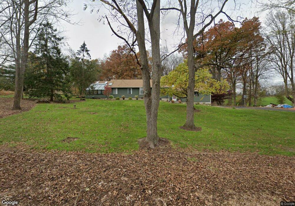
517 Ervey Rd Andover, NJ 07821
Estimated Value: $391,923 - $576,000
--
Bed
--
Bath
1,813
Sq Ft
$275/Sq Ft
Est. Value
About This Home
This home is located at 517 Ervey Rd, Andover, NJ 07821 and is currently estimated at $499,481, approximately $275 per square foot. 517 Ervey Rd is a home located in Warren County with nearby schools including Mountain Villa School, Allamuchy Township Elementary School, and Tranquility Adventist School.
Ownership History
Date
Name
Owned For
Owner Type
Purchase Details
Closed on
Dec 9, 2020
Sold by
Wrb Enterprises Llc
Bought by
Metzgar Valerie M
Current Estimated Value
Purchase Details
Closed on
Feb 22, 2016
Sold by
Gallahue Lorene S and Gallahue Robert C
Bought by
Wrb Enterprises Llc
Home Financials for this Owner
Home Financials are based on the most recent Mortgage that was taken out on this home.
Interest Rate
3.65%
Purchase Details
Closed on
Jul 15, 2003
Sold by
Dejongh Suzanne M
Bought by
Gallahue Robert C and Gallahue Lorene S
Purchase Details
Closed on
Aug 6, 2001
Sold by
Dejongh Antonius P
Bought by
Dejongh Antonius P and Dejongh Suzanne M
Purchase Details
Closed on
May 18, 1998
Sold by
Dejongh Suzanne M
Bought by
Dejongh Antonius P
Create a Home Valuation Report for This Property
The Home Valuation Report is an in-depth analysis detailing your home's value as well as a comparison with similar homes in the area
Home Values in the Area
Average Home Value in this Area
Purchase History
| Date | Buyer | Sale Price | Title Company |
|---|---|---|---|
| Metzgar Valerie M | -- | None Available | |
| Metzgar Valerie M | -- | None Listed On Document | |
| Wrb Enterprises Llc | $250,000 | -- | |
| Gallahue Robert C | $329,900 | -- | |
| Dejongh Antonius P | -- | -- | |
| Dejongh Antonius P | -- | -- |
Source: Public Records
Mortgage History
| Date | Status | Borrower | Loan Amount |
|---|---|---|---|
| Previous Owner | Wrb Enterprises Llc | -- |
Source: Public Records
Tax History Compared to Growth
Tax History
| Year | Tax Paid | Tax Assessment Tax Assessment Total Assessment is a certain percentage of the fair market value that is determined by local assessors to be the total taxable value of land and additions on the property. | Land | Improvement |
|---|---|---|---|---|
| 2025 | $8,012 | $249,600 | $101,400 | $148,200 |
| 2024 | $8,038 | $249,600 | $101,400 | $148,200 |
| 2023 | $7,869 | $249,600 | $101,400 | $148,200 |
| 2022 | $7,693 | $244,900 | $101,400 | $143,500 |
| 2021 | $5,613 | $244,900 | $101,400 | $143,500 |
| 2020 | $7,232 | $244,900 | $101,400 | $143,500 |
| 2019 | $7,114 | $244,900 | $101,400 | $143,500 |
| 2018 | $7,332 | $244,900 | $101,400 | $143,500 |
| 2017 | $7,190 | $244,900 | $101,400 | $143,500 |
| 2016 | $7,136 | $244,900 | $101,400 | $143,500 |
| 2015 | $7,241 | $244,900 | $101,400 | $143,500 |
| 2014 | $6,932 | $244,900 | $101,400 | $143,500 |
Source: Public Records
Map
Nearby Homes
- 8 Limekiln Ct
- 88 Kennedy Rd
- 37 Pequest Rd
- 300 Alphano Rd
- 10 Rushmore Ln
- 5 Ajax Ct
- 411 Shades of Death Rd
- 15 Ajax Ct
- 25 Osprey Unit C2G3
- 78 Hillside Terrace
- 57 Marsh Hawk Unit 8
- 156 Osprey Unit 5
- 73 Wolfs Corner Rd
- 247 Main St
- 244 Main St
- 8 Woodfield Rd
- 25 Green Heron Dr
- 21 Junegrass Way Unit 1921
- 41 Green Heron Dr
- 14 Hillside Terrace