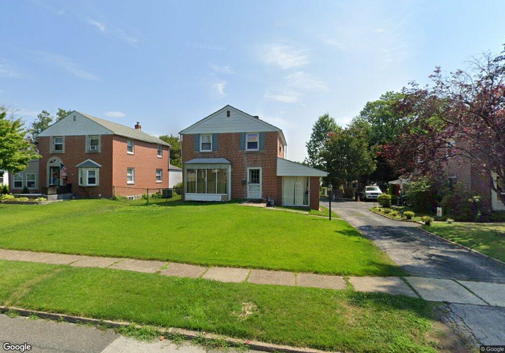
517 Glenfield Ave Glenolden, PA 19036
Estimated Value: $292,682 - $424,000
3
Beds
2
Baths
1,782
Sq Ft
$200/Sq Ft
Est. Value
About This Home
This home is located at 517 Glenfield Ave, Glenolden, PA 19036 and is currently estimated at $355,671, approximately $199 per square foot. 517 Glenfield Ave is a home located in Delaware County with nearby schools including Glenolden School, Interboro Senior High School, and Our Lady Of Fatima School.
Ownership History
Date
Name
Owned For
Owner Type
Purchase Details
Closed on
Dec 18, 2015
Sold by
Parkinson Maureen Murphy
Bought by
Brennan Michael and Loftus Nicole
Current Estimated Value
Purchase Details
Closed on
Jan 24, 2014
Sold by
Parkinson Edward J
Bought by
Parkinson Edward J and Parkinson Maureen Murphy
Purchase Details
Closed on
Apr 12, 2013
Sold by
Parkinson Edward J and Parkinson Beverly J
Bought by
Parkinson Edward J
Create a Home Valuation Report for This Property
The Home Valuation Report is an in-depth analysis detailing your home's value as well as a comparison with similar homes in the area
Home Values in the Area
Average Home Value in this Area
Purchase History
| Date | Buyer | Sale Price | Title Company |
|---|---|---|---|
| Brennan Michael | $100,000 | None Available | |
| Parkinson Edward J | -- | None Available | |
| Parkinson Edward J | -- | None Available |
Source: Public Records
Tax History Compared to Growth
Tax History
| Year | Tax Paid | Tax Assessment Tax Assessment Total Assessment is a certain percentage of the fair market value that is determined by local assessors to be the total taxable value of land and additions on the property. | Land | Improvement |
|---|---|---|---|---|
| 2025 | $5,502 | $153,440 | $45,870 | $107,570 |
| 2024 | $5,502 | $153,440 | $45,870 | $107,570 |
| 2023 | $5,383 | $153,440 | $45,870 | $107,570 |
| 2022 | $5,295 | $153,440 | $45,870 | $107,570 |
| 2021 | $7,471 | $153,440 | $45,870 | $107,570 |
| 2020 | $5,581 | $107,240 | $32,370 | $74,870 |
| 2019 | $5,519 | $107,240 | $32,370 | $74,870 |
| 2018 | $5,420 | $107,240 | $0 | $0 |
| 2017 | $5,300 | $107,240 | $0 | $0 |
| 2016 | $589 | $107,240 | $0 | $0 |
| 2015 | $601 | $107,240 | $0 | $0 |
| 2014 | $601 | $107,240 | $0 | $0 |
Source: Public Records
Map
Nearby Homes
- 464 Andrews Ave
- 618 W South Ave
- 21 Benson Dr
- 303 Urban Ave
- 311 Urban Ave
- 363 Holmes Rd
- 614 Highland Terrace
- 409 Urban Ave
- 211 Cedar Ave
- 604 Crescent Dr
- 357 Cedar Ave
- 5 Sparks Cir
- 1646 Norwood Ave
- 707 Crescent Dr
- 122 Leon Ave
- 614 S Garfield Ave
- 209 Amosland Rd
- 668 Hutchinson Terrace
- 630 Richfield Ave
- 103 Willows Ave Unit 90
- 519 Glenfield Ave
- 515 Glenfield Ave
- 521 Glenfield Ave
- 513 Glenfield Ave
- 512 W South Ave
- 514 W South Ave
- 523 Glenfield Ave
- 511 Glenfield Ave
- 516 W South Ave
- 508 W South Ave
- 431 Hibbs Ave
- 423 Hibbs Ave
- 437 Hibbs Ave
- 516 Glenfield Ave
- 518 Glenfield Ave
- 514 Glenfield Ave
- 518 W South Ave
- 509 Glenfield Ave
- 520 Glenfield Ave
- 512 Glenfield Ave