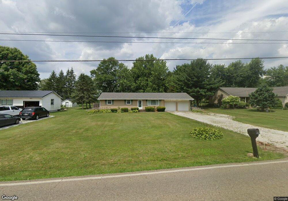
5171 California Ave Louisville, OH 44641
Estimated Value: $222,000 - $244,000
3
Beds
1
Bath
1,144
Sq Ft
$202/Sq Ft
Est. Value
About This Home
This home is located at 5171 California Ave, Louisville, OH 44641 and is currently estimated at $230,557, approximately $201 per square foot. 5171 California Ave is a home located in Stark County with nearby schools including Louisville High School and St. Thomas Aquinas High School & Middle School.
Ownership History
Date
Name
Owned For
Owner Type
Purchase Details
Closed on
Sep 10, 2001
Sold by
Malmsberry and Cheryl
Bought by
Burns Robert F
Current Estimated Value
Home Financials for this Owner
Home Financials are based on the most recent Mortgage that was taken out on this home.
Original Mortgage
$179,000
Outstanding Balance
$70,156
Interest Rate
7.06%
Mortgage Type
Purchase Money Mortgage
Estimated Equity
$160,401
Purchase Details
Closed on
Apr 20, 1998
Sold by
Allman Dennis M
Bought by
Malmsberry Scott and Malmsberry Cheryl
Home Financials for this Owner
Home Financials are based on the most recent Mortgage that was taken out on this home.
Original Mortgage
$100,800
Interest Rate
7.27%
Mortgage Type
New Conventional
Purchase Details
Closed on
Aug 4, 1995
Sold by
Vanpelt Charles V
Bought by
Allman Dennis M and Allman Debra
Home Financials for this Owner
Home Financials are based on the most recent Mortgage that was taken out on this home.
Original Mortgage
$90,250
Interest Rate
7.56%
Mortgage Type
New Conventional
Purchase Details
Closed on
Jun 13, 1990
Create a Home Valuation Report for This Property
The Home Valuation Report is an in-depth analysis detailing your home's value as well as a comparison with similar homes in the area
Home Values in the Area
Average Home Value in this Area
Purchase History
| Date | Buyer | Sale Price | Title Company |
|---|---|---|---|
| Burns Robert F | $140,000 | -- | |
| Malmsberry Scott | $126,000 | -- | |
| Allman Dennis M | $95,000 | -- | |
| -- | $70,500 | -- |
Source: Public Records
Mortgage History
| Date | Status | Borrower | Loan Amount |
|---|---|---|---|
| Open | Burns Robert F | $179,000 | |
| Previous Owner | Malmsberry Scott | $100,800 | |
| Previous Owner | Allman Dennis M | $90,250 |
Source: Public Records
Tax History Compared to Growth
Tax History
| Year | Tax Paid | Tax Assessment Tax Assessment Total Assessment is a certain percentage of the fair market value that is determined by local assessors to be the total taxable value of land and additions on the property. | Land | Improvement |
|---|---|---|---|---|
| 2025 | $0 | $63,280 | $16,240 | $47,040 |
| 2024 | -- | $63,280 | $16,240 | $47,040 |
| 2023 | $2,492 | $51,170 | $13,160 | $38,010 |
| 2022 | $2,499 | $51,170 | $13,160 | $38,010 |
| 2021 | $2,506 | $51,170 | $13,160 | $38,010 |
| 2020 | $2,405 | $45,610 | $11,870 | $33,740 |
| 2019 | $2,414 | $45,610 | $11,870 | $33,740 |
| 2018 | $2,407 | $45,610 | $11,870 | $33,740 |
| 2017 | $2,301 | $41,310 | $8,890 | $32,420 |
| 2016 | $2,256 | $41,310 | $8,890 | $32,420 |
| 2015 | $2,261 | $41,310 | $8,890 | $32,420 |
| 2014 | $269 | $38,370 | $8,260 | $30,110 |
| 2013 | $1,138 | $38,370 | $8,260 | $30,110 |
Source: Public Records
Map
Nearby Homes
- 1175 Sturbridge Dr
- 1149 Sturbridge Dr
- 1561 Noel St
- 6083 Apple St
- 248 Menegay Rd
- 0 Brookridge Ave
- 3580 Brookridge Ave Lot 15
- 0 Glenbar St
- 201 Indiana Ave
- 524 Glenbar St
- 414 Honeycrisp Dr NE
- 300 Kennedy St
- 0 Pilot Knob Ave NE
- 428 Honeycrisp Dr NE
- 3047 Mcintosh Dr NE
- 432 Honeycrisp Dr NE
- 2962 Mcintosh Dr NE
- 2963 Mcintosh Dr NE
- 430 Honeycrisp Dr NE
- 2957 Mcintosh Dr NE
- 5147 California Ave
- 5189 California Ave
- 5129 California Ave
- 5211 California Ave
- 5194 California Ave
- 5150 California Ave
- 5132 California Ave
- 6464 Crock St
- 5110 California Ave
- 6442 Crock St
- 5180 California Ave
- 5085 California Ave
- 1293 California Ave
- 1293 California Ave Unit A
- 5065 California Ave
- 5272 California Ave
- 5080 California Ave
- 1303 California Ave
- 1241 Shawn Cir
- 1121 Aubrey Cir