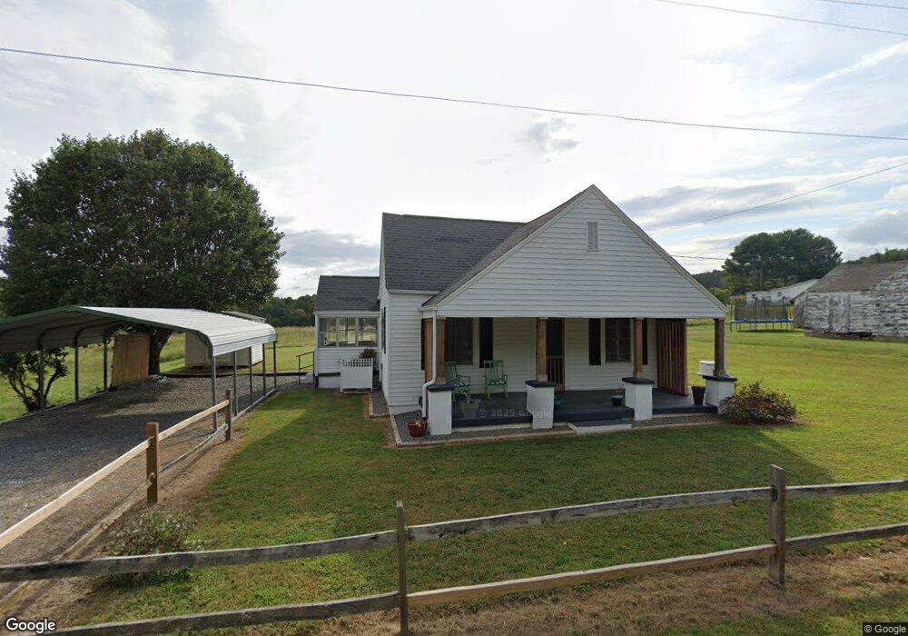
5172 Westfield Rd Mount Airy, NC 27030
Estimated Value: $106,264 - $209,000
2
Beds
1
Bath
1,064
Sq Ft
$151/Sq Ft
Est. Value
About This Home
This home is located at 5172 Westfield Rd, Mount Airy, NC 27030 and is currently estimated at $161,066, approximately $151 per square foot. 5172 Westfield Rd is a home with nearby schools including Westfield Elementary School, Pilot Mountain Middle School, and East Surry High School.
Ownership History
Date
Name
Owned For
Owner Type
Purchase Details
Closed on
May 7, 2020
Sold by
Wilson Kimberly N
Bought by
Lawson Susan G
Current Estimated Value
Purchase Details
Closed on
Jun 11, 2013
Sold by
Lawson Susan Gail and Lawson Johnny Allen
Bought by
Wilson Kimberly Nicole and Lawson Susan Gail
Purchase Details
Closed on
Jan 1, 1995
Purchase Details
Closed on
Nov 1, 1994
Purchase Details
Closed on
Oct 1, 1994
Purchase Details
Closed on
Apr 1, 1940
Create a Home Valuation Report for This Property
The Home Valuation Report is an in-depth analysis detailing your home's value as well as a comparison with similar homes in the area
Home Values in the Area
Average Home Value in this Area
Purchase History
| Date | Buyer | Sale Price | Title Company |
|---|---|---|---|
| Lawson Susan G | $15,000 | None Available | |
| Wilson Kimberly Nicole | -- | None Available | |
| -- | -- | -- | |
| -- | $22,000 | -- | |
| -- | -- | -- | |
| -- | -- | -- |
Source: Public Records
Tax History Compared to Growth
Tax History
| Year | Tax Paid | Tax Assessment Tax Assessment Total Assessment is a certain percentage of the fair market value that is determined by local assessors to be the total taxable value of land and additions on the property. | Land | Improvement |
|---|---|---|---|---|
| 2025 | $390 | $56,820 | $6,500 | $50,320 |
| 2024 | $335 | $43,830 | $6,000 | $37,830 |
| 2023 | $330 | $43,830 | $6,000 | $37,830 |
| 2022 | $330 | $43,830 | $6,000 | $37,830 |
| 2021 | $335 | $43,830 | $6,000 | $37,830 |
| 2020 | $330 | $41,280 | $6,000 | $35,280 |
| 2019 | $327 | $42,280 | $0 | $0 |
| 2018 | $316 | $42,280 | $0 | $0 |
| 2017 | $309 | $42,280 | $0 | $0 |
| 2016 | $309 | $42,280 | $0 | $0 |
| 2013 | -- | $40,130 | $0 | $0 |
Source: Public Records
Map
Nearby Homes
- 140 Daniels Dell Ln
- Lot 4,5,6 Sideview Ln
- 7.8ac Norman Rd
- 733 Slate Mountain Rd
- 0 Norman Rd
- 00 Albion Church Rd
- 731 Indian Grove Church Rd
- 107 Cory Trail
- 583 Snody Rd
- 00 Blue Hollow Rd Unit 5
- 0 Blue Hollow Rd Unit 33 1176021
- 0 Blue Hollow Rd Unit 23105199
- 000 Blue Hollow Rd Unit 27
- Lot 5 Howell Rd
- 1305 Brim Rd
- 1507 Rogers Rd
- 339 Jessup Grove Church Rd
- 446 Gilley Rd
- 0 Sunset Ridge Rd
- TBD Rogers Rd Unit TBD Rogers Road
- 5156 Westfield Rd
- 5159 Westfield Rd
- 124 Baxter Ln
- 108 Baxter Ln
- 5213 Westfield Rd
- 5129 Westfield Rd
- 5251 Westfield Rd
- 5268 Westfield Rd
- 122 Clifton Ln
- 5274 Westfield Rd
- 107 Woodville Rd
- 102 Wytheville Ln
- 103 Wytheville Ln
- 5286 Westfield Rd
- 141 Cimmaron Ln
- 108 Woodville Rd
- 181 Woodville Rd
- 5311 Westfield Rd
- 5312 Westfield Rd
- 5005 Westfield Rd